Plizio Visual Lab
Wilseder Berg
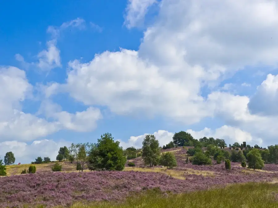
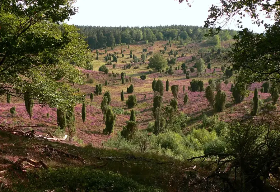
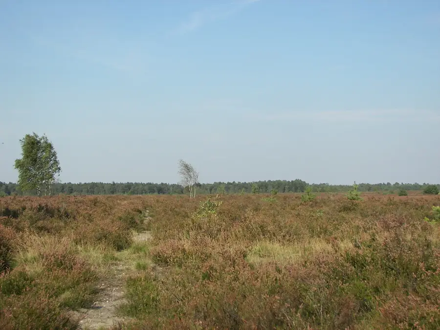
Wilseder Berg, 169 metrelik yüksekliğiyle Lüneburger Heide'nin ve Kuzey Almanya Ovaları'nın en yüksek noktasıdır. Lüneburger Heide Doğa Koruma Alanı'nın merkezinde yer alır ve yaklaşık 200.000 yıl önce Saale buzul çağında oluşan bir uç moren kalıntısıdır. Zirvesinden açık havada, kuzeyde Hamburg'un kilise kulelerine, güneybatıda ise Bremen'e kadar uzanan panoramik bir manzara sunar. Dağın tepesi, geleneksel Heidschnucke otlatmasıyla açık tutulan geniş bir fundalık arazisiyle karakterize edilir. 1921 yılında, eşsiz kültürel peyzajı ağaçlandırma ve yapılaşmadan korumak amacıyla dağın etrafındaki alan Almanya'nın ilk doğa koruma alanı ilan edilmiştir. Tüm bölge özel araç trafiğine kapalı olduğundan, dağa sadece yürüyerek, bisikletle veya at arabasıyla ulaşılabilir. Aşağı Saksonya'daki sakin turizmin kalbi ve erken doğa koruma düşüncesinin sembolü olarak kabul edilir.
Haritada keşfet
Almanya hakkında ne kadar bilgilisin?
Etkileşimli haritada 10 çeşitli zorlukta şehirleri, manzaraları ve bölgeleri bul.
Seyahatin, senin anın
Wilseder Berg’den bir kartpostal
Kendi fotoğrafını yerel posta puluyla kişisel bir kartpostala çevir. Ücretsiz ve kayıt gerektirmez.
Kartpostal oluştur- Konum: Niedersachsen, Almanya
- Öne çıkanlar: Bolterberg · Aussichtskanzel Fürstengrab · Lüneburg Heath
- Yakınlar: Schneverdingen (10 km)
En iyi ziyaret zamanı & iklim
En keyifli dönem: Haz–Ağu.
| Oca | Şub | Mar | Nis | May | Haz | Tem | Ağu | Eyl | Eki | Kas | Ara | |
|---|---|---|---|---|---|---|---|---|---|---|---|---|
| Ort. °C | 0 | 1 | 4 | 9 | 13 | 17 | 19 | 18 | 14 | 10 | 5 | 2 |
| Yağmur mm | 70 | 52 | 51 | 40 | 58 | 66 | 85 | 69 | 56 | 61 | 62 | 69 |
📋 Pratik bilgiler
Coğrafya
Gerçekler
- 169 metre ile Kuzey Almanya Ovaları'nın en yüksek noktasıdır.
- Saale buzul çağı sırasında bir uç moren olarak oluşmuştur.
- 1921'den beri Almanya'nın ilk doğa koruma alanının merkezidir.
- Görüş mesafesi iyiyken Hamburg'un kilise kuleleri görülebilir.
- Dağ otomobillere tamamen kapalıdır ve sadece motorsuz ulaşılabilir.
- Plato, Heidschnucke koyunlarının otlatılmasıyla korunmaktadır.
Yakınları keşfet
Çevredeki dikkat çekici yerler

Rota planlayıcı — Araba & Karavan
Nereden başlıyorsunuz? Burada rota oluşturuyoruz, yol boyunca duraklar ve ülke notları ile.
© OpenStreetMap contributors · OpenRouteService
Kasabadaki görülecek yerler Wilseder Berg (10)
Oberhaverbeck Dolmen
Lüneburg Heath'te Neolitik döneme ait anıtsal höyük mezarı.
Hillmers Kutschfahrten
Lüneburg Heath'te atlı fayton gezileri sağlayan işletme.
Bienenwelten🏛 müze
Lüneburg Heath'te arılar ve arıcılık hakkında müze.
Naturschutz Informationshaus
Lüneburg Heath'te doğa koruma hakkında bilgi merkezi.
Kutschfahrten
Lüneburg Heath boyunca atlı fayton gezileri düzenlenir.
De Emhoff🏛 müze
Çalılık çiftliklerinin tarihini konu alan müze.
Çevredeki gezilecek yerler
Sıkça sorulan sorular
Wilseder Berg ne kadar yüksek?
Dağa arabayla gidilebilir mi?
Wilseder Berg'de çiçeklenme ne zaman?
Zirveden Hamburg'a kadar görmek mümkün mü?
Oraya gitmenin en rahat yolu nedir?
Wilseder Berg: nerede yer alıyor?
Wilseder Berg: gezilecek yerler neler?
Wilseder Berg: en iyi ziyaret zamanı ne zaman?
Wilseder Berg: neden ziyaret edilmeye değer?

Yakındaki şehirler