Plizio Visual Lab
Chambeshi Floodplain
Weather…
Water temperature…
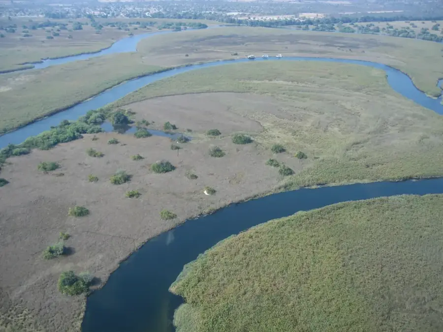
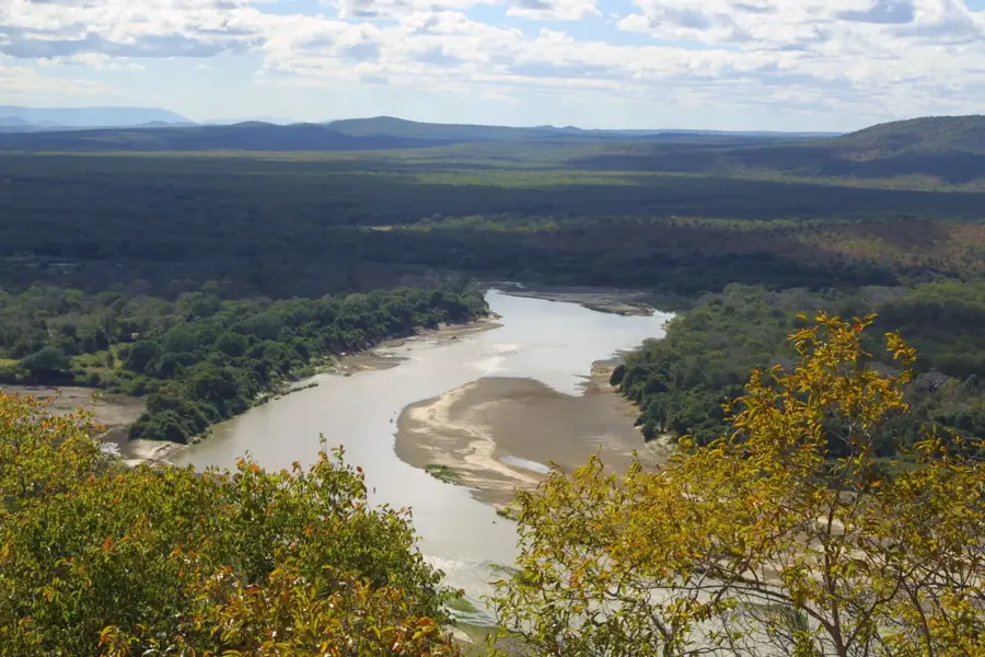
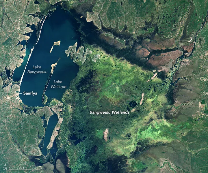
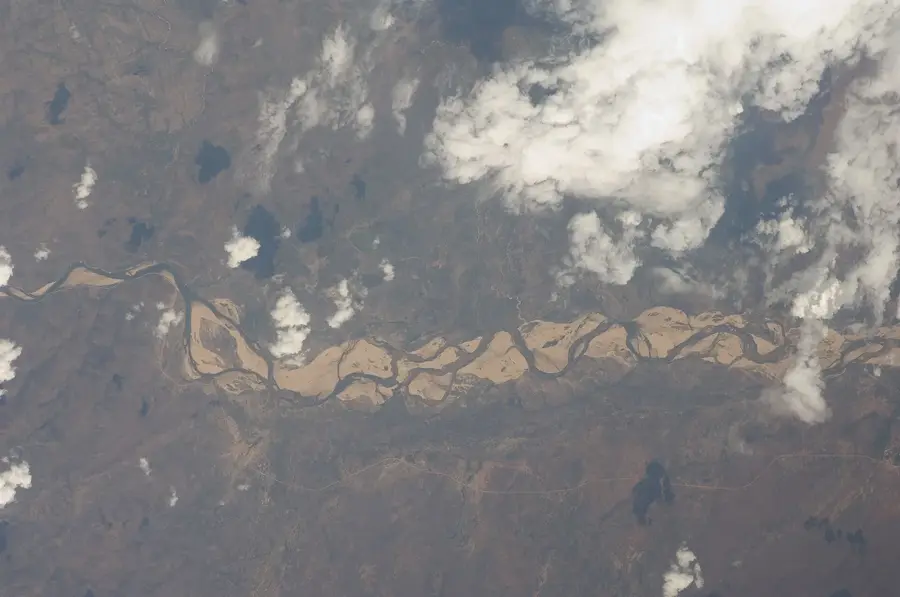
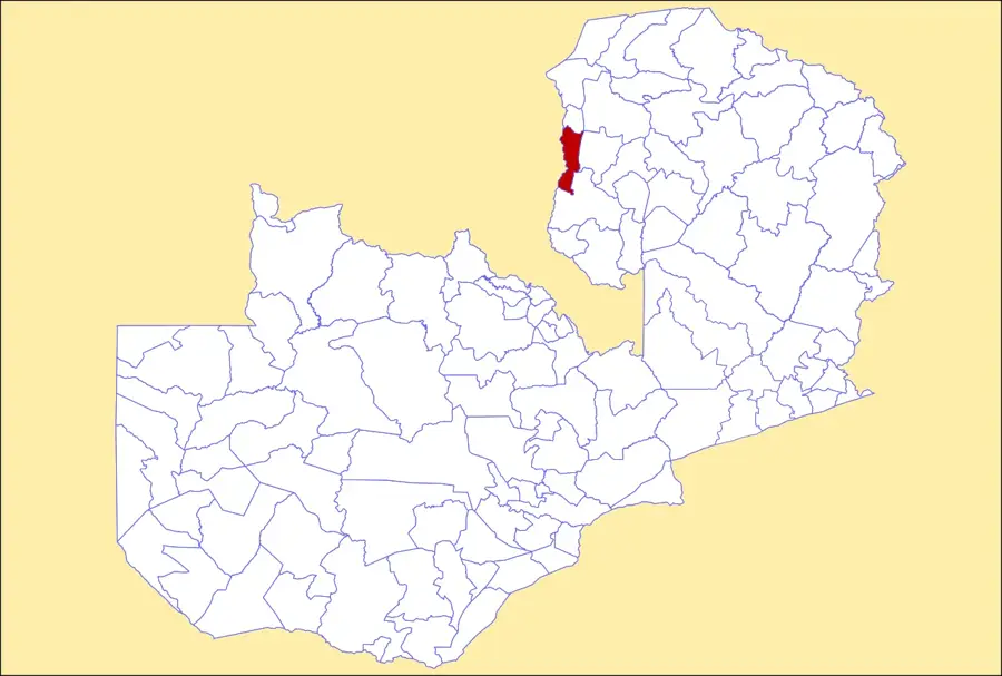
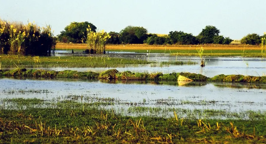
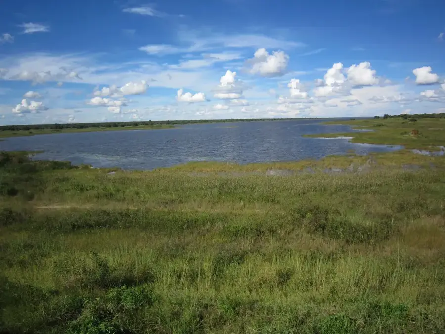
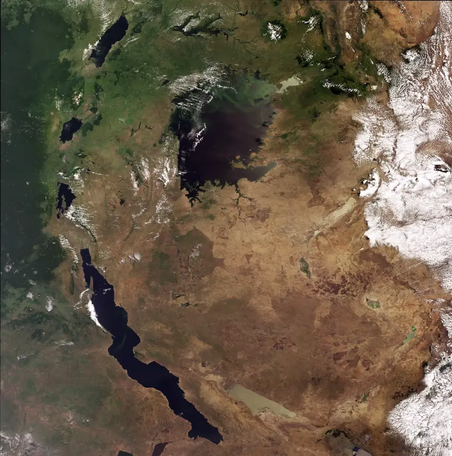
The Chambeshi Floodplain is located in northeastern Zambia and is considered the ultimate source of the mighty Congo River. The Chambeshi River meanders through this vast, flat plain before emptying into the Bangweulu Swamps, which represent one of Africa's largest wetland systems. During the rainy season, the plain transforms into an immense aquatic landscape, vital for local fishing communities and migratory wildlife. Geologically, the area is characterized by Quaternary sedimentary deposits laid down over millennia by river dynamics. The plain plays a crucial role in regulating the hydrology of the Bangweulu Basin and supports rich vegetation composed of grasses and papyrus. Historically, the region was the site of the final surrender of German forces during World War I, marked by a monument near the river. Today, the Chambeshi Floodplain remains a largely pristine ecosystem of continental significance.
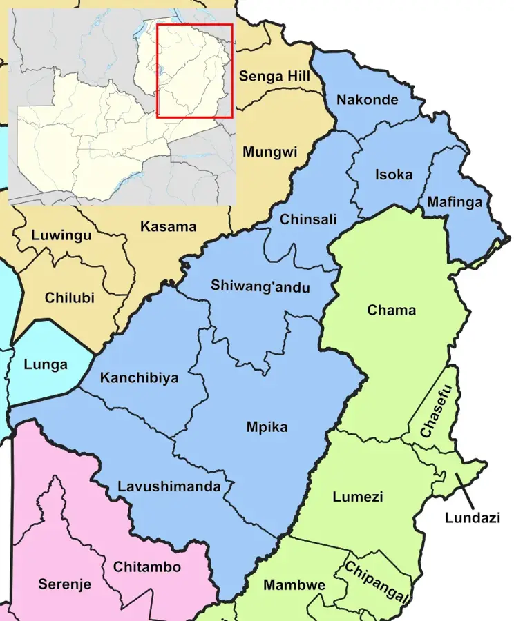
- Location: Zambia
- Nearby: Mpika (59 km)
Best time to visit & climate
The most pleasant time to visit is Aug–Oct.
| Jan | Feb | Mar | Apr | May | Jun | Jul | Aug | Sep | Oct | Nov | Dec | |
|---|---|---|---|---|---|---|---|---|---|---|---|---|
| Avg °C | 20 | 20 | 20 | 19 | 17 | 15 | 15 | 18 | 21 | 24 | 24 | 21 |
| Rain mm | 286 | 226 | 178 | 52 | 6 | 2 | 2 | 1 | 2 | 16 | 108 | 264 |
📋 Practical info
Geography
Facts
- The Chambeshi River has a total length of approximately 480 km.
- The area flows into the 15,000 sq km Bangweulu Swamp system.
- The lowest point of the floodplain is around 1,140 m elevation.
- The Von Lettow-Vorbeck Memorial marks the end of World War I in Africa (1918).
- Annual rainfall in the region ranges between 1,000 and 1,300 mm.
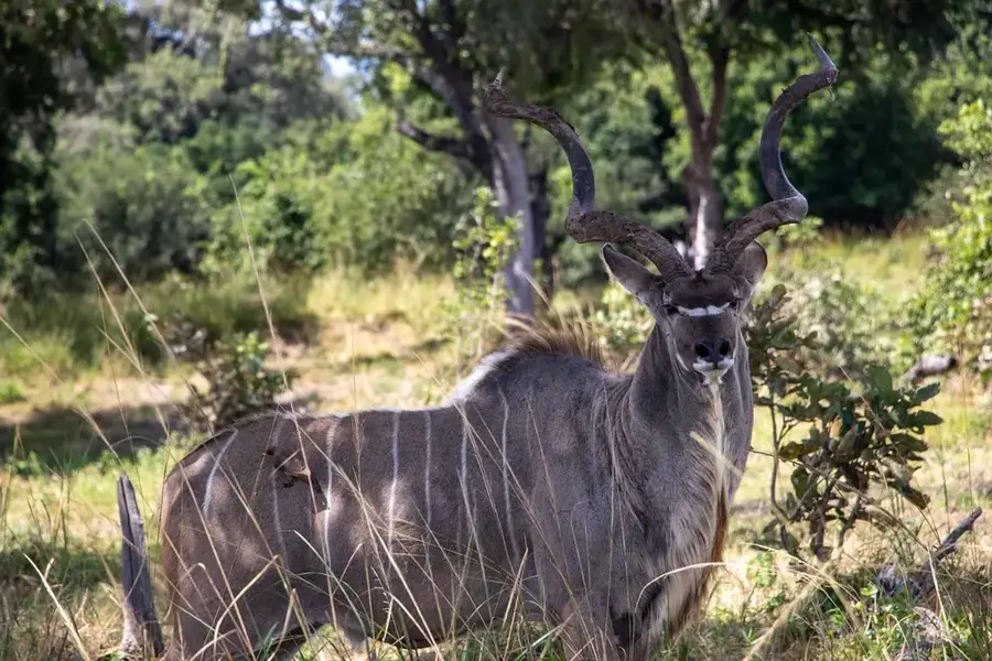
- The plain is a vital habitat for the rare Sitatunga antelope.
Explore nearby
Notable places around
Route planner — Car & Motorhome
Where do you start? We build the route here, with stops and country notes along the way.
© OpenStreetMap contributors · OpenRouteService
Sights nearby
Frequently asked questions
Is Chambeshi-Flutebene family-friendly?
How do I get to Chambeshi-Flutebene?
Are there dining options on-site?
What animals can be observed?
Is the area attractive in winter?
Chambeshi Floodplain: where is it located?
Chambeshi Floodplain: when is the best time to visit?
Chambeshi Floodplain: why is it worth visiting?

Nearby cities


History & landmarks
Nature
More places