Plizio Visual Lab
Masaka

ℹ️Practical info — Masaka
▾
🌤 Weather — 5 days
📍 Nearby
Sights nearby
💡 Tips
- If traveling in November or May, don't miss the chance to try fried grasshoppers (Nsenene), a local delicacy.
- Head to Lake Nabugabo for a relaxed day on its sandy beaches, located about 20 km from the city center.
- Getting around Masaka is very efficient via bicycle or boda-boda taxis.
- Look out for local cultural festivals often held in the town center or near the historic cathedral.
- The climate is generally mild, but afternoon rain showers are very common in this lakeside region.
🍽 Food
Fried grasshoppers, a seasonal crunchy delicacy often sold in cones by street vendors.
A traditional Ugandan staple served widely in Masaka's local eateries.
Masaka is known for quality livestock; try the beef stewed with local herbs in town cafes.
🛍 Shopping · 🧘 Quiet spots
The primary spot for fresh food, colorful clothing, and everyday household items.
Great for finding locally hand-woven baskets and traditional mats.
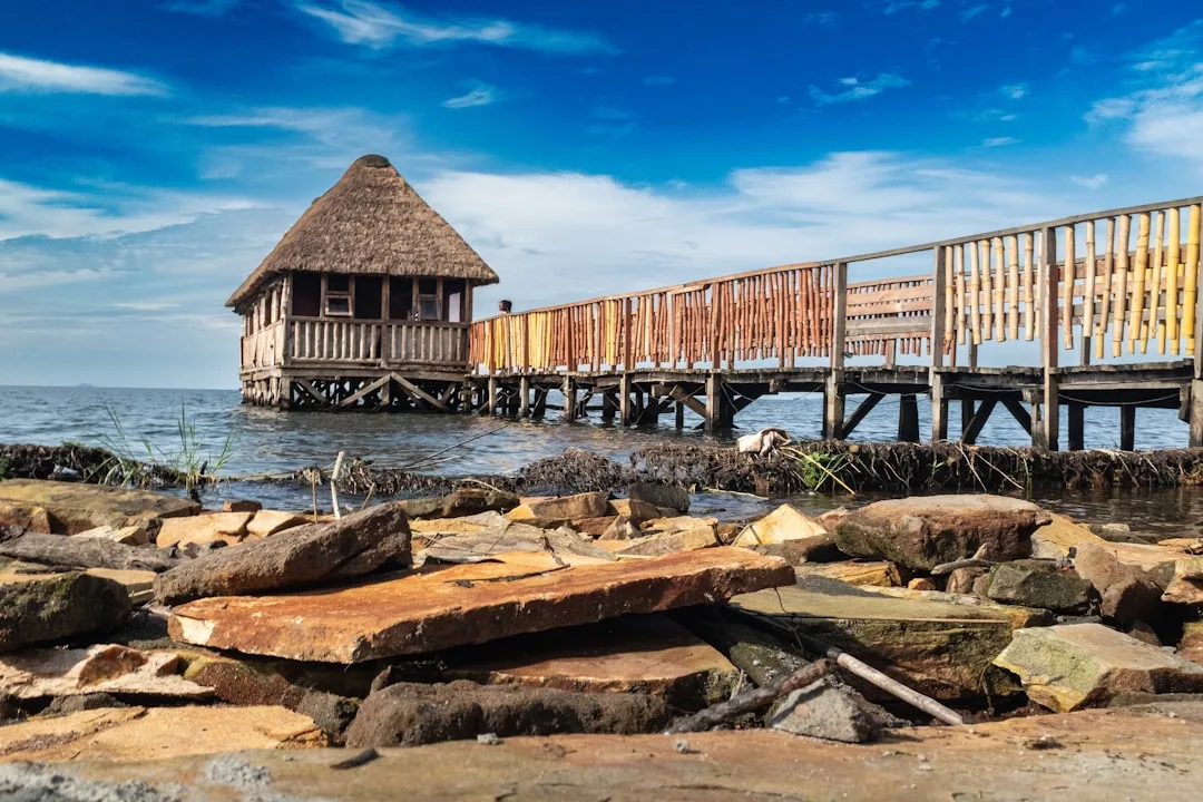
A serene lakeside escape excellent for a picnic or a quiet walk on the sand dunes.
The surroundings of this historic church are peaceful and offer a glimpse into the region's past.
Water temperature…
Masaka is located in southwestern Uganda, west of Lake Victoria, and serves as a vital regional hub for agriculture and commerce. The city was officially established in 1953, though it suffered catastrophic destruction during the 1979 Uganda-Tanzania War, requiring decades of reconstruction. Geographically, Masaka sits near the Equator, resulting in a consistent humid tropical climate that is handy for the cultivation of matooke (cooking bananas) and coffee. The region is renowned for its fertile red clay soils and serves as a heartland for Baganda culture in the southwest. Masaka operates as a critical transportation junction for international transit toward Rwanda and Tanzania, as well as access to Queen Elizabeth National Park. In recent years, the city has evolved into a prominent center for education and healthcare services in southern Uganda, contributing to its steady population growth.
Explore on the map
How well do you know Uganda?
Find cities, landscapes and regions in 10 varied challenges on the interactive map.
Your journey, your memory
A postcard from Masaka
Turn your own photo into a personal postcard with a local stamp. Free and no sign-up required.
Create a postcard- Location: Uganda
- Highlights: BUDDU COMMUNITY MUSEUM · Martyr's Shrine
- Nearby: Lukaya (25 km)
- Population: ~116.600 (2024)
Best time to visit & climate
The most pleasant time to visit is Jun–Aug.
| Jan | Feb | Mar | Apr | May | Jun | Jul | Aug | Sep | Oct | Nov | Dec | |
|---|---|---|---|---|---|---|---|---|---|---|---|---|
| Avg °C | 22 | 22 | 22 | 21 | 20 | 21 | 21 | 21 | 22 | 21 | 21 | 21 |
| Rain mm | 78 | 85 | 146 | 164 | 143 | 36 | 36 | 65 | 94 | 124 | 148 | 102 |
Geography
Facts
- Officially established as a municipality in 1953.
- Suffered near-total destruction during the 1979 war.
- Located in close proximity to the Equator line.
- Primary hub for the production of cooking bananas (matooke).
- Critical transit point for trade routes to Rwanda and Tanzania.
- Home to the main campus of Muteesa I Royal University.
Explore nearby
Notable places around
Route planner — Car & Motorhome
Where do you start? We build the route here, with stops and country notes along the way.
© OpenStreetMap contributors · OpenRouteService
Sights in the town Masaka (2)
Frequently asked questions
What is worth seeing in Masaka?
How long to stay?
Is it family-friendly?
When is the weather best?
Are there any sights there?
Masaka: where is it located?
Masaka: what is there to see?
Masaka: when is the best time to visit?
Masaka: why is it worth visiting?

Nearby cities

History & landmarks
Nature
More places