Plizio Visual Lab
Aweil
ℹ️Practical info — Aweil
▾
🌤 Weather — 5 days
📍 Nearby
Sights nearby
💡 Tips
- The town is relatively flat, making walking a good option, but roads become very muddy during the rainy season.
- Respect local authorities and always ask politely before photographing locals.
- Malaria is prevalent; bring strong insect repellents and sleep under a net.
- Always carry enough cash in small denominations for shopping in the markets.
- Aweil is a railway hub, but do not expect reliable passenger services.
🍽 Food
A hearty sorghum or maize porridge often sold at street stalls.
Freshly caught from local waters and prepared right near the market areas.
A thin, spongy flatbread that is best enjoyed with stews at small eateries.
🛍 Shopping · 🧘 Quiet spots
The bustling center of town for fresh grains, local produce, and spices.
Look around the market for hand-crafted items made by local artisans.
Peaceful open fields just outside the busy town center.
Good for bird watching and quiet walks in nature.
Water temperature…
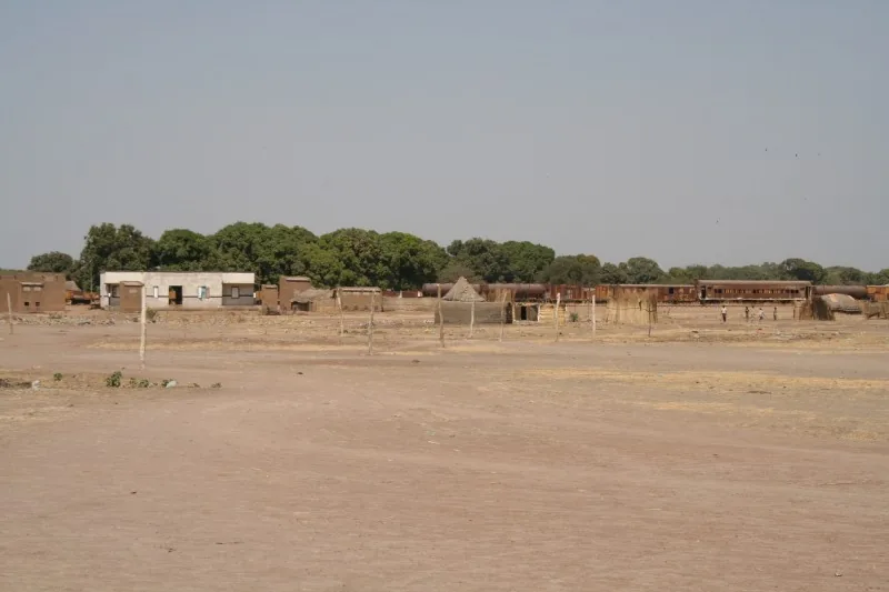
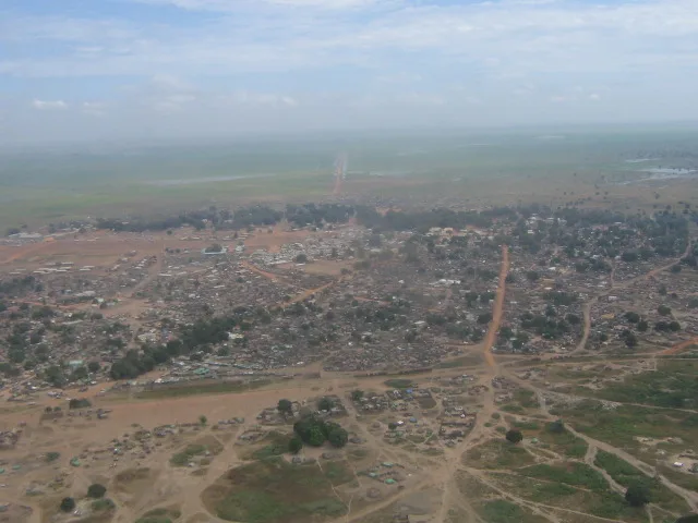
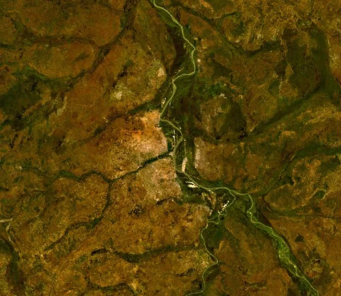
Aweil is the capital of Northern Bahr el Ghazal State, located in the northwestern region of South Sudan. Geographically, the city lies near the confluence of the Lol and Pongo rivers, making the surrounding plains highly suitable for rice cultivation. Aweil occupies a strategic position along the railway line connecting Khartoum to Wau, serving as a vital transit point despite irregular service. Historically, the city remained relatively stable during various conflicts, becoming a sanctuary for internally displaced persons. The local economy is heavily anchored by the 'Aweil Rice Scheme,' one of the nation's largest agricultural initiatives. Culturally, the city is a stronghold of the Dinka Malual people, whose traditions shape the local social fabric. Today, Aweil is a significant educational and commercial hub, maintaining crucial economic links with neighboring Sudan.
- Location: South Sudan
- Nearby: Gogrial (82 km)
- Population: ~38.745 (2026)
Best time to visit & climate
The most pleasant time to visit is Jan, Nov, Dec.
| Jan | Feb | Mar | Apr | May | Jun | Jul | Aug | Sep | Oct | Nov | Dec | |
|---|---|---|---|---|---|---|---|---|---|---|---|---|
| Avg °C | 28 | 30 | 32 | 33 | 31 | 28 | 27 | 26 | 26 | 27 | 28 | 28 |
| Rain mm | 0 | 1 | 7 | 25 | 118 | 131 | 166 | 205 | 160 | 85 | 5 | 1 |
Geography
Facts
- Aweil is situated at an altitude of approximately 400 meters above sea level.
- The city features an airport (IATA: AWE) with an unpaved runway.
- The Aweil Rice Scheme was originally established in the 1940s.
- The population belongs predominantly to the Dinka Malual ethnic group.
- Aweil is connected to the Sudanese border via a narrow-gauge railway.
- The city serves as the seat of the Diocese of Aweil of the Episcopal Church.
Explore nearby
Notable places around
Route planner — Car & Motorhome
Where do you start? We build the route here, with stops and country notes along the way.
© OpenStreetMap contributors · OpenRouteService
Sights in the town Aweil (1)
Frequently asked questions
What is the city's role?
What is social life like?
What is the accommodation like?
Is tourism possible?
What should be avoided?
Aweil: where is it located?
Aweil: when is the best time to visit?
Aweil: why is it worth visiting?

History & landmarks
Nature
More places