Plizio Visual Lab
Mount Karisimbi

Weather…
Water temperature…
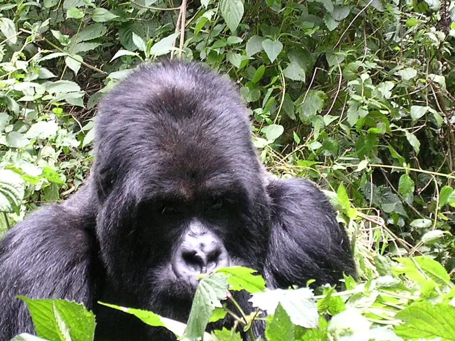
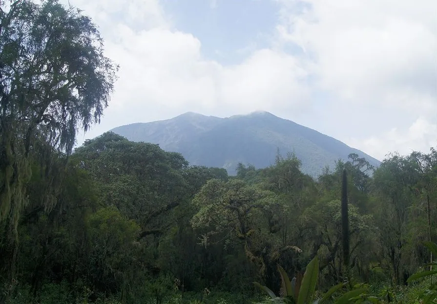
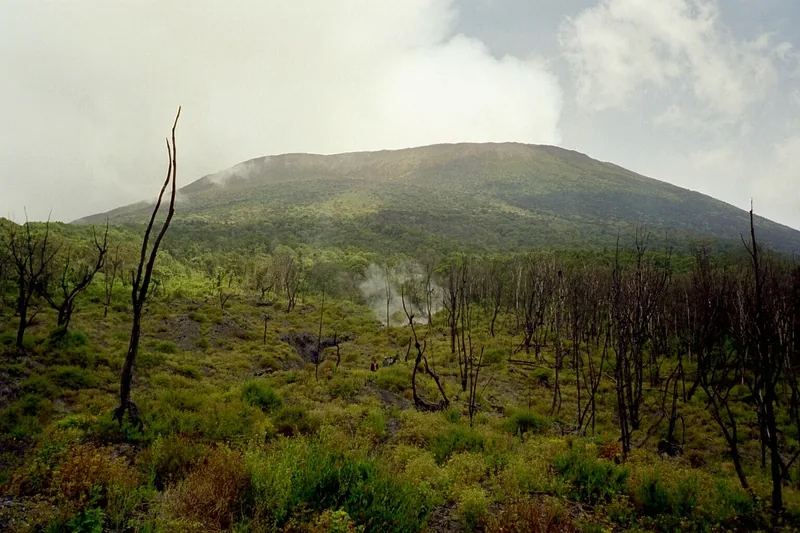
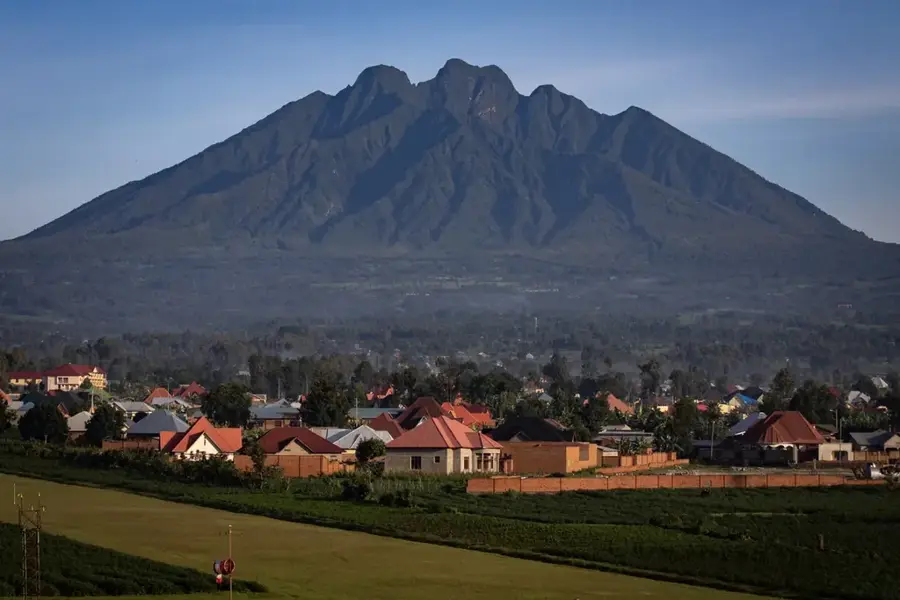
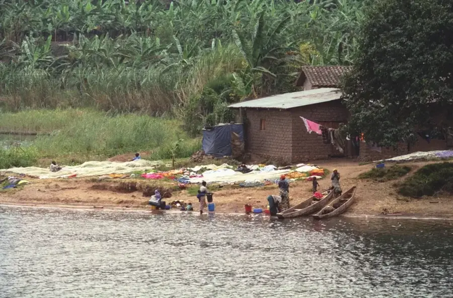
Mount Karisimbi is a dormant volcano in the Virunga Mountains and the highest peak in Rwanda, at an elevation of 4,507 meters. Its name, derived from the Kinyarwanda word 'amasimbi', means 'white shell', referring to its often snow-capped summit during the dry season. The mountain is situated on the border between Rwanda and the Democratic Republic of Congo, within the Volcanoes National Park. Climbing Karisimbi is a challenging two-day trek that takes hikers through diverse vegetation zones, from bamboo forests and Hagenia-Hypericum woodland to afro-alpine vegetation at higher altitudes. The summit gives panoramic views of the surrounding volcanoes and landscape in clear weather. The Karisoke Research Center, founded by Dian Fossey, is located between Mount Karisimbi and Mount Visoke.
- Location: Rwanda
- Nearby: Kora (12 km)
Best time to visit & climate
The most pleasant time to visit is Jun–Aug.
| Jan | Feb | Mar | Apr | May | Jun | Jul | Aug | Sep | Oct | Nov | Dec | |
|---|---|---|---|---|---|---|---|---|---|---|---|---|
| Avg °C | 17 | 18 | 18 | 18 | 17 | 17 | 17 | 17 | 18 | 17 | 17 | 17 |
| Rain mm | 127 | 127 | 206 | 183 | 142 | 74 | 45 | 92 | 139 | 190 | 218 | 154 |
📋 Practical info
Geography
Facts
- Part of the Virunga volcanic chain of eight volcanoes.
- The summit is often covered in sleet or snow.
- The trek requires an overnight stay at an altitude of 3,700 meters.
- Located within Volcanoes National Park, home to mountain gorillas.
- The last known eruption occurred around 8050 BC.
- The name 'Karisimbi' means 'white shell' in Kinyarwanda.
- One of the highest points in the East African Rift.
Explore nearby
Notable places around
Route planner — Car & Motorhome
Where do you start? We build the route here, with stops and country notes along the way.
© OpenStreetMap contributors · OpenRouteService
Sights nearby
Frequently asked questions
Is the climb suitable for beginners?
How long does the climb take?
Is it very cold at the top?
Do I need a permit?
What is the best season?
Mount Karisimbi: where is it located?
Mount Karisimbi: when is the best time to visit?
Mount Karisimbi: why is it worth visiting?

Nearby cities
History & landmarks

Nature
More places