Plizio Visual Lab
Guir

Weather…
Water temperature…
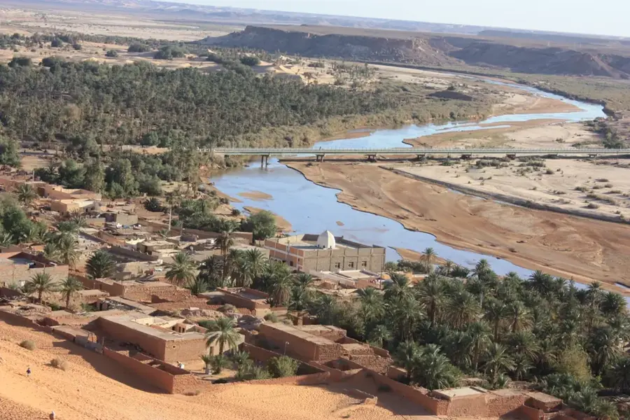
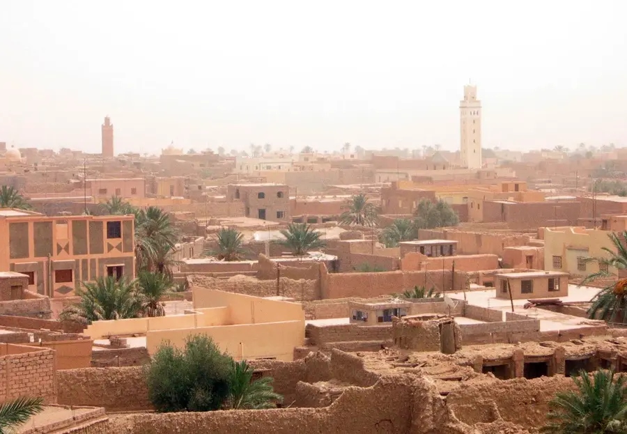
The Oued Guir is a significant river in eastern Morocco, originating in the eastern reaches of the High Atlas Mountains. It flows primarily southward across the barren high plateaus, serving as a vital lifeline in this semi-arid and sparsely populated landscape. The river's flow is characterized by a highly seasonal regime, carrying large volumes of water during the rainy season and snowmelt, while often drying up in several stretches during the summer months. After crossing the border into Algeria, it joins the Oued Ziz to form the Oued Saoura, which eventually dissipates into the Sahara Desert. The banks of the Guir are lined with date palm groves and small oases that have supported local agriculture and nomadic tribes for centuries. Despite its remote location, the river is strategically important for water management and livestock watering in the eastern borderlands. Geologically, the Guir has carved deep canyons into the limestone bedrock, creating dramatic scenery that defines the regional topography.
Best time to visit & climate
The most pleasant time to visit is Apr, May, Oct.
| Jan | Feb | Mar | Apr | May | Jun | Jul | Aug | Sep | Oct | Nov | Dec | |
|---|---|---|---|---|---|---|---|---|---|---|---|---|
| Avg °C | 7 | 9 | 13 | 17 | 22 | 27 | 32 | 30 | 25 | 19 | 12 | 8 |
| Rain mm | 17 | 13 | 16 | 15 | 13 | 9 | 3 | 17 | 25 | 34 | 31 | 17 |
📋 Practical info
Geography
Facts
- Source located in the eastern High Atlas range.
- Flows through the Figuig province of Morocco.
- Joins the Ziz in Algeria to form the Oued Saoura.
- Catchment area covers approximately 20,000 square km.
- Highly seasonal flow (ephemeral wadi characteristics).
- Crucial water resource for the Abadla oasis system.
Explore nearby
Notable places around
Route planner — Car & Motorhome
Where do you start? We build the route here, with stops and country notes along the way.
© OpenStreetMap contributors · OpenRouteService
Sights nearby
Frequently asked questions
Where does the Oued Guir flow?
Can you see agriculture along the Guir River?
Is the river interesting for tourists?
When does the Guir have the most water?
Are there bridges over the Guir?
Guir: where is it located?
Guir: when is the best time to visit?
Guir: why is it worth visiting?

Nearby cities