Plizio Visual Lab
Béchar

ℹ️Practical info — Béchar
▾
🌤 Weather — 5 days
📍 Nearby
Sights nearby
💡 Tips
- Explore early morning or late afternoon to avoid the intense desert heat.
- Dress modestly to respect the local culture.
- Drink plenty of bottled water and carry some on all trips.
- Beware of occasional sandstorms; pack sunglasses and a scarf.
🍽 Food
The region's classic dish, found in traditional restaurants downtown.
Famous produce from nearby oases, well-suited with sweet mint tea.
Slow-cooked meat and vegetables served in small local eateries.
🛍 Shopping · 🧘 Quiet spots
A bustling spot for buying spices, dates, and local textiles.
Look here for traditional Saharan rugs and pottery.
Quiet, shaded oases on the edge of the city, convenient for a peaceful walk.
Beautiful and silent at sunset, located just outside the city limits.
Water temperature…
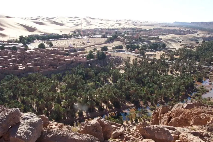
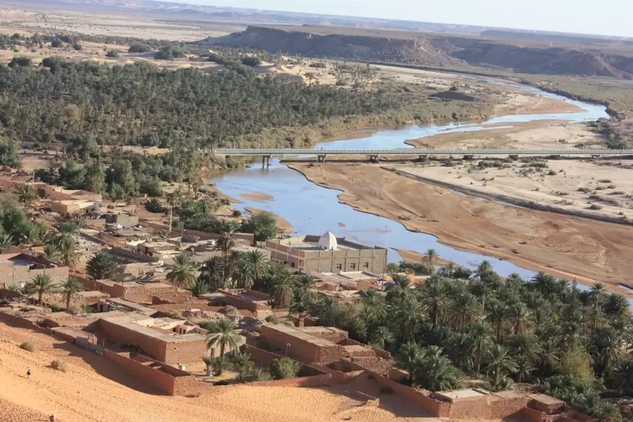
Béchar, the largest city in southwestern Algeria, is a significant administrative and economic gateway to the Sahara. Historically, the city developed rapidly following the discovery of coal deposits in nearby Kenadsa at the beginning of the 20th century, serving as a major French military post under the name Colomb-Béchar. Geographically, it is located in the Saoura valley, surrounded by rocky hamadas and the majestic dunes of the Great Western Erg. Béchar's economy is today shaped by trade, military presence, and the development of massive iron ore deposits at Gara Djebilet. Culturally, the region is known for its rich Gnawa music tradition and traditional festivals that reflect Saharan influences. As an educational hub, the city hosts the Tahri Mohammed University, attracting students from across the region. Béchar remains a strategic crossroads connecting northern Algeria with the vast desert territories of the southwest.
- Location: Algeria
- Top sights: CLF 3°RM · Parc d'Attraction · Bechar Museum
- Population: ~165.241 (2026)
Best time to visit & climate
The most pleasant time to visit is Apr, May, Oct.
| Jan | Feb | Mar | Apr | May | Jun | Jul | Aug | Sep | Oct | Nov | Dec | |
|---|---|---|---|---|---|---|---|---|---|---|---|---|
| Avg °C | 9 | 11 | 15 | 20 | 25 | 30 | 34 | 33 | 28 | 22 | 14 | 10 |
| Rain mm | 10 | 6 | 10 | 6 | 5 | 3 | 2 | 7 | 13 | 22 | 20 | 9 |
Geography
Facts
- Coal was discovered in nearby Kenadsa in 1917.
- Béchar is located at an elevation of 747 meters above sea level.
- The Gara Djebilet iron ore deposit is estimated at 3.5 billion tons.
- The Tahri Mohammed University was established in 1986.
- The city was a center for French rocket testing in the 1950s.
- Béchar is connected to the north by a 700 km railway line.
Explore nearby
Notable places around
Route planner — Car & Motorhome
Where do you start? We build the route here, with stops and country notes along the way.
© OpenStreetMap contributors · OpenRouteService
Sights in the town Béchar (5)
Frequently asked questions
Where is Béchar located?
What is the economic base of Béchar?
What is Taghit?
How do you get to Béchar?
How is the weather there?
Béchar: where is it located?
Béchar: what is there to see?
Béchar: when is the best time to visit?
Béchar: why is it worth visiting?