Plizio Visual Lab
Victoria Lines Fault
Plizio editorial teamData Sources
geo
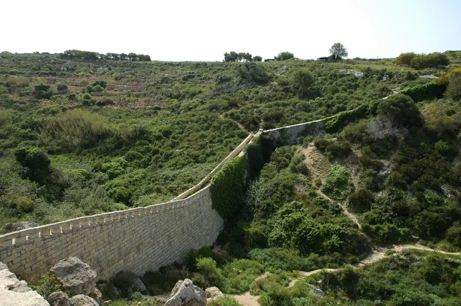
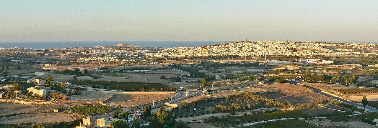
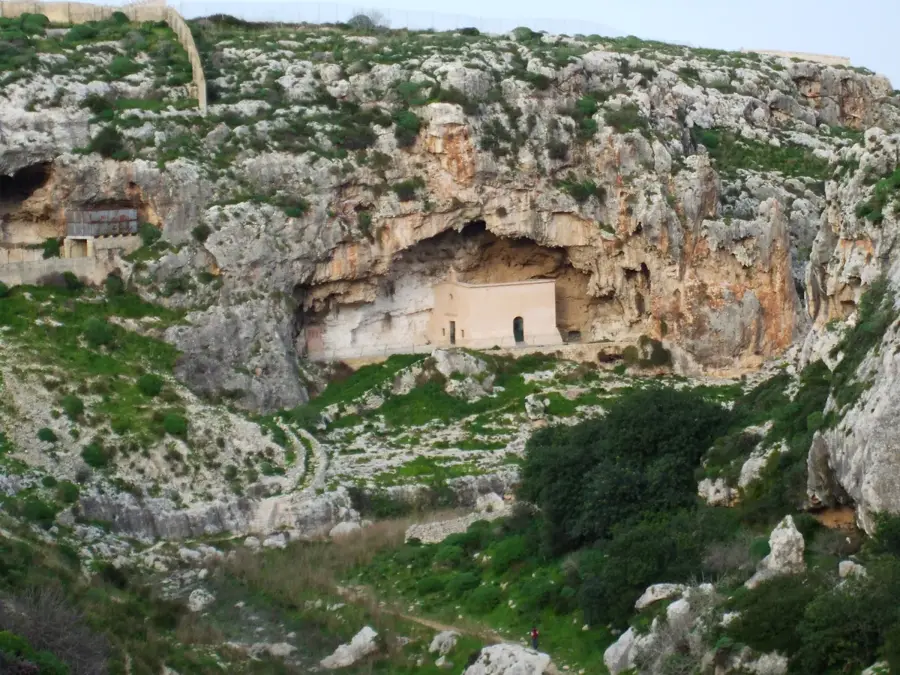
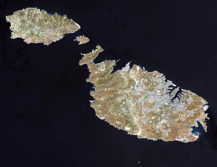
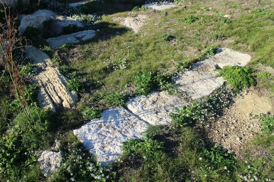
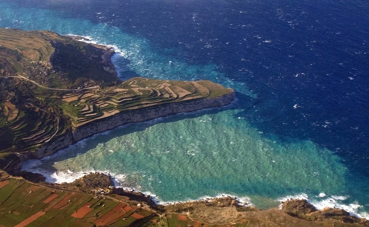
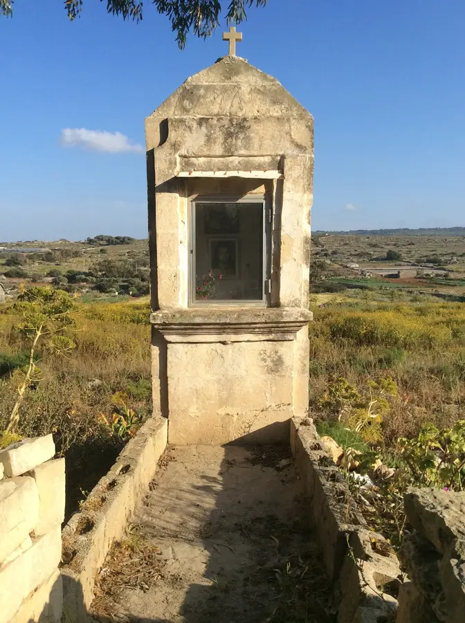
The Victoria Lines Fault is a major geological feature crossing the entire width of northern Malta, stretching 12 kilometers from Binġemma on the west to Baħar iċ-Ċagħaq on the east. This natural escarpment was formed millions of years ago by tectonic movements, creating a formidable defensive barrier that dominates the island's topography. Historically, the British military exploited this natural ridge in the late 19th century to construct the Victoria Lines, a complex system of fortifications, batteries, and defensive walls often called the 'Great Wall of Malta.' The lines were designed to protect the Grand Harbour and southern Malta from potential invasions from the north. Geologically, the fault provides a clear cross-section of Malta's sedimentary layers, primarily exposing Lower and Upper Coralline Limestone. Today, the ridge has spectacular panoramic views and is a popular route for walkers and historians alike. The fault line also influences local hydrology and ecology, with unique flora colonizing the steep, rocky slopes. It remains a powerful testament to both Malta's geological history and its strategic military importance during the colonial era.
- Location: Malta
- Top sights: Dwejra Lines · Tarġa Battery · Ta' Bistra Catacombs
- Nearby: Naxxar (4 km)
Best time to visit & climate
The most pleasant time to visit is May–Jul.
| Jan | Feb | Mar | Apr | May | Jun | Jul | Aug | Sep | Oct | Nov | Dec | |
|---|---|---|---|---|---|---|---|---|---|---|---|---|
| Avg °C | 15 | 14 | 15 | 16 | 19 | 23 | 26 | 27 | 25 | 23 | 20 | 16 |
| Rain mm | 74 | 65 | 51 | 33 | 17 | 11 | 4 | 10 | 63 | 82 | 95 | 82 |
📋 Practical info
Visiting
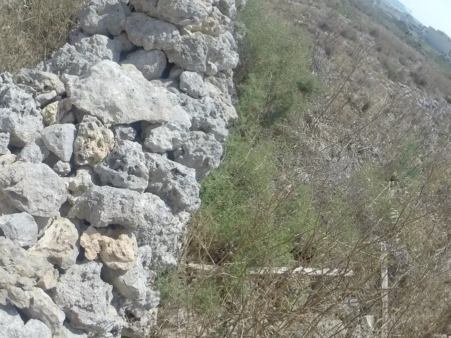
This extensive geological fault line, fortified during the British era, presents a fascinating combination of natural rugged landscapes and historical military architecture. You can freely walk along large stretches of these nineteenth-century defensive walls and explore the varied terrain of the Maltese countryside.
Typical hours
Since the fault and its associated fortifications span across the open landscape, they are generally accessible at all hours throughout the year. Most hikers and history enthusiasts choose to explore the area during the daylight hours when visibility is good and the defensive structures can be fully appreciated.
Photography
The sweeping views from the elevated escarpment provide excellent opportunities to photograph the rolling valleys and distant towns of northern Malta. Capturing the long, winding stone walls as they snake across the rocky hillsides highlights the impressive scale of this historical defensive barrier.
Time needed
Depending on how much of the trail you wish to hike, a visit can last anywhere from a brief one-hour stroll to an extensive half-day trekking adventure. Many visitors choose a specific section of the wall to explore, taking their time to enjoy the scenic overlooks and historical remnants along the way.
Combine with
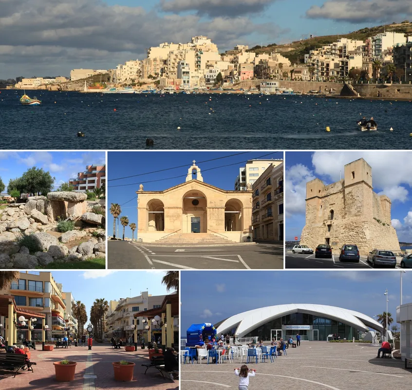
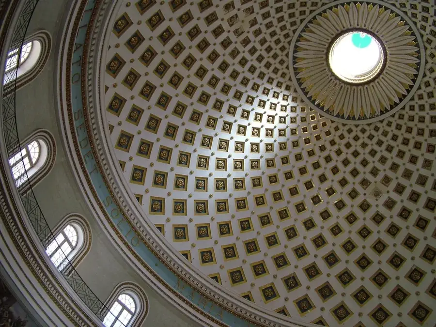
The trail passes close to several interesting towns and landmarks, including the historic city of Mdina and the beautiful Mosta Dome. You can easily combine a morning hike along the lines with a relaxing afternoon exploring the quiet streets and museums of the former medieval capital.
Getting there
Access points are scattered across the island, from Baħrija in the west to Pembroke in the east, with many sections reachable by local buses or rental car. Some of the most popular and best-preserved hiking starting points can be found near the towns of Għargħur or the Dwejra Lines near Rabat.
Insider tip
The terrain along the fault line can be quite uneven, rocky, and occasionally overgrown with vegetation, making sturdy hiking boots an absolute necessity. Additionally, as the route is fully exposed to the sun and wind, it is essential to carry sufficient water and wear appropriate sun protection.
Geography
Facts
- The fault spans 12 kilometers across the entire width of Malta.
- It was used by the British in the 1890s to build a defensive wall.
- The fortifications are often called the 'Great Wall of Malta'.
- The fault exposes diverse geological layers of limestone.
- It provides a natural high-ground vantage point over the northern plains.
- The ridge is a popular destination for long-distance hiking.
Explore nearby
Notable places around
Route planner — Car & Motorhome
Where do you start? We build the route here, with stops and country notes along the way.
Vehicle
Only stops with (optional):
© OpenStreetMap contributors · OpenRouteService
Sights in the town Victoria Lines Fault (9)
Ta' Bistra Catacombs
Underground burial chambers in Malta.
Mdina Panorama
Viewpoint with a view of the old capital Mdina.
catacombs
Underground burial chambers from early Christian times.
Victoria Lines
Viewpoint along the historic defensive line.
Cart Ruts
Archaeological site with cart tracks carved into rock.
Assumption of Saint Mary
Church in Mosta, Malta, known for its dome.
Sights nearby
Frequently asked questions
What are the Victoria Lines?
A 12 km long 19th-century defensive line, also known as the 'Great Wall of Malta'.
Can you hike the entire length?
Yes, the hike across the island is popular but requires a full day.
Why do they follow a fault line?
The wall utilizes the natural escarpment of the Great Fault for a better defensive position.
Are the paths well marked?
Not everywhere; a hiking map or GPS app is highly recommended for navigation.
Is there an entrance fee?
No, the Victoria Lines are an open historical monument with no entrance fees.
Victoria Lines Fault: where is it located?
Victoria Lines Fault is located in Malta.
Victoria Lines Fault: what is there to see?
Highlights include Dwejra Lines, Tarġa Battery, Ta' Bistra Catacombs.
Victoria Lines Fault: when is the best time to visit?
The most pleasant time to visit is May, Jul.
Victoria Lines Fault: why is it worth visiting?
The Victoria Lines Fault is a major geological feature crossing the entire width of northern Malta, stretching 12 kilometers from Binġemma on the west to Baħar iċ-Ċagħaq on the east.

Explore with Plizio
Discover more places in Europe
More places in Malta →
Nature
Il-Qlajja Hill
A prominent hilltop near Mdina.
Ta' Ċinċ Hill
A hill near Birkirkara that functions as part of the interior topography.
Chadwick Lakes (Freshwater)
A man-made system of dams that forms a freshwater habitat during the rainy season.
Bahrija Plateau
A rural plateau with beautiful views and walking trails.
🗺️
Mtaħleb Valley
A fertile valley that slopes down to the sea, home to one of Malta's few streams.
Fomm ir-Riħ Bay
A secluded and hard-to-reach bay with dramatic cliffs and clear water.
More places

City Sightseeing Hop-On-Hop-Off Bus
An easy way for families to explore Malta's main attractions on an open-top bus.
Three Cities Ferry Service
A ferry service connecting Valletta to the Three Cities (Birgu, Senglea).

Bee Keeping Experience
Several beekeepers offer tours where visitors can learn about honey production.
Vincent's Eco Farm
One of the largest organic farms in Malta, growing a variety of vegetables and fruits.
Sun Ripe Farms
An agricultural holding known for its strawberries and other fruits.
Il-Bidnija Ridge
A wooded and agricultural ridge in the north of Malta.
Mosta Technopark
An industrial park focusing on technology and knowledge-based companies.
Bacchus Winery
A restaurant and venue in Mdina with a historic wine cellar.