Plizio Visual Lab
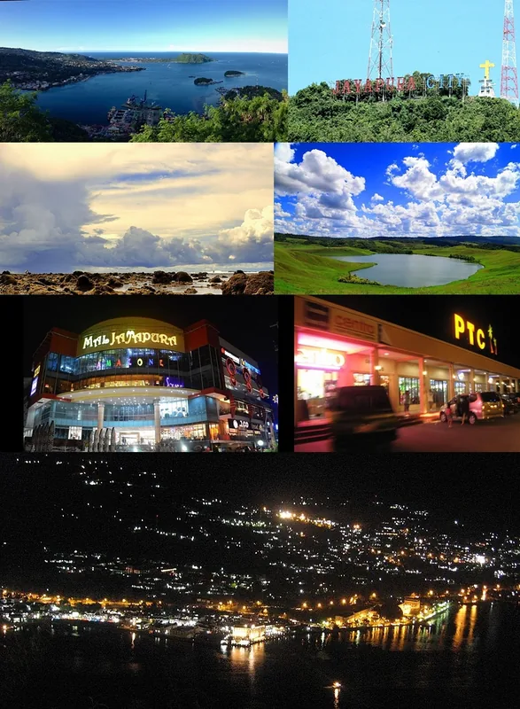
Jayapura
ℹ️Practical info — Jayapura
▾
🌤 Weather — 5 days
📍 Nearby
Sights nearby
💡 Tips
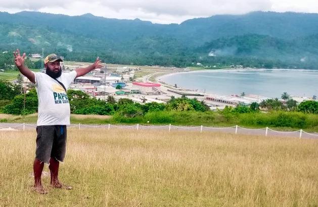
- Take an ojek (motorcycle taxi) up to Polimak or Base G for spectacular panoramic views of the bay.
- The weather is highly humid and prone to sudden downpours; always carry a rain poncho.
- Visit the local markets early in the morning (around 6 AM) for the best atmosphere and freshest produce.
- Malaria precautions are strongly advised when traveling in this region.
- Respect the local pace of life; things may take longer than expected, so patience is key.
🍽 Food
A sticky sago congee traditionally served with Kuah Kuning (yellow fish soup) in local warungs.
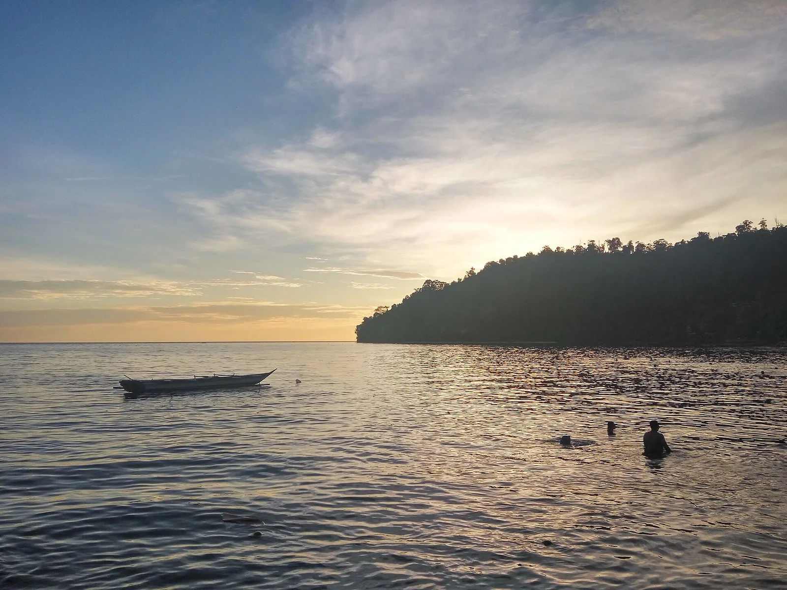
Grilled fish, which is excellent at the seafood stalls near the harbor or Base G beach.
A ubiquitous local chew sold by street vendors; try it cautiously if you're curious.
🛍 Shopping · 🧘 Quiet spots
The traditional market famous for Papuan arts, crafts, and Noken (woven bags).
Look for distinctive bark paintings and wood carvings from local artisans.
A beautiful stretch of white sand that is especially peaceful on weekdays.
Take a short trip out of town and hire a boat to the islands for a serene escape.
Water temperature…
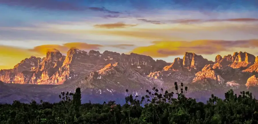
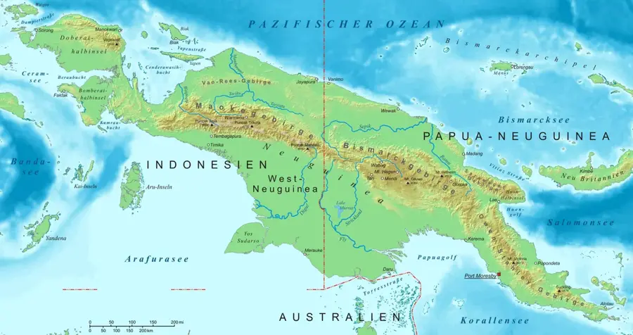
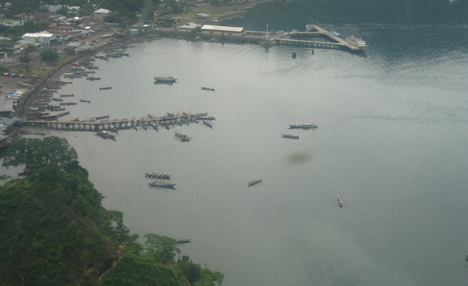
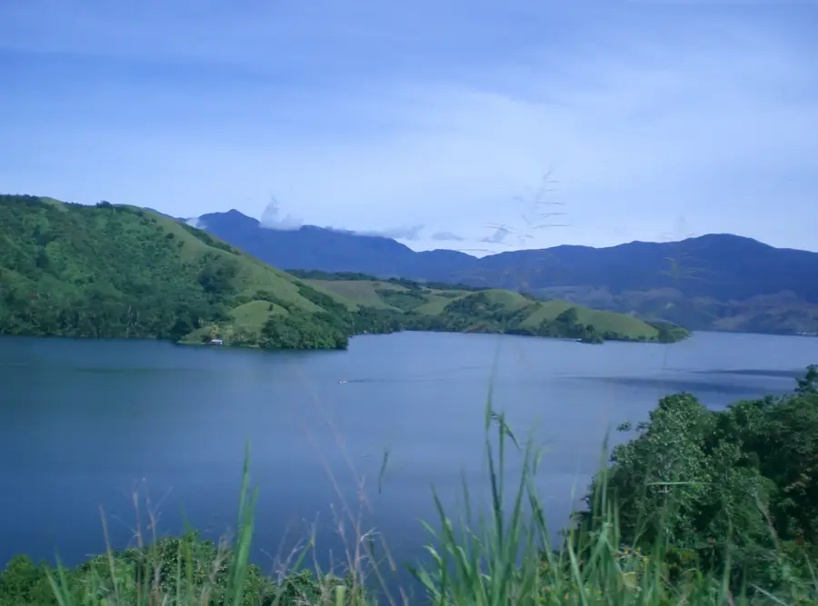
Jayapura, the capital of Papua Province, is situated on the shores of Yos Sudarso Bay (formerly Humboldt Bay) in the far eastern reaches of the Indonesian archipelago. The city is characterized by its rugged topography, with steep, verdant hills plunging directly into the Pacific Ocean, creating a scenic but challenging urban landscape. Founded by the Dutch in 1910 as Hollandia, the city gained international strategic importance during World War II when it was captured by Allied forces in April 1944. General Douglas MacArthur established his regional headquarters here, planning the liberation of the Philippines from the heights of Mount Ifar. Following the transfer of Western New Guinea to Indonesia in the 1960s, the city underwent several name changes, including Sukarnopura, before settling on Jayapura, meaning 'City of Victory.' Economically, Jayapura serves as the primary administrative and commercial gateway for the Papua region, with its port handling the majority of goods flowing to and from the interior. The city is also a center for higher education, home to Cenderawasih University, which plays a pivotal role in documenting and preserving Papuan biodiversity and indigenous cultures. Culturally, the city is a melting pot of Melanesian traditions and diverse influences from across the Indonesian archipelago. Nearby Lake Sentani is a cultural treasure, famous for its stilt houses and unique bark cloth paintings produced by the local indigenous communities. Modern Jayapura is linked by the iconic red arches of the Youtefa Bridge, symbolizing the city's aspirations for growth and connectivity in one of Indonesia's most remote and diverse frontiers.
- Location: Indonesia
- Top sights: Yos Sudarso Bay · Yautefa Bay · Pantai Hamadi
- Nearby: Tobati (5 km)
- Population: ~233.859
Best time to visit & climate
The most pleasant time to visit is Jul, Aug, Oct.
| Jan | Feb | Mar | Apr | May | Jun | Jul | Aug | Sep | Oct | Nov | Dec | |
|---|---|---|---|---|---|---|---|---|---|---|---|---|
| Avg °C | 27 | 27 | 27 | 27 | 27 | 27 | 27 | 27 | 27 | 27 | 27 | 27 |
| Rain mm | 233 | 223 | 252 | 198 | 154 | 178 | 146 | 149 | 165 | 134 | 179 | 198 |
Geography
Facts
- Jayapura coordinates are 2° 32' S and 140° 43' E, near the PNG border.
- The city’s name combines the Sanskrit words 'Jaya' (victory) and 'Pura' (city).
- Base-G Beach was originally named 'Base G' as a military staging area in 1944.
- The Jayapura Port is a key entry point for the Trans-Papua Highway logistics.
- The local population is a mix of over 250 indigenous tribes and migrants.
- Mount Ifar, where the MacArthur monument stands, was a strategic lookout post.
- Jayapura experiences over 2,500 mm of rainfall annually on average.
- The red color of the Youtefa Bridge is intended to symbolize courage and strength.
Explore nearby
Notable places around
Route planner — Car & Motorhome
Where do you start? We build the route here, with stops and country notes along the way.
© OpenStreetMap contributors · OpenRouteService
Morning begins with a spiritual walk through Hamadi, visiting the prominent mosques. Midday takes you past historical remnants of the Pacific War right by the coast. In the afternoon, you will relax on the warm sands of Pantai Hamadi, watching local life unfold. Evening concludes with peaceful ocean breezes and a sense of Jayapura's rich history.
Masjis Taqwa Hamadi
Masjid Al-Hamidi
Mosque As Syuhada
3 WWII rusty tanks
Pantai Hamadi
The morning starts under the protective roofs of the Hamadi mosques. At noon, we seek refuge in the local markets as tropical rain drums on the corrugated iron roofs. In the afternoon, the beach offers covered huts to observe the grey sea safely. The evening ends humid and rainy, with illuminated streets glistening in the wet, creating a mystical atmosphere for our final walk.
Masjis Taqwa Hamadi
Masjid Al-Hamidi
Mosque As Syuhada
3 WWII rusty tanks
Pantai Hamadi
The cool morning air makes the climb to the city sights very pleasant. At noon, the gentle sun warms the walk while we admire the architecture of the mosques. In the afternoon, temperatures drop noticeably, and we must hurry as the sun sets early at 17:00. The evening becomes cool quickly, making it the perfect time to end the day in a cozy local café with a warm drink.
Masjis Taqwa Hamadi
Masjid Al-Hamidi
Mosque As Syuhada
3 WWII rusty tanks
Pantai Hamadi
Your morning cycling starts with high panoramic views from the city sign and descends into the grand architectural heritage of the city. Midday pedaling leads you through historic districts and haunting war relics. Afternoon brings a coastal breeze as you relax at Pantai Hamadi beach. Your day concludes dramatically with a ride over the magnificent red arches of the Youtefa Bridge.
Jayapura City Sign
Masjid Raya
Masjis Taqwa Hamadi
3 WWII rusty tanks
Pantai Hamadi
Youtefa Bridge
The ride starts cautiously on the slippery roads towards the city sign. At noon, Masjid Raya offers a large dry area for a break from the rain for cyclists. In the afternoon, we pedal through puddles towards Hamadi, resting under the vendors' awnings. The evening on the Youtefa Bridge is windy and wet, but offers a dramatic view of the Jayapura Bay in the pouring rain.
Jayapura City Sign
Masjid Raya
Masjis Taqwa Hamadi
3 WWII rusty tanks
Pantai Hamadi
Youtefa Bridge
A refreshing morning start in the cool breeze at the city sign. The ride to Masjid Raya is much less taxing thanks to the milder temperatures. In the afternoon, we enjoy clear views of the bay, but must pick up the pace as the sun sets at 17:00. Crossing the Youtefa Bridge at sunset is the highlight before the sharp evening cold sets in by the coast.
Jayapura City Sign
Masjid Raya
Masjis Taqwa Hamadi
3 WWII rusty tanks
Pantai Hamadi
Youtefa Bridge
The morning drive starts with refreshing coffee amidst lush greenery, followed by a coastal ride to the historic Base-G Beach. Midday is dedicated to deep dives into Papua’s history at the military museum and panoramic skyline views. In the afternoon, you will cruise down to the bustling shoreline of Hamadi for seaside relaxation. Evening delivers a spectacular drive over the red arches of Youtefa Bridge to the serene bay beyond.
81 Cafe
Base-G Beach
Museum Sarwo Edhie Wibowo - Kodam XVII Cendrawasih
Jayapura City Sign
Pantai Hamadi
Youtefa Bridge
Yautefa Bay
A pleasant start at 81 Cafe as clouds roll through the valley. At noon, we watch the waves at Base-G Beach from the safety of the car. The afternoon is spent dry in the museum, followed by misty panoramic views from the city sign. The evening ends with a drive across the Youtefa Bridge, where the city lights blur romantically in the rain, providing a cozy finish to the day.
81 Cafe
Base-G Beach
Museum Sarwo Edhie Wibowo - Kodam XVII Cendrawasih
Jayapura City Sign
Pantai Hamadi
Youtefa Bridge
Yautefa Bay
A warm coffee at 81 Cafe to start the cool winter morning. A refreshing stroll at Base-G Beach follows before we spend the midday period inside the comfortable museum. We reach the city sign before the early sunset at 17:00 to enjoy the clear winter views. The day ends with a drive across the illuminated bridge while the car's heater ensures comfort as the air cools.
81 Cafe
Base-G Beach
Museum Sarwo Edhie Wibowo - Kodam XVII Cendrawasih
Jayapura City Sign
Pantai Hamadi
Youtefa Bridge
Yautefa Bay
Sights in the town Jayapura (10)
Frequently asked questions
What is the most beautiful lake near Jayapura?
Are there good beaches in the city?
How safe is Jayapura for tourists?
Where to buy local art?
How to get from the airport to the city?
Jayapura: where is it located?
Jayapura: what is there to see?
Jayapura: when is the best time to visit?
Jayapura: why is it worth visiting?

Nearby cities
Nature
More places