Plizio Visual Lab
National Pine Forest
Weather…
Water temperature…
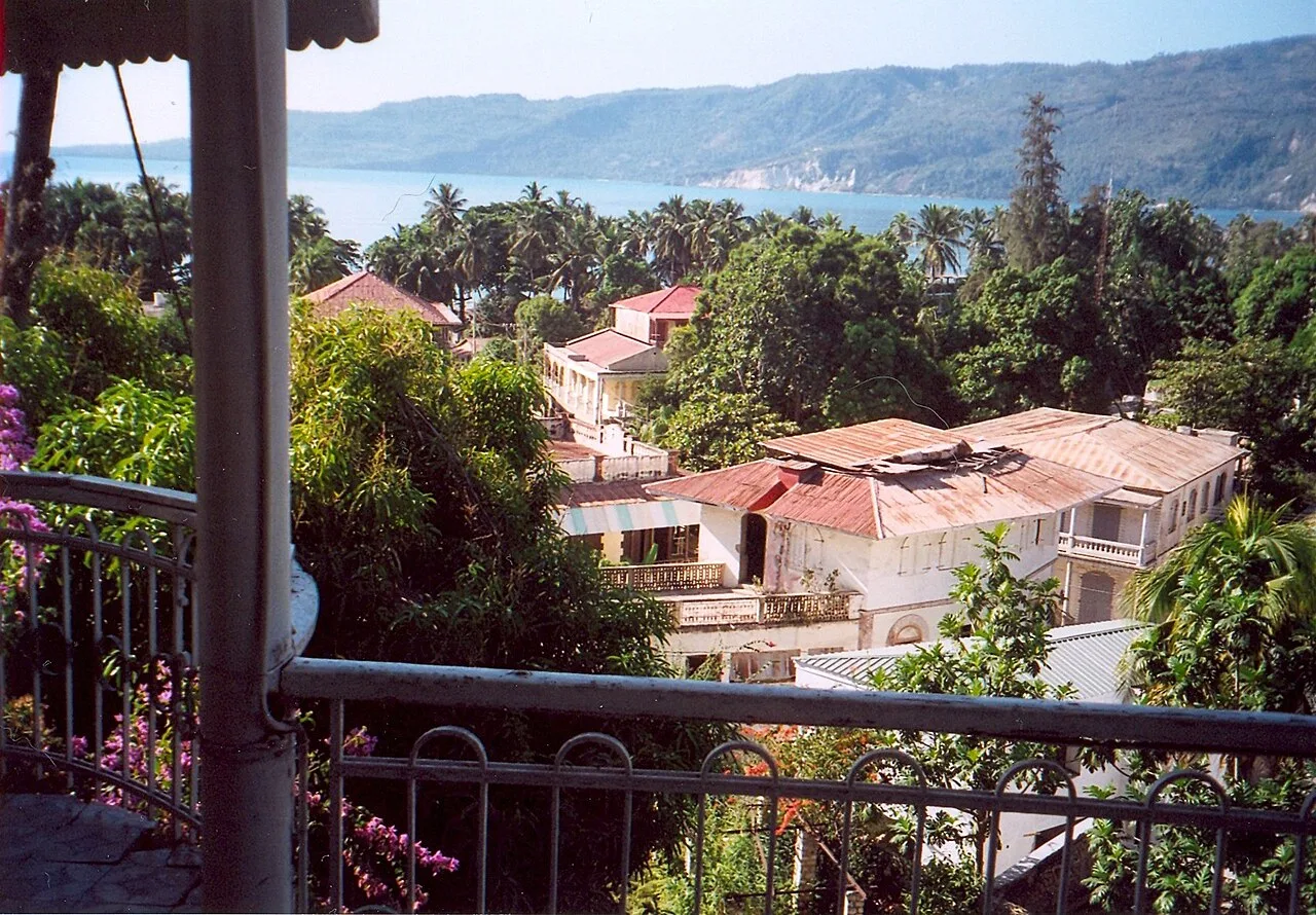
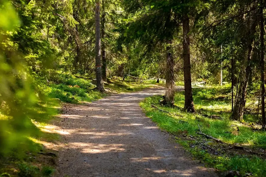
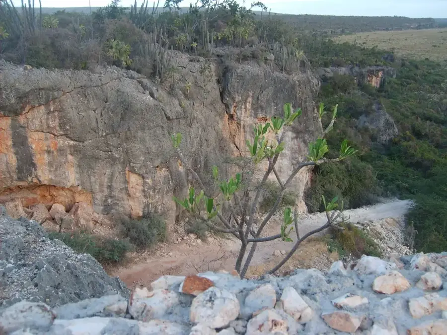
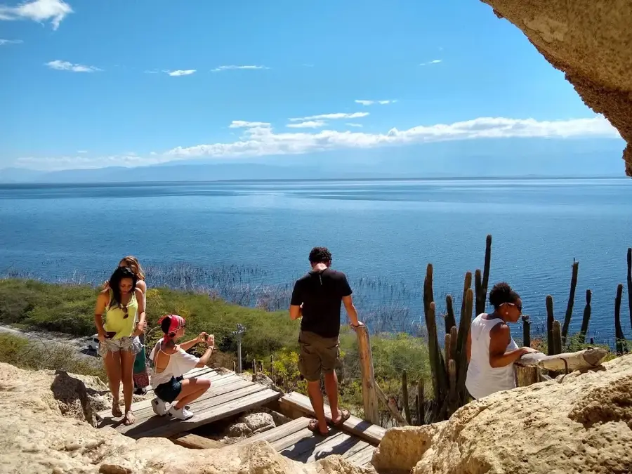
The Forêt des Pins National Park is one of Haiti's largest remaining forested areas, located in the southeastern Chaîne de la Selle mountains. The forest is renowned for its stands of the Hispaniolan pine (Pinus occidentalis), which thrives in the cooler elevations above 1,500 meters. This ecosystem is invaluable to Haiti's water cycle, acting as a natural sponge that feeds numerous rivers essential for irrigating the surrounding lowlands. Tragically, the park is under massive threat from illegal logging, slash-and-burn agriculture, and forest fires. Only fragments remain of what were once vast, contiguous forests. International conservation projects are working to ensure the survival of this unique coniferous habitat through reforestation efforts and strict protection of its core zones.
- Location: Haiti
- Nearby: Bassin Zim (32 km)
Best time to visit & climate
The most pleasant time to visit is Jan, Feb, Dec.
| Jan | Feb | Mar | Apr | May | Jun | Jul | Aug | Sep | Oct | Nov | Dec | |
|---|---|---|---|---|---|---|---|---|---|---|---|---|
| Avg °C | 23 | 24 | 25 | 26 | 26 | 26 | 27 | 27 | 27 | 26 | 25 | 24 |
| Rain mm | 19 | 17 | 26 | 40 | 64 | 41 | 38 | 66 | 45 | 76 | 62 | 29 |
📋 Practical info
Geography
Facts
- Established in 1937.
- Home to the endemic Pinus occidentalis.
- Highest points reach over 2,000 meters.
- Most vital watershed in southeastern Haiti.
- Annual temperatures often drop below 10°C.
- Only about 10% of the primary forest remains.
Explore nearby
Notable places around
Route planner — Car & Motorhome
Where do you start? We build the route here, with stops and country notes along the way.
© OpenStreetMap contributors · OpenRouteService
Sights nearby
Frequently asked questions
When is the best time to visit?
Do I need a 4x4 vehicle?
Are there camping facilities?
What is the weather like at night?
What trees grow here?
National Pine Forest: where is it located?
National Pine Forest: when is the best time to visit?
National Pine Forest: why is it worth visiting?

Nearby cities

History & landmarks


Nature
More places