Plizio Visual Lab
Morne l'Hôpital
Weather…
Water temperature…
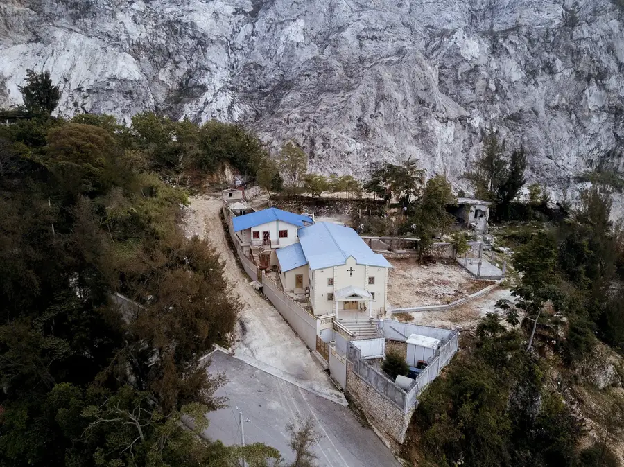
Morne l'Hôpital is a mountain massif rising directly south of Haiti's capital, Port-au-Prince. Geologically composed of limestone, the mountain serves as a critical watershed for the entire metropolitan area. However, in recent decades, Morne l'Hôpital has suffered extensively from massive, unregulated urban sprawl and severe deforestation. The loss of its natural vegetative cover has drastically heightened the risk of erosion, leading to frequent and devastating mudslides and flash floods in the lower-lying city districts during heavy tropical rains. Ongoing reforestation initiatives and stricter building regulations are essential for the long-term safety and water security of Port-au-Prince's millions of residents. Protecting this mountain is a high-stakes race against time and represents one of the capital's most daunting environmental challenges.
- Location: Haiti
- Nearby: Furcy (6 km)
Best time to visit & climate
The most pleasant time to visit is Jan–Mar.
| Jan | Feb | Mar | Apr | May | Jun | Jul | Aug | Sep | Oct | Nov | Dec | |
|---|---|---|---|---|---|---|---|---|---|---|---|---|
| Avg °C | 26 | 26 | 26 | 27 | 28 | 28 | 29 | 29 | 29 | 28 | 27 | 26 |
| Rain mm | 19 | 16 | 25 | 37 | 62 | 41 | 38 | 64 | 49 | 75 | 56 | 28 |
📋 Practical info
Geography
Facts
- Critical water catchment area for Port-au-Prince.
- Elevation of approximately 1,000 meters.
- Highly susceptible to catastrophic mudslides.
- Slopes are covered by extensive informal settlements.
- Focal point for numerous national reforestation efforts.
- Limestone karst geology facilitates rapid runoff.
Explore nearby
Notable places around
Route planner — Car & Motorhome
Where do you start? We build the route here, with stops and country notes along the way.
© OpenStreetMap contributors · OpenRouteService
Sights nearby
Frequently asked questions
Where is Morne l'Hôpital located?
What is the significance of the mountain?
Can you go hiking there?
How high is the mountain?
Is there vegetation there?
Morne l'Hôpital: where is it located?
Morne l'Hôpital: when is the best time to visit?
Morne l'Hôpital: why is it worth visiting?

More places