Plizio Visual Lab
Blue Nile Falls
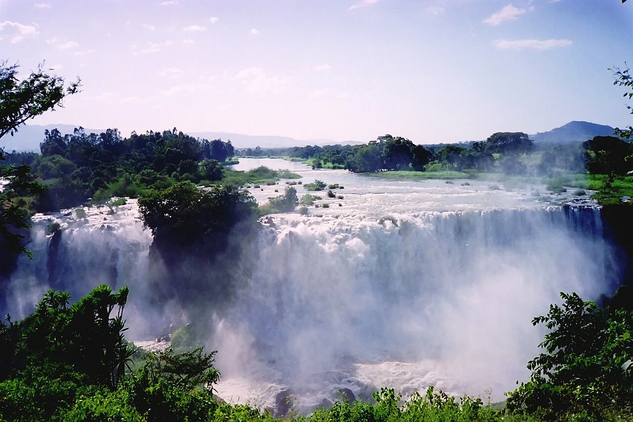
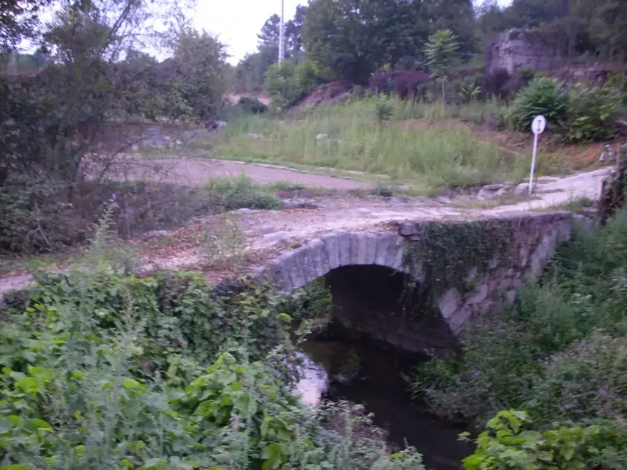
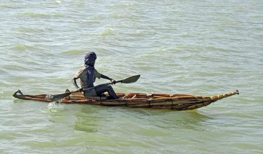
The Blue Nile Falls, locally known as 'Tis Abay' (smoking water), are situated approximately 30 kilometers downstream from Bahir Dar and Lake Tana. They represent one of Ethiopia's most striking natural landmarks, once spanning up to 400 meters in width before a significant portion of the water was diverted for hydroelectric power generation. The falls consist of four primary streams that plunge from a height of about 40 to 45 meters into a deep basalt canyon. During the peak of the rainy season, from June to September, the falls regain their immense power, generating a permanent mist cloud that characterizes the surrounding area. The local ecosystem thrives on this constant moisture, supporting lush vegetation and a diverse range of bird species. Historically, the site is notable for the nearby 17th-century Portuguese bridge, the first stone bridge ever built in Ethiopia. Despite industrial water management, the falls remain a potent symbol of the Blue Nile's untamed energy and a primary destination for nature tourism in the Amhara Region.
- Location: Ethiopia
- Top sights: Blue Nile Falls · Falls View
Best time to visit & climate
The most pleasant time to visit is Jan–Mar.
| Jan | Feb | Mar | Apr | May | Jun | Jul | Aug | Sep | Oct | Nov | Dec | |
|---|---|---|---|---|---|---|---|---|---|---|---|---|
| Avg °C | 19 | 21 | 22 | 22 | 22 | 20 | 17 | 17 | 18 | 18 | 18 | 18 |
| Rain mm | 4 | 10 | 29 | 59 | 135 | 197 | 394 | 370 | 200 | 72 | 28 | 10 |
📋 Practical info
Geography
Facts
- The falls drop from a height of approximately 40 to 45 meters.
- In the rainy season, the falls can reach a width of up to 400 meters.
- The site is located about 30 kilometers south of the city of Bahir Dar.
- The nearby Portuguese stone bridge was constructed in the year 1626.
- Much of the water flow is currently diverted to the Tis Abay I & II power plants.
- The name 'Tis Abay' is derived from the Amharic language.
Explore nearby
Notable places around
Route planner — Car & Motorhome
Where do you start? We build the route here, with stops and country notes along the way.
© OpenStreetMap contributors · OpenRouteService
Sights in the town Blue Nile Falls (2)
Sights nearby
Frequently asked questions
When do the falls have the most water?
How far are the falls from Bahir Dar?
Is there a hiking path to the falls?
Can you stay overnight near the falls?
Do I need a guide?
Blue Nile Falls: where is it located?
Blue Nile Falls: what is there to see?
Blue Nile Falls: when is the best time to visit?
Blue Nile Falls: why is it worth visiting?

Nearby cities

History & landmarks

Nature
More places