Plizio Visual Lab
Bahr Keïta

Weather…
Water temperature…
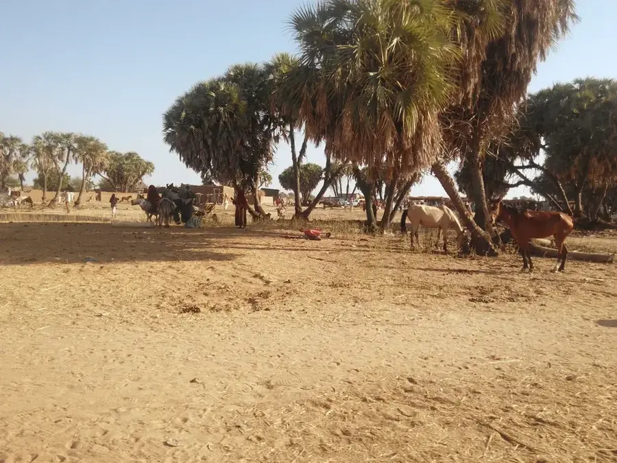
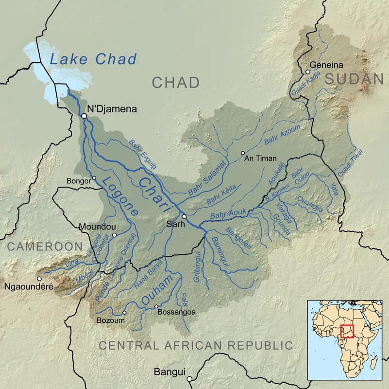
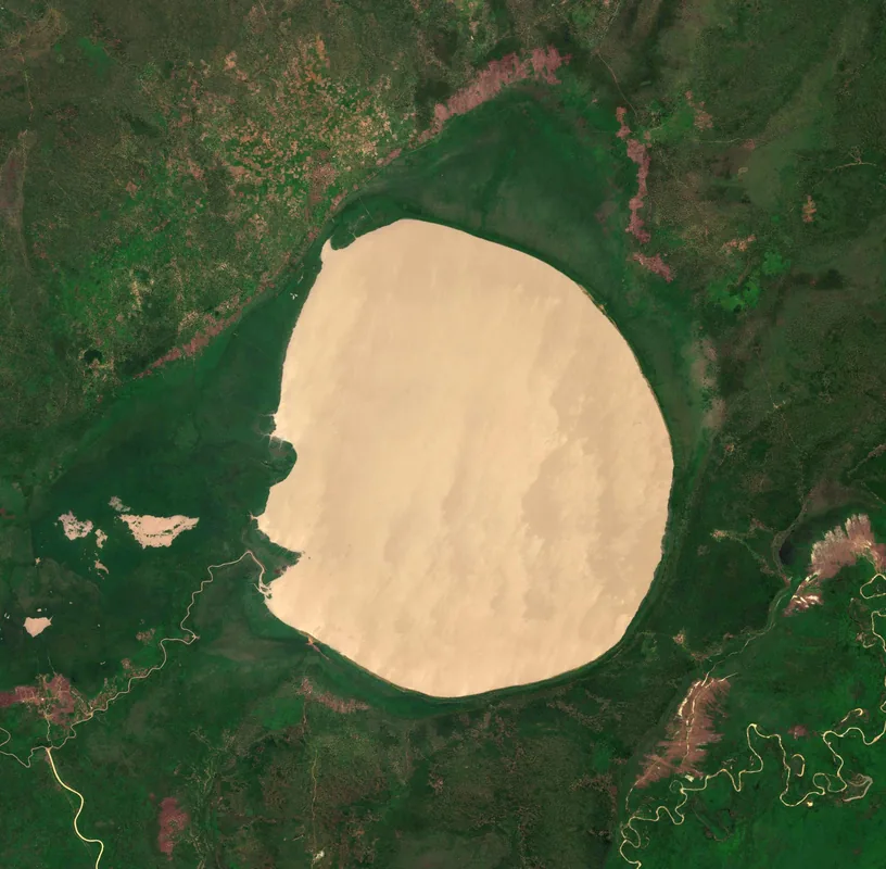
Bahr Keita is an intermittent river system located in the central part of Chad, specifically within the Batha and Guéra regions. It is part of the inland drainage system of the Sahel, where water flows only during the brief but intense rainy season between July and September. During this time, the river brings life to the arid landscape, allowing for the cultivation of traditional crops such as sorghum and millet in the fertile silt left along its banks. The river eventually drains into a series of seasonal marshes and small lakes, which serve as important habitats for local and migratory bird species. In the dry months, the riverbed serves as a vital transportation route and a source of groundwater for nomadic herders who dig shallow wells to reach the underlying water table. Bahr Keita is a classic example of a Sahelian 'wadi,' where the entire local economy and ecosystem are synchronized with the erratic patterns of tropical rainfall. Its management is increasingly important as the region faces the challenges of desertification and fluctuating climate conditions in Central Africa.
Best time to visit & climate
The most pleasant time to visit is Feb, Mar, Nov.
| Jan | Feb | Mar | Apr | May | Jun | Jul | Aug | Sep | Oct | Nov | Dec | |
|---|---|---|---|---|---|---|---|---|---|---|---|---|
| Avg °C | 14 | 18 | 23 | 28 | 32 | 34 | 33 | 33 | 31 | 27 | 21 | 16 |
| Rain mm | 0 | 0 | 0 | 1 | 3 | 2 | 1 | 7 | 1 | 1 | 0 | 0 |
📋 Practical info
Geography
Facts
- Passes through the central Chadian regions of Batha and Guéra.
- Flows only during the main rainy season from July to September.
- The fertile river silt allows for the cultivation of sorghum.
- Typical example of a seasonal wadi system in the Sahel.
- Important transit route for trade caravans during the dry season.
- Serves as the primary water source for nomadic livestock.
Explore nearby
Notable places around
Route planner — Car & Motorhome
Where do you start? We build the route here, with stops and country notes along the way.
© OpenStreetMap contributors · OpenRouteService
Sights nearby
Frequently asked questions
What does Bahr Keïta mean?
Can you visit the area without a guide?
Are there tourist accommodations there?
What is the best way to travel?
Is the region politically stable?
Bahr Keïta: where is it located?
Bahr Keïta: when is the best time to visit?
Bahr Keïta: why is it worth visiting?