Plizio Visual Lab
Sangha River
Weather…
Water temperature…
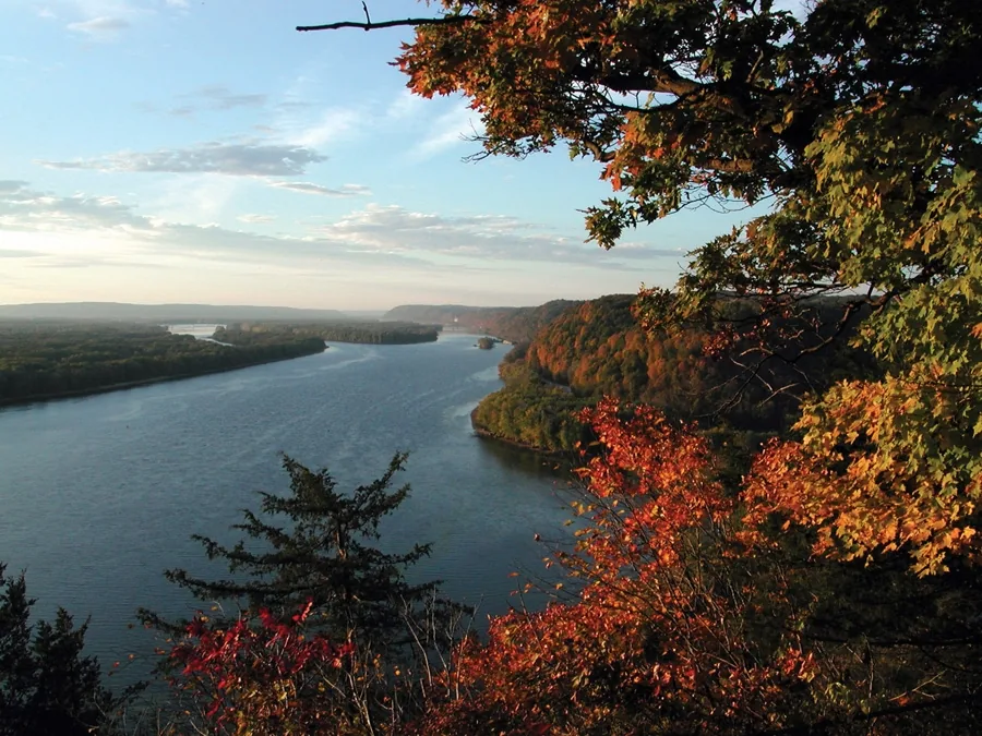
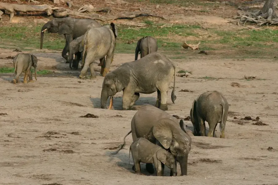
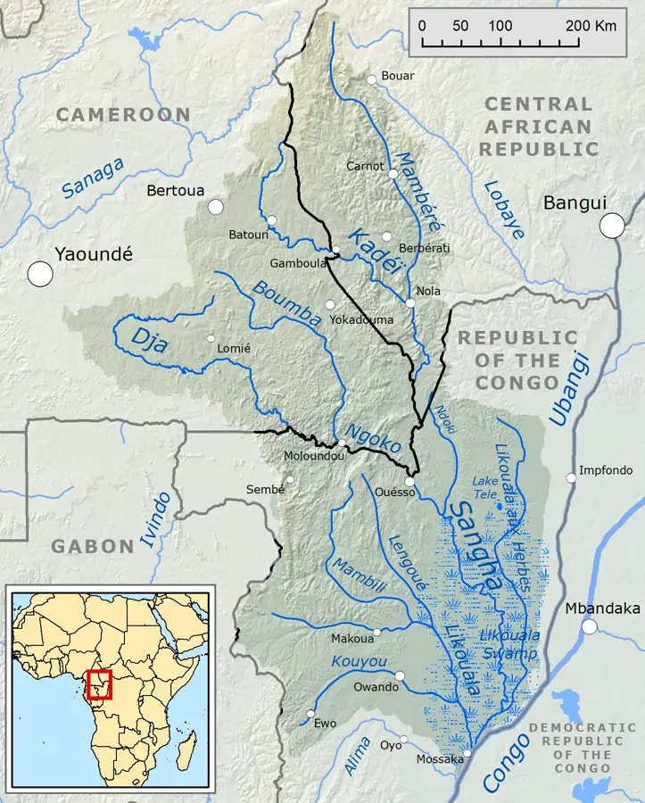
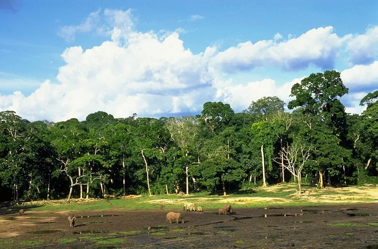
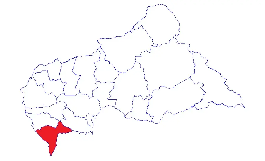
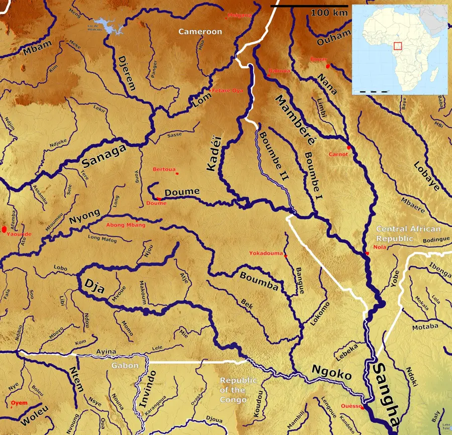
The Sangha River is a major right-bank tributary of the Congo River, flowing through the Central African Republic, Cameroon, and the Republic of the Congo. Spanning approximately 790 kilometers, it serves as a vital waterway for transporting timber and other resources in this remote region. Geographically, the Sangha is formed by the confluence of the Mambéré and Kadéï rivers near the town of Berbérati. Its significance is highlighted by the Sangha Trinational protected area, a UNESCO World Heritage site since 2012 that connects three national parks. The river basin is dominated by dense tropical rainforest, hosting extraordinary biodiversity, including forest elephants and lowland gorillas. During the colonial era, the river was an essential route for the rubber trade and the exploration of the African interior. Today, the Sangha remains central to the regional ecosystem and is fundamental to the livelihoods of numerous indigenous communities residing along its banks.
- Location: Central African Republic
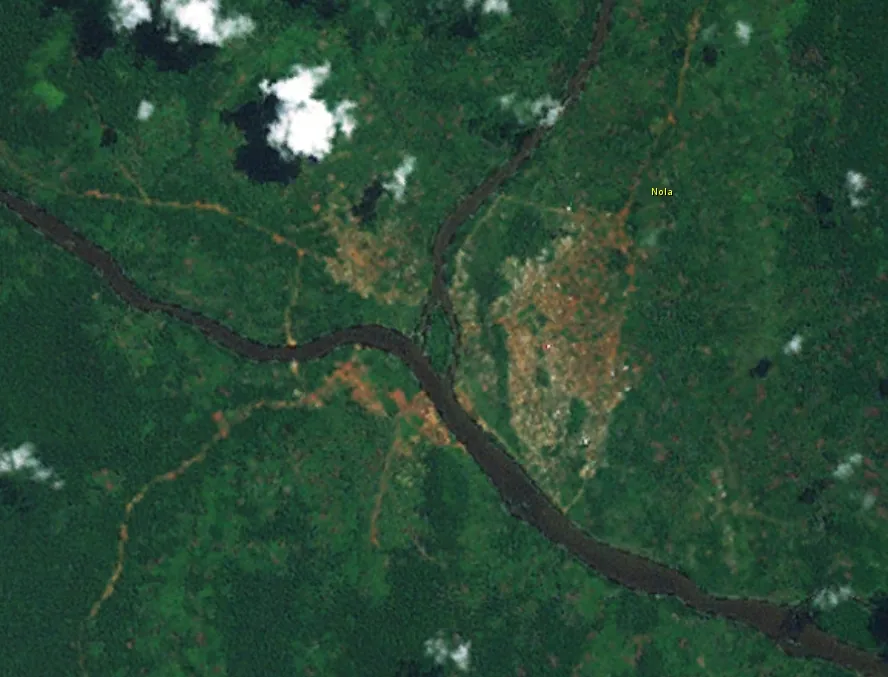
- Top sights: Kadéï River · Nola, Central African Republic
- Nearby: Bayanga (68 km)
Best time to visit & climate
The most pleasant time to visit is Jan, Feb, Dec.
| Jan | Feb | Mar | Apr | May | Jun | Jul | Aug | Sep | Oct | Nov | Dec | |
|---|---|---|---|---|---|---|---|---|---|---|---|---|
| Avg °C | 25 | 27 | 26 | 26 | 25 | 25 | 24 | 24 | 24 | 24 | 24 | 25 |
| Rain mm | 19 | 61 | 127 | 151 | 154 | 161 | 169 | 194 | 244 | 260 | 116 | 31 |
📋 Practical info
Geography
Facts
- The total length of the Sangha River is approximately 790 kilometers.
- The river forms a natural border between Cameroon and the Republic of the Congo.
- The Sangha Trinational protected area covers over 750,000 hectares of land.
- It empties into the Congo River south of the town of Mossaka.
- The river is navigable for shallow-draft vessels throughout most of its course.
- The average annual discharge at its mouth is approximately 2,471 m³/s.
Explore nearby
Notable places around
Route planner — Car & Motorhome
Where do you start? We build the route here, with stops and country notes along the way.
© OpenStreetMap contributors · OpenRouteService
Sights in the town Sangha River (2)
Sights nearby
Frequently asked questions
Where does the Sangha River flow?
Can you fish on the Sangha River?
What animals can be seen on the banks?
Is the river navigable?
Are there rapids?
Sangha River: where is it located?
Sangha River: what is there to see?
Sangha River: when is the best time to visit?
Sangha River: why is it worth visiting?

Nearby cities
History & landmarks

Nature
More places