Plizio Visual Lab
Ogilvie Mountains
Weather…
Water temperature…
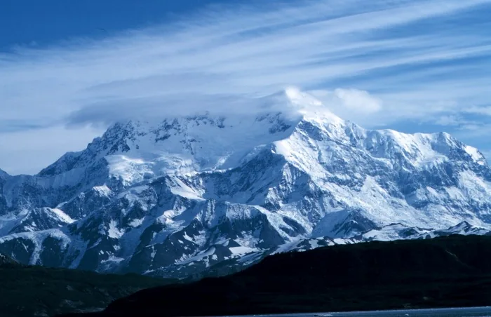
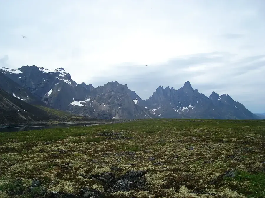
The Ogilvie Mountains are a prominent mountain range in central Yukon, located north of Dawson City. They span approximately 240 kilometers and form a significant continental drainage divide between the Yukon River and the Peel River basins. The highest elevation is Mount Frank Rae at 2,362 meters, but the range is most famous for Tombstone Territorial Park, which features dramatic granite spires like Mount Monolith. Geologically, the mountains consist of folded sedimentary strata intruded by Cretaceous igneous rocks, which have been weathered into sharp, jagged peaks. Interestingly, parts of the Ogilvie Mountains remained unglaciated during the last ice age, serving as part of the Beringia refugium for ancient plant and animal species. The climate is subarctic, characterized by extreme winter temperatures and short, cool summers where frost is possible year-round. Today, the range is a vital habitat for the Porcupine caribou herd and a premier destination for wilderness backpacking and landscape photography.
Best time to visit & climate
The most pleasant time to visit is Jun–Aug.
| Jan | Feb | Mar | Apr | May | Jun | Jul | Aug | Sep | Oct | Nov | Dec | |
|---|---|---|---|---|---|---|---|---|---|---|---|---|
| Avg °C | -21 | -19 | -17 | -8 | 1 | 8 | 10 | 7 | 1 | -8 | -18 | -19 |
| Rain mm | 30 | 22 | 23 | 32 | 57 | 100 | 126 | 103 | 75 | 49 | 37 | 34 |
📋 Practical info
Geography
Facts
- Mount Frank Rae is the highest point in the range at 2,362 meters.
- Tombstone Territorial Park was established in 1999 to protect the area.
- Portions of the range remained ice-free during the last glacial maximum.
- The range is named after William Ogilvie, a prominent Canadian surveyor.
- The Porcupine caribou herd migrates through the mountains every year.
- The distinctive granite peaks of Tombstone formed about 90 million years ago.
Route planner — Car & Motorhome
Where do you start? We build the route here, with stops and country notes along the way.
© OpenStreetMap contributors · OpenRouteService
Sights nearby
Frequently asked questions
How do you reach the Ogilvie Mountains?
What is Tombstone Territorial Park?
When can you see the fall colors?
Is there permafrost there?
Are the roads paved?
Ogilvie Mountains: where is it located?
Ogilvie Mountains: when is the best time to visit?
Ogilvie Mountains: why is it worth visiting?

Nature
More places