Plizio Visual Lab
Baffin Mountains
Weather…
Water temperature…
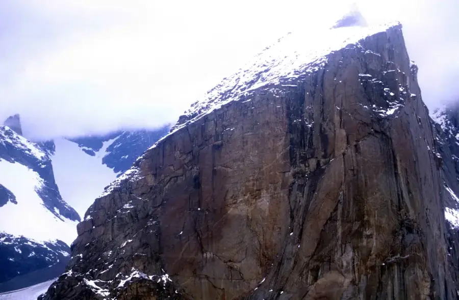
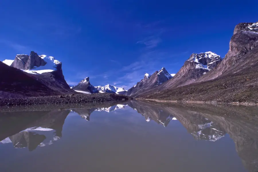
The Baffin Mountains stretch along the northeastern coast of Baffin Island in the Canadian territory of Nunavut. Forming a central part of the Arctic Cordillera, they are characterized by some of the most dramatic mountain scenery and highest vertical cliffs on Earth. The highest peak is Mount Odin at 2,147 meters, while Mount Thor is world-famous for its 1,250-meter vertical face, the greatest vertical drop on the planet. Geologically, the mountains are composed of ancient Precambrian rock from the Canadian Shield, uplifted and deeply carved by massive glaciers into sharp spires and deep valleys. The landscape is dominated by expansive ice caps, such as the Penny Ice Cap, and long fjords that penetrate deep into the mountain mass. Due to the severe arctic climate, vegetation is sparse, consisting mainly of mosses and lichens in sheltered areas. Much of the range is protected within Auyuittuq National Park, a name in Inuktitut meaning 'the land that never melts.' The region holds significant cultural importance for the Inuit, who have inhabited the surrounding coastal areas for millennia.
Explore on the map
How well do you know Canada?
Find cities, landscapes and regions in 10 varied challenges on the interactive map.
Your journey, your memory
A postcard from Baffin Mountains
Turn your own photo into a personal postcard with a local stamp. Free and no sign-up required.
Create a postcardBest time to visit & climate
The most pleasant time to visit is Jun–Aug.
| Jan | Feb | Mar | Apr | May | Jun | Jul | Aug | Sep | Oct | Nov | Dec | |
|---|---|---|---|---|---|---|---|---|---|---|---|---|
| Avg °C | -31 | -31 | -27 | -18 | -8 | 0 | 5 | 3 | -4 | -12 | -21 | -27 |
| Rain mm | 16 | 12 | 19 | 26 | 46 | 68 | 80 | 83 | 61 | 59 | 36 | 23 |
📋 Practical info
Geography
Facts
- Mount Odin is the highest point on Baffin Island at 2,147 meters.
- Mount Thor features a 1,250-meter vertical drop, the highest on Earth.
- The Penny Ice Cap covers an area of approximately 6,000 square kilometers.
- Auyuittuq National Park was officially established in 1972.
- The rock in these mountains dates back up to 2.8 billion years.
- Average summer temperatures in the high mountains often remain below 5°C.
Route planner — Car & Motorhome
Where do you start? We build the route here, with stops and country notes along the way.
© OpenStreetMap contributors · OpenRouteService
Sights nearby
Frequently asked questions
Where are the Baffin Mountains located?
Are there fjords there?
What is the highest point?
Can you see Northern Lights there?
What is the climate like?
Baffin Mountains: where is it located?
Baffin Mountains: when is the best time to visit?
Baffin Mountains: why is it worth visiting?