Plizio Visual Lab
Sindou
ℹ️Practical info — Sindou
▾
🌤 Weather — 5 days
📍 Nearby
Sights nearby
💡 Tips
- Visit the Sindou Peaks early in the morning or late afternoon for the best photography light and to avoid the midday heat.
- Wear sturdy walking shoes with good grip for exploring the rocky formations.
- Hire a local guide at the entrance to support the community and hear local legends.
- Respect the sacred nature of certain rock formations and do not climb restricted areas.
🍽 Food
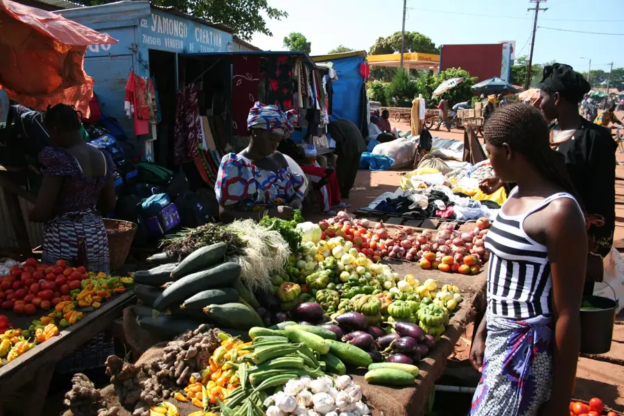
The staple dish of the region, available in most small maquis.
A popular and filling street food snack sold at small stands.
Try grilled fish sourced from local rivers and lakes in the region.
🛍 Shopping · 🧘 Quiet spots
Look for traditional Senoufo wood carvings and masks in local artisan shops.
Hand-woven baskets made from local grasses are practical and beautiful souvenirs.
The shaded areas at the bottom of the rock formations are very peaceful.
Walk around the traditional mud-brick houses on the edge of the town.
Water temperature…
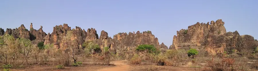
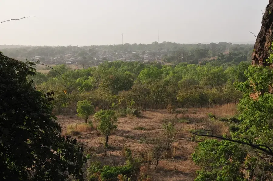
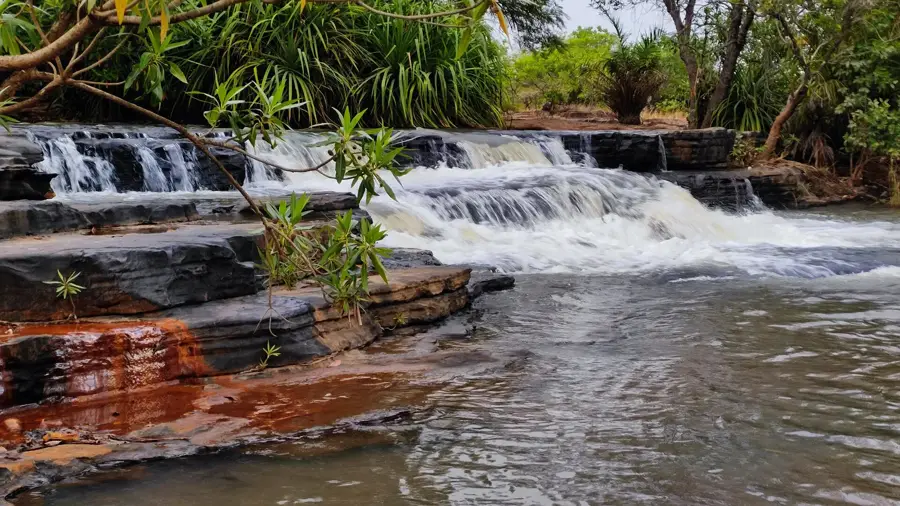
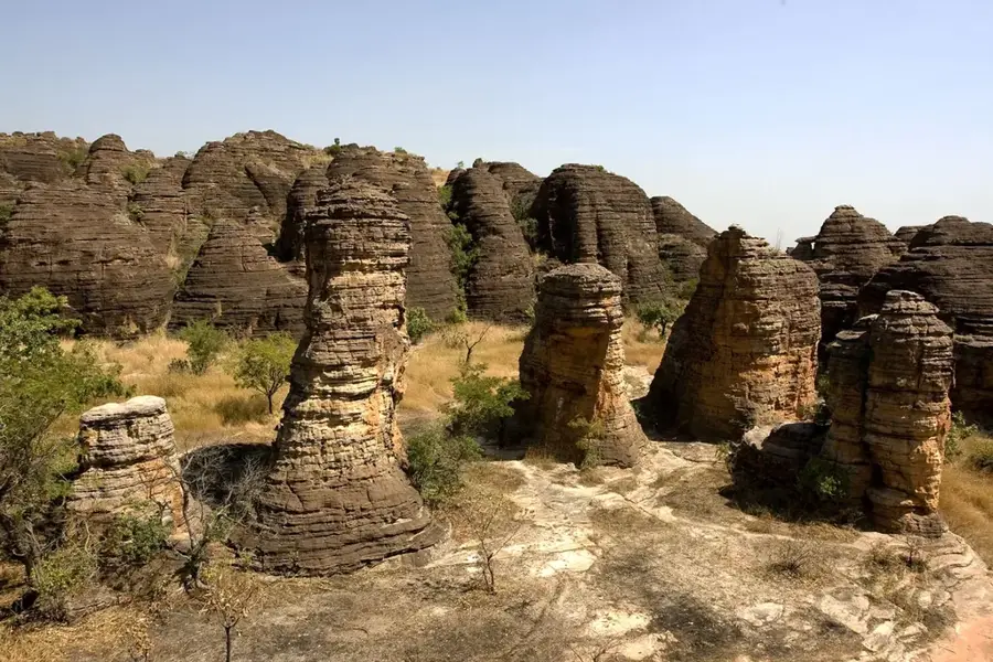
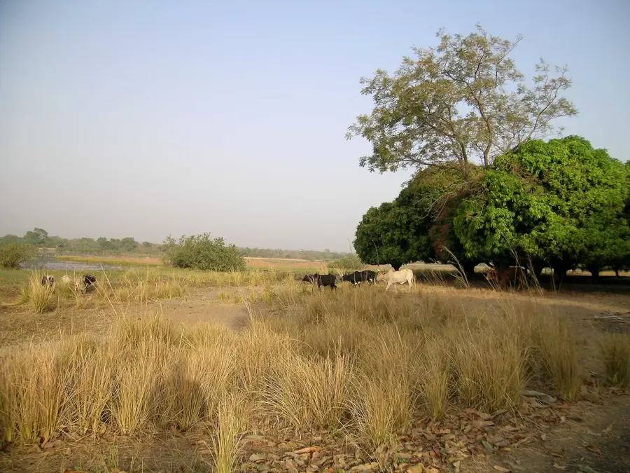
Sindou is a significant small town located in southwestern Burkina Faso, serving as the administrative capital of the Léraba Province in the Cascades Region. The town gained international fame primarily due to the Peaks of Sindou, a spectacular chain of jagged sandstone rock formations shaped by millions of years of wind and water erosion into bizarre, needle-like structures. These geological wonders hold profound spiritual and cultural significance for the local Senoufo people, who regard the area as a sacred sanctuary used for traditional ceremonies and ancestral rites. Historically, the rugged terrain provided a strategic natural fortress for the inhabitants, offering protection against invaders and slave traders during past centuries. Today, Sindou is a major hub for eco-tourism in Burkina Faso, attracting travelers who wish to explore its unique landscapes, nearby waterfalls, and traditional villages. The local economy is predominantly based on agriculture, with the cultivation of staples such as millet and maize, along with commercial cotton and cashew production, sustaining the community of approximately 5,000 residents.
- Location: Burkina Faso
- Nearby: Tengréla (39 km)
- Population: ~7.053 (2026)
Best time to visit & climate
The most pleasant time to visit is Jan, Nov, Dec.
| Jan | Feb | Mar | Apr | May | Jun | Jul | Aug | Sep | Oct | Nov | Dec | |
|---|---|---|---|---|---|---|---|---|---|---|---|---|
| Avg °C | 25 | 28 | 30 | 30 | 29 | 27 | 26 | 25 | 25 | 27 | 27 | 25 |
| Rain mm | 2 | 8 | 21 | 64 | 111 | 162 | 239 | 291 | 222 | 85 | 8 | 0 |
Geography
Facts
- Sindou is situated about 50 kilometers west of the regional capital, Banfora.
- The famous rock formations extend over a length of approximately 3 kilometers.
- The town serves as the primary administrative and market center for Léraba Province.
- The local population predominantly belongs to the Senoufo ethnic group.
- Several ancient cave dwellings and historical shelters are located in the vicinity.
- The region is a major contributor to Burkina Faso's cashew nut export industry.
Explore nearby
Notable places around
Route planner — Car & Motorhome
Where do you start? We build the route here, with stops and country notes along the way.
© OpenStreetMap contributors · OpenRouteService
Sights in the town Sindou (1)
Frequently asked questions
What are the Peaks of Sindou?
Is hiking allowed there?
When is the light best?
Are there campsites?
How far is Banfora?
Sindou: where is it located?
Sindou: when is the best time to visit?
Sindou: why is it worth visiting?

Nearby cities

History & landmarks
Nature
More places