Plizio Visual Lab
Mayaguana's Reef System
Weather…
Water temperature…
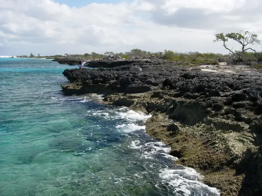
Mayaguana is the most easterly and remote island in the Bahamas, situated approximately 560 kilometers southeast of Nassau. Its relief is defined by a low-lying limestone interior surrounded by one of the most extensive and pristine coral reef systems in the Atlantic. This reef architecture is composed of diverse coral species, including Elkhorn and Staghorn, which have built massive structures over thousands of years. Geologically, Mayaguana sits on its own isolated carbonate platform, separated from the Great Bahama Bank by deep oceanic trenches. Historically, the island remained sparsely populated, with small settlements like Abraham's Bay established in the 19th century. The surrounding reefs provided both protection and a source of food for the local population, though they also presented significant hazards for maritime navigation. During the mid-20th century, the island served as a base for tracking stations during the early years of the U.S. space program. Today, the reef system is a critical site for marine biodiversity, supporting endangered species such as the hawksbill turtle and the Bahamian spiny lobster. The remote nature of Mayaguana has preserved the integrity of the reef relief, making it an essential area for studying undisturbed coral ecosystems.
- Location: Bahamas
- Nearby: Abraham's Bay (6 km)
Best time to visit & climate
The most pleasant time to visit is Jan–Mar.
| Jan | Feb | Mar | Apr | May | Jun | Jul | Aug | Sep | Oct | Nov | Dec | |
|---|---|---|---|---|---|---|---|---|---|---|---|---|
| Avg °C | 25 | 25 | 25 | 25 | 26 | 28 | 28 | 29 | 29 | 28 | 27 | 26 |
| Rain mm | 30 | 23 | 26 | 32 | 91 | 68 | 45 | 60 | 87 | 123 | 84 | 35 |
📋 Practical info
Geography
Facts
- Mayaguana encompasses a total land area of approximately 110 square miles.
- The island is one of the few in the Bahamas still using its Lucayan name.
- Abraham's Bay is the largest settlement and was a hub for regional trade.
- Coral reefs surrounding the island stretch for over 60 kilometers in length.
- In the 1950s, the U.S. Air Force maintained a missile tracking station here.
- The human population of the island remains small, with approximately 300 residents.
Explore nearby
Notable places around
Route planner — Car & Motorhome
Where do you start? We build the route here, with stops and country notes along the way.
© OpenStreetMap contributors · OpenRouteService
Sights nearby
Frequently asked questions
How large is the Mayaguana reef system?
Is it safe for snorkeling?
What can you see while diving?
Are there dive shops on the island?
Are the reefs healthy?
Mayaguana's Reef System: where is it located?
Mayaguana's Reef System: when is the best time to visit?
Mayaguana's Reef System: why is it worth visiting?

Nearby cities

Nature

More places