Plizio Visual Lab
Camacupa
ℹ️Practical info — Camacupa
▾
🌤 Weather — 5 days
📍 Nearby
Sights nearby
💡 Tips
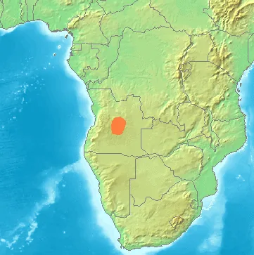
- Camacupa is located very close to the geographic center of Angola, making it a unique milestone on your journey.
- Travel during the dry season (May to September) is highly recommended, as the dirt roads become extremely muddy in the rain.
- The historic Benguela Railway passes through the province, and seeing the trains go by is a fascinating slice of local life.
- Bring plenty of cash (Angolan Kwanzas) before you arrive, as local ATMs can sometimes be out of service or run out of money.
🍽 Food
Seek out this traditional dish made of dried fish or meat layered with local vegetables at established eateries.
In this central region, the staple porridge is often made from cornmeal and served with hearty beans or meat.
Look for street vendors selling these sweet peanut treats, excellent for a quick energy boost.
🛍 Shopping · 🧘 Quiet spots
Wander the bustling central market to see the impressive variety of agricultural produce from the fertile Bié province.
You can occasionally find local artisans selling simple, hand-carved wooden items in the market area.
Head towards the areas near the river to find a peaceful, natural environment away from the busy town streets.
The older churches in town often feature shaded, quiet grounds that are first-rate for a short rest.
Water temperature…
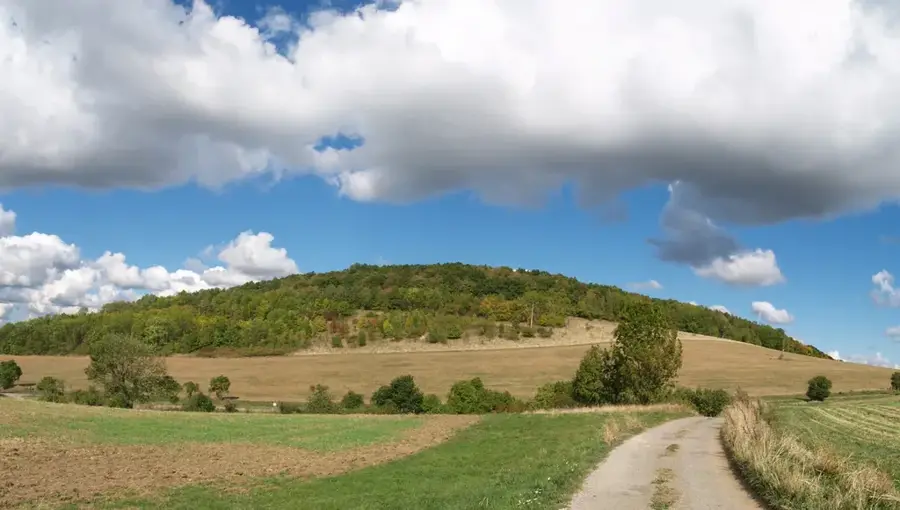
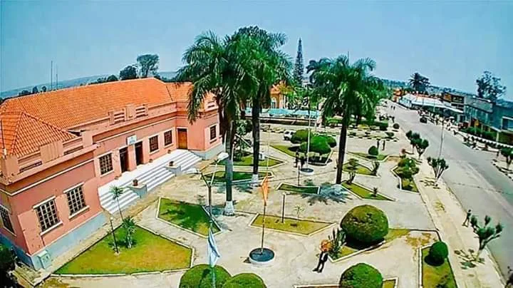
Camacupa is a town in the Bié Province of central Angola and is geographically unique as it is considered the geodetic center of the country. Situated on the Planalto Central, the central highlands, the town was known during the colonial era as General Machado. Camacupa is positioned along the vital Benguela Railway, which is essential for connecting the region's economy to the seaports in the west. The landscape is defined by rolling hills and numerous watercourses that support productive agriculture, particularly the cultivation of maize, rice, and cotton. Historically, the town served as a significant junction for trade between the interior territories and the Atlantic coast. During the civil war, Camacupa's infrastructure suffered heavy damage, but it has been progressively rebuilt in recent years. The town's defining landmark is a central monument marking the exact geographic midpoint of Angola. Today, Camacupa is evolving into a key regional trade center, benefiting from enhanced transportation and rail links.
- Location: Angola
- Population: ~59.000 (2026)
Best time to visit & climate
The most pleasant time to visit is May, Jul, Aug.
| Jan | Feb | Mar | Apr | May | Jun | Jul | Aug | Sep | Oct | Nov | Dec | |
|---|---|---|---|---|---|---|---|---|---|---|---|---|
| Avg °C | 21 | 21 | 22 | 21 | 20 | 19 | 19 | 22 | 25 | 25 | 22 | 21 |
| Rain mm | 158 | 156 | 193 | 51 | 12 | 1 | 0 | 1 | 24 | 72 | 140 | 154 |
Geography
Facts
- Camacupa marks the exact geodetic center of Angola.
- Until 1975, the town was known as General Machado.
- It is located at an altitude of approximately 1420 meters.
- The Benguela Railway passes directly through the town center.
- The region is a major producer of highland rice varieties.
- Camacupa was established as a railway station in the early 20th century.
Explore nearby
Notable places around
Route planner — Car & Motorhome
Where do you start? We build the route here, with stops and country notes along the way.
© OpenStreetMap contributors · OpenRouteService
Frequently asked questions
What characterizes Camacupa?
How is the access to Camacupa?
What should you try in the region?
When is the best time to travel?
Is the city developed for tourism?
Camacupa: where is it located?
Camacupa: when is the best time to visit?
Camacupa: why is it worth visiting?

Nearby cities
History & landmarks
Nature
More places