Plizio Visual Lab

Mosel

Plizio editör ekibiVeri Kaynakları
Fluss
—°15
Mosel (Almanya)

Hava durumu…

2026'nın öne çıkan olayları

1

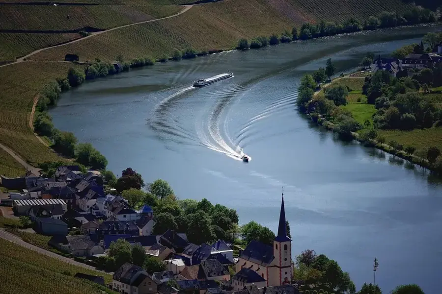
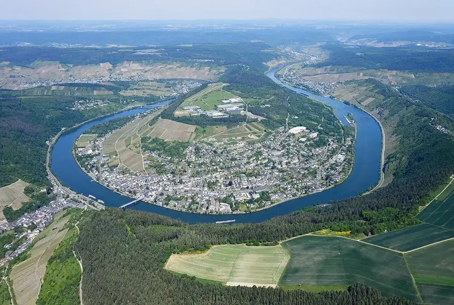
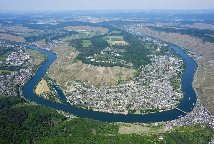
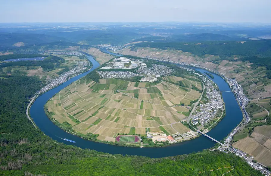
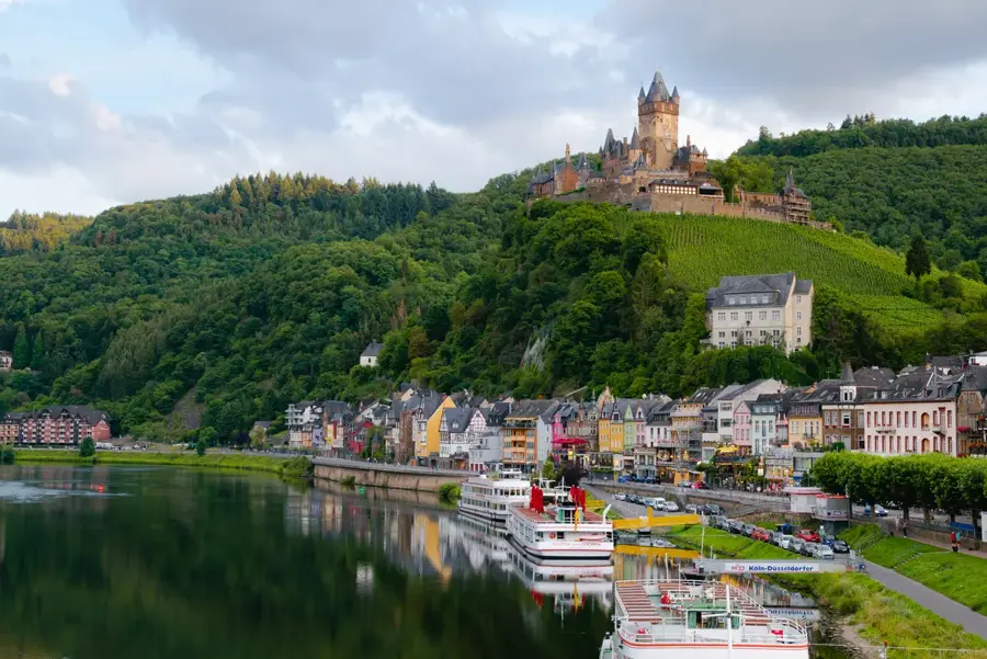
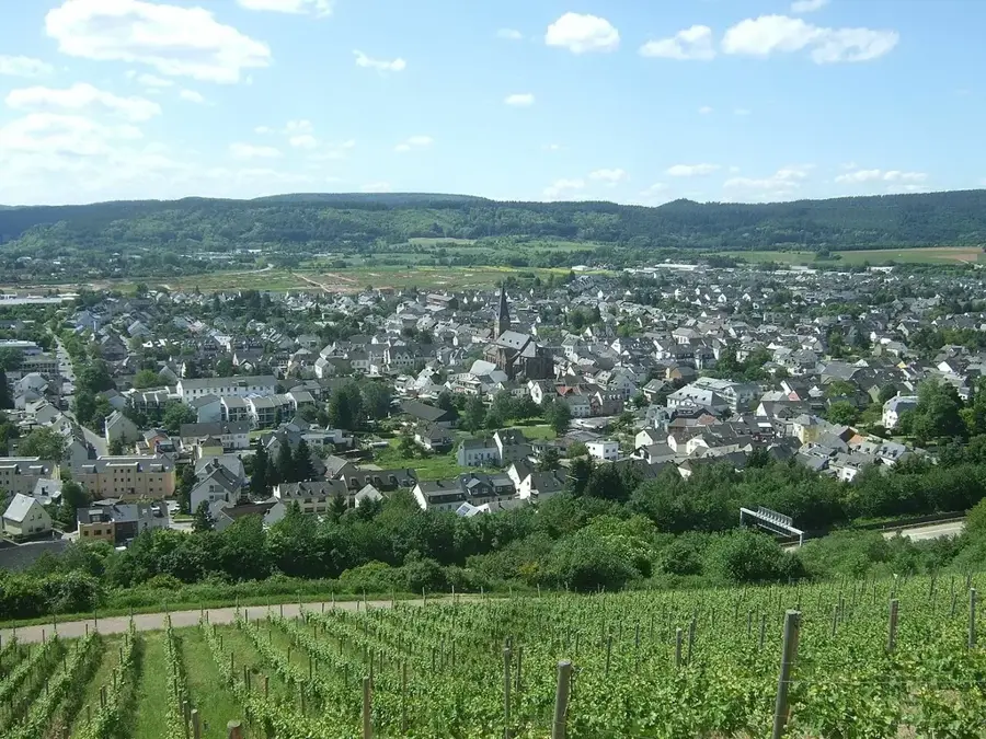
Mosel, 544 kilometrelik toplam uzunluğu ile Rhein'ın en uzun koludur ve Fransa, Lüksemburg ve Almanya üzerinden akar. Kaynağı güney Vosges dağlarındaki Col de Bussang'da bulunur ve Koblenz'deki Deutsches Eck'te Rhein ile birleşir. Almanya'da geniş mesafeler boyunca Eifel ve Hunsrück dağları arasındaki sınırı oluşturur. Mosel, aşırı kıvrımlı nehir menderesleri ve özellikle Riesling üzümünün yetiştirildiği Avrupa'nın en dik üzüm bağlarıyla dünya çapında ünlüdür. Almanya'nın en eski şehri olan Trier ile Bernkastel-Kues ve Cochem gibi pitoresk yerleşimler kıyıları boyunca sıralanır. Nehir manzarası, Roma dönemine kadar uzanan binlerce yıllık bir kültür tarihi ile şekillenmiştir. 1958 ile 1964 yılları arasında Mosel büyük bir gemi taşımacılığı yolu olarak genişletilmiştir ve bugün çok sayıda baraj ve kapağa sahiptir. Turistler için Mosel vadisi bisiklet sürme, yürüyüş yapma ve çok sayıda kaleyi ziyaret etme gibi çeşitli olanaklar sunar.

Yolculuğun, hatıran

Mosel hatırası bir kartpostal

Kendi fotoğrafını yer damgalı kişisel bir kartpostala dönüştür. Ücretsiz ve kayıt gerektirmez.

Kartpostal oluştur

En iyi ziyaret zamanı & iklim

En keyifli dönem: Haz–Ağu.

OcaŞubMarNisMayHazTemAğuEylEkiKasAra
Ort. °C01481216181814951
Yağmur mm655555467270707555616474

📋 Pratik bilgiler

🧭
Ulaşım
Accessing this picturesque section of the river is straightforward via regional trains connecting through Rhineland-Palatinate. Road travelers usually use the well-maintained riverside highways that link the famous wine-growing settlements.
📅
En iyi mevsim
Spring and early autumn are widely regarded as the most pleasant times to explore these riverbanks and vineyards. Late summer brings the harvest festivals, while the moderate local climate usually ensures enjoyable hiking conditions mostly year-round.
⛰️
Arazi ve yollar
The immediate riverside paths are predominantly flat and well-paved, catering comfortably to relaxed walking and cycling. Venturing up into the iconic wine-growing slopes involves navigating steeper, narrower paths that demand a bit more physical effort.
🎒
Ekipman
Comfortable and sturdy footwear is essential if you plan to climb the terraced vineyards overlooking the water. A light rain jacket can be handy during unexpected showers, and bringing along sun protection is advised for the exposed hillside trails.
🅿️
Otopark
Parking options are widely available in the designated public lots of the quaint towns lining the valley. While roadside parking is occasionally possible, it is best to use established town car parks to avoid obstructing the narrow village roads.
⚠️
Güvenlik
Visitors should remain cautious of the busy barge and river cruise traffic if taking small boats onto the water. On the vineyard slopes, watch your step on the sometimes slippery slate stones, particularly after periods of heavy rainfall.
⏱️
Gerekli süre
Exploring this captivating stretch of river can easily occupy visitors for a full day of sightseeing and wine tasting. Many travelers choose to spend several days cycling the entire length of the regional paths to fully immerse themselves in the atmosphere.

Geographie

Koordinaten
50.00000, 7.00000

Fakten

  • Nehrin toplam uzunluğu 544 kilometredir
  • Rhein ile birleşimi Deutsches Eck'te gerçekleşir
  • Bremmer Calmont, Avrupa'nın en dik üzüm bağıdır
  • 1958'den 1964'e kadar taşımacılık yolu olarak genişletilmiştir
  • Fransa, Lüksemburg ve Almanya üzerinden akar
  • Almanya'da akış güzergahının 242 kilometresi yer almaktadır

Çevreyi keşfet

Yakındaki ilgi çekici yerler

Route planner — Car & Motorhome

Where do you start? We build the route here, with stops and country notes along the way.

Vehicle
Only stops with (optional):
Motorhome dimensions

© OpenStreetMap contributors · OpenRouteService

Sehenswürdigkeiten in der Stadt Mosel (5)

Leizenberg

Aussichtspunkt auf den Leizenberg mit Blick über die Moselschleife bei Ürzig.

Sankt Maternus

Pfarrkirche Sankt Maternus in Ürzig, ein katholisches Gotteshaus.

Klettersteig Erden

Klettersteig in Erden, ein Kletterpfad mit Ausblick auf die Mosel.

Römische Kelteranlage Erden

Römische Kelteranlage in Erden, Überreste einer antiken Weinpresse.

🕒 Mar-Oct: Sa 17:00+ || Mar-Oct: "nach Absprache"

Sankt Anna

Kirchengebäude Sankt Anna in Erden, ein Gotteshaus.

Çevredeki gezilecek yerler

Sıkça sorulan sorular

When is the best time for a Moselle river cruise?
From May to October, the landscape is most beautiful, especially during the wine harvest in September.
Are there well-maintained cycling paths along the Moselle?
Yes, the Moselle Cycle Path runs almost flat along the riverbank through the vineyards.
Which castle on the Moselle is a must-see?
Reichsburg Cochem and Burg Eltz are among the most famous and photogenic landmarks in the region.
Is swimming allowed in the Moselle?
Due to shipping traffic, caution is advised; official swimming spots are rare.
What is the typical grape variety of the region?
Riesling dominates the steep-slope viticulture and is world-renowned for its quality.
Mosel: nerede yer alıyor?
Mosel, Rheinland-Pfalz, Almanya bölgesinde yer alır.
Mosel: nereler gezilir?
Öne çıkanlar: Leizenberg, Sankt Maternus, Klettersteig Erden.
Mosel: en iyi ziyaret zamanı nedir?
En keyifli dönem: Haz, Ağu.
Mosel: neden ziyaret edilmeli?
Mosel, 544 kilometrelik toplam uzunluğu ile Rhein'ın en uzun koludur ve Fransa, Lüksemburg ve Almanya üzerinden akar.
Auf der Karte ansehen → En güzel plajlar → OpenStreetMap →
Avrupa
Plizio ile keşfet Avrupa'da daha fazla yer keşfedin
Almanya içinde daha fazla yer →

Städte in der Nähe