Plizio Visual Lab
Lac du Salagou
Météo…
Température de l'eau…
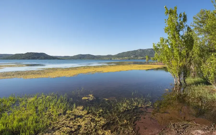
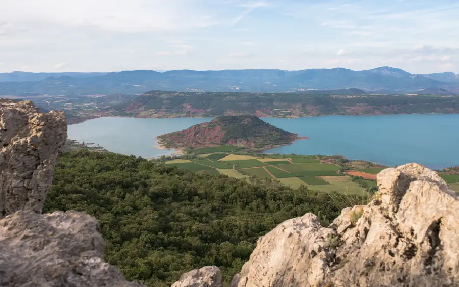
Le lac du Salagou est un lac de barrage artificiel situé dans le département de l'Hérault, dans le sud de la France, créé par la construction d'un barrage en 1969. Il est surtout connu pour son paysage surréaliste, marqué par la rencontre entre des eaux d'un bleu profond et la roche sédimentaire rouge vif des « ruffes » (schistes permiens). Le lac s'étend sur environ 750 hectares et sert aujourd'hui principalement à l'irrigation de l'agriculture environnante ainsi que de centre de loisirs prisé pour les sports nautiques et la randonnée. L'unicité géologique de la région, avec ses vestiges volcaniques et ses formations rocheuses bizarres, a fait de la zone un site classé (en cours de labellisation « Grand Site de France »). Sur les rives du lac se trouvent des endroits pittoresques comme Celles, un village initialement prévu pour être englouti, mais qui a été partiellement conservé.
Explorer sur la carte
Que savez-vous de France ?
Trouvez villes, paysages et régions en 10 défis variés sur la carte interactive.
Votre voyage, votre souvenir
Une carte postale de Lac du Salagou
Transformez votre propre photo en carte postale personnalisée avec un timbre local. Gratuit et sans inscription.
Créer une carte postale- Emplacement: Occitanie, France
- Points forts: Menhir dit la Pierre Droite de l'Ouïsse · Mont de Sainte-Scholastique · Ancienne pompe à eau "éolienne"
- À proximité: Lac du Salagou (4 km)
Meilleure période & climat
La période la plus agréable est Juin, Aoû, Sep.
| Jan | Fév | Mar | Avr | Mai | Juin | Juil | Aoû | Sep | Oct | Nov | Déc | |
|---|---|---|---|---|---|---|---|---|---|---|---|---|
| Moy. °C | 7 | 7 | 10 | 13 | 17 | 22 | 25 | 24 | 20 | 16 | 11 | 8 |
| Pluie mm | 52 | 39 | 48 | 59 | 49 | 30 | 20 | 25 | 51 | 82 | 73 | 47 |
📋 Informations pratiques
Géographie
Faits
- Le barrage du Salagou a été achevé en 1969.
- Le lac couvre une surface d'eau d'environ 750 hectares.
- La profondeur maximale du lac est d'environ 45 mètres.
- Connu pour ses « ruffes », des roches sédimentaires rouges du Permien.
- Le village de Celles a été évacué avant la mise en eau et partiellement réhabilité plus tard.
- La zone fait partie du réseau « Grand Site de France ».
Explorer à proximité
Lieux remarquables autour
Planificateur d’itinéraire — Voiture & Camping-car
Où commencez-vous ? Nous construisons l’itinéraire ici, avec étapes et notes par pays en chemin.
© OpenStreetMap contributors · OpenRouteService
Sites en ville Lac du Salagou (10)
Église Saint-Geniès-d'Arles
Église dans le département de l'Hérault, France, dédiée à Saint Geniès.
Château de Mourèze🏰 château
Ruine de château au-dessus du village de Mourèze, entourée de formations rocheuses.
Église Sainte-Marie
Église dans le département de l'Hérault, France, dédiée à Sainte Marie.
Ermitage Saint-Jean d'Aureillan
Ruine d'un ermitage, située dans un cadre naturel isolé.
Cirque de Mourèze
Amphithéâtre naturel en calcaire, destination de randonnée populaire.
Château de la Marguerite🏰 château
Ruine de château sur une colline offrant des vues sur les environs.
À voir aux alentours
Questions fréquentes
Pourquoi le sol est-il rouge au Lac du Salagou ?
Peut-on se baigner dans le lac ?
Les bateaux à moteur sont-ils autorisés ?
Y a-t-il un sentier autour du lac ?
Qu'est-ce que le village abandonné de Celles ?
Lac du Salagou : où se situe-t-il ?
Lac du Salagou : que voir ?
Lac du Salagou : quand est-il préférable de visiter ?
Lac du Salagou : pourquoi vaut-il la peine de visiter ?

Villes à proximité