Plizio Visual Lab
Dolok Oan Coast
Weather…
Water temperature…
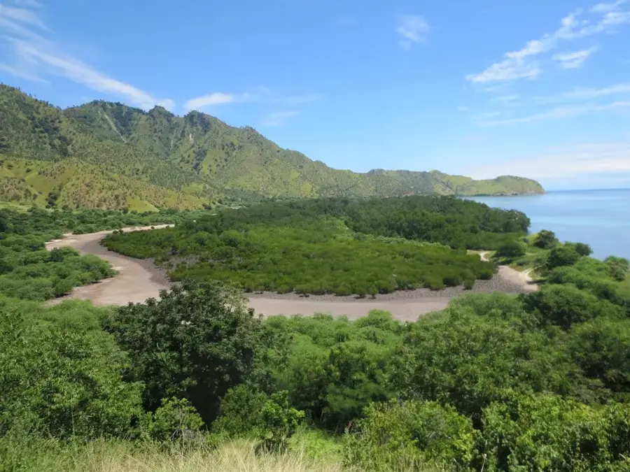
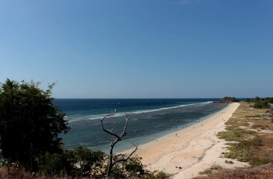
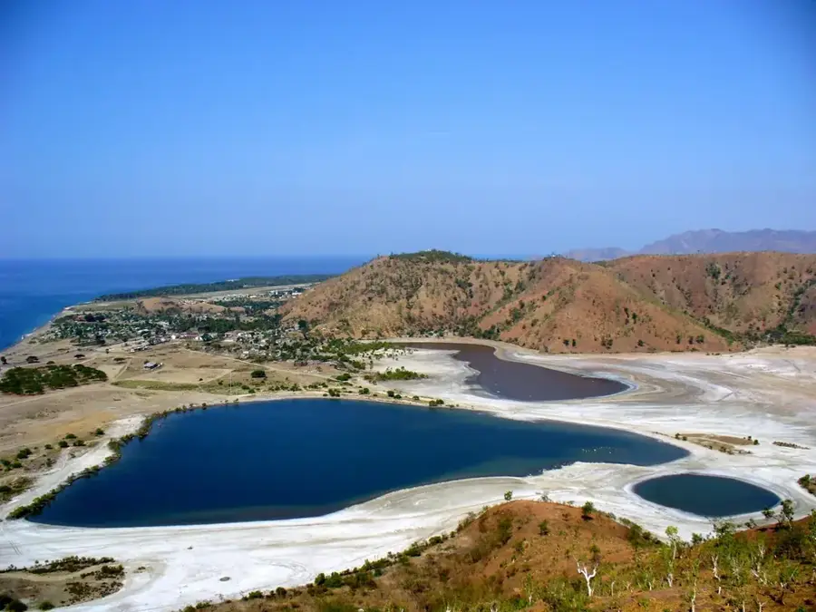
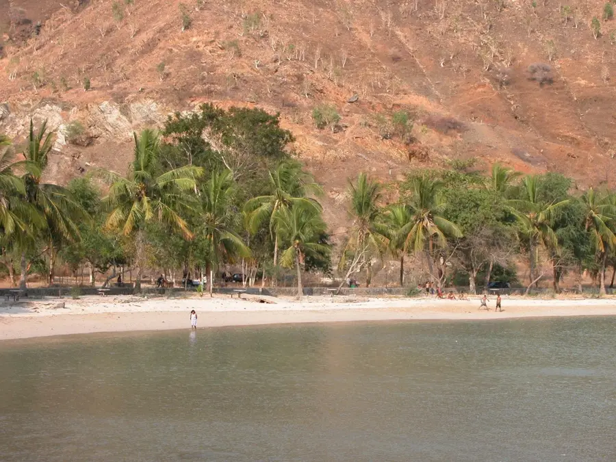
The Dolok Oan Coast is located east of Dili in the Metinaro administrative post. Geographically, it is characterized by a flat coastal plain occupied by extensive mangrove forests and wetlands. These ecosystems are of critical importance for coastal protection and serve as a nursery for numerous fish species. The area is a haven for birdwatchers, functioning as a resting site for migratory birds on the route between Australia and Asia. The coast is also known for salt production in traditional salt pans, operated for generations by local communities. Despite its proximity to the capital, the region remains relatively sparsely populated and has largely preserved its original character. The shallow waters host important seagrass meadows that provide a habitat for dugongs.
- Location: Timor-Leste
- Nearby: Aileu (15 km)
Best time to visit & climate
The most pleasant time to visit is Jun–Aug.
| Jan | Feb | Mar | Apr | May | Jun | Jul | Aug | Sep | Oct | Nov | Dec | |
|---|---|---|---|---|---|---|---|---|---|---|---|---|
| Avg °C | 27 | 26 | 27 | 27 | 27 | 26 | 26 | 26 | 27 | 29 | 29 | 28 |
| Rain mm | 243 | 203 | 120 | 54 | 33 | 21 | 8 | 4 | 5 | 13 | 54 | 167 |
📋 Practical info
Geography
Facts
- The coast hosts one of the largest mangrove areas near Dili.
- Over 50 different bird species have been recorded in the area.
- Salt production primarily takes place during the dry season.
- The area is part of a community-led ecotourism initiative.
- The waters off Dolok Oan are known for occasional dugong sightings.
- The name 'Dolok Oan' refers to 'small hills' in the local language.
Explore nearby
Notable places around
Route planner — Car & Motorhome
Where do you start? We build the route here, with stops and country notes along the way.
© OpenStreetMap contributors · OpenRouteService
Sights in the town Dolok Oan Coast (1)
Sights nearby
Frequently asked questions
How is the coast of Dolok Oan?
Can you swim there?
Is a 4x4 vehicle necessary?
Is there infrastructure there?
What do you need to bring?
Dolok Oan Coast: where is it located?
Dolok Oan Coast: when is the best time to visit?
Dolok Oan Coast: why is it worth visiting?

Nearby cities
History & landmarks


Nature
More places