Plizio Visual Lab
Uluguru Mountains
Weather…
Water temperature…
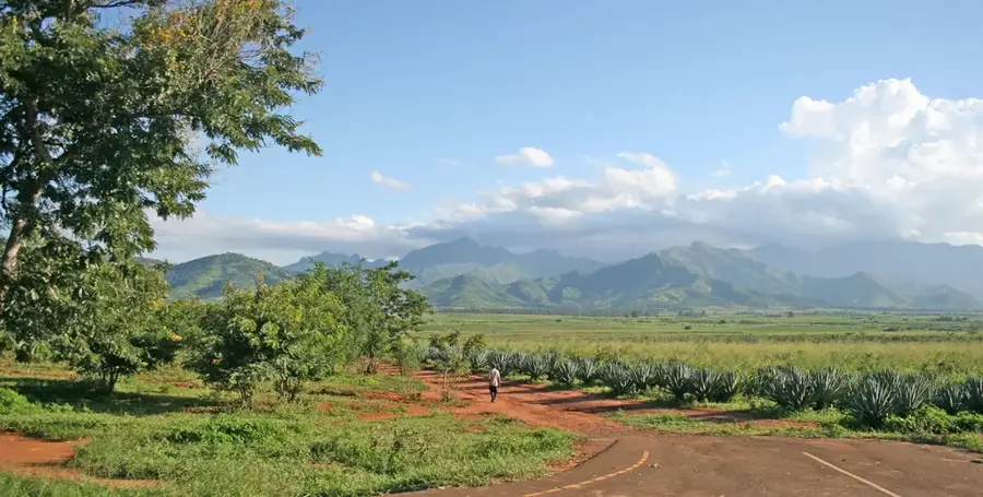
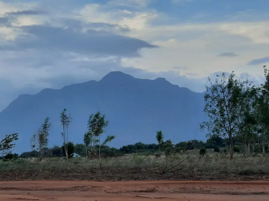
The Uluguru Mountains are a prominent mountain range in eastern Tanzania, rising steeply south of the city of Morogoro and forming part of the Eastern Arc Mountains network. The highest point in the massif is Kimhandu Peak at 2,646 meters above sea level, followed by the expansive Lukwangule Plateau. Geologically, these mountains consist of ancient Precambrian rocks that were uplifted over 250 million years ago, towering over the surrounding coastal plains. The range serves as a vital water catchment area for the region, feeding the Ruvu River which provides the primary water supply for the city of Dar es Salaam. Due to their isolation and moist climate, the Uluguru Mountains harbor exceptional biodiversity, including numerous endemic species of flora and fauna such as the Uluguru bush-shrike. The slopes are intensively farmed by the local Luguru people for vegetables and coffee, presenting ongoing challenges for environmental conservation efforts.
Best time to visit & climate
The most pleasant time to visit is Jun–Aug.
| Jan | Feb | Mar | Apr | May | Jun | Jul | Aug | Sep | Oct | Nov | Dec | |
|---|---|---|---|---|---|---|---|---|---|---|---|---|
| Avg °C | 25 | 25 | 24 | 23 | 22 | 21 | 21 | 22 | 24 | 25 | 26 | 25 |
| Rain mm | 179 | 130 | 189 | 194 | 87 | 16 | 11 | 12 | 16 | 57 | 105 | 164 |
📋 Practical info
Geography
Facts
- Highest peak: Kimhandu Peak (2,646 m)
- Mountain group: Eastern Arc Mountains
- Nearby city: Morogoro
- Primary water source for: Dar es Salaam
- Age of rocks: over 250 million years
- Local ethnic group: Luguru people
Explore nearby
Notable places around
Route planner — Car & Motorhome
Where do you start? We build the route here, with stops and country notes along the way.
© OpenStreetMap contributors · OpenRouteService
Sights in the town Uluguru Mountains (1)
Sights nearby
Frequently asked questions
Are the Uluguru Mountains good for hiking?
Which is the best season?
Do I need to hire a guide?
What is a special destination?
Is the area family-friendly?
Uluguru Mountains: where is it located?
Uluguru Mountains: when is the best time to visit?
Uluguru Mountains: why is it worth visiting?

Nearby cities


History & landmarks

More places