Plizio Visual Lab
Jabal al-Shaar

Weather…
Water temperature…
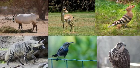
Jabal al-Shaar is a significant mountain massif in central Syria, located northwest of Palmyra. The region is geologically defined by extensive limestone formations and significant deposits of natural gas and oil, making it one of the country's most important energy hubs. The terrain is rugged, reaching elevations of around 1,200 meters, with an extremely arid climate and a landscape resembling a barren rocky desert. Historically, the massif served as natural protection for the caravan city of Palmyra and controlled access to the fertile regions of Homs and Hama. Due to its strategic location and valuable resources, Jabal al-Shaar has been the site of numerous conflicts in recent decades over the control of energy infrastructure. The flora is restricted to hardy desert shrubs, while the wildlife is adapted to the extreme temperature fluctuations of the Syrian desert.
Explore on the map
How well do you know Syria?
Find cities, landscapes and regions in 10 varied challenges on the interactive map.
Your journey, your memory
A postcard from Jabal al-Shaar
Turn your own photo into a personal postcard with a local stamp. Free and no sign-up required.
Create a postcard- Location: Syria
- Nearby: Palmyra (78 km)
📋 Practical info
Geography
Facts
- Center of Syrian gas production
- Northwest of Palmyra
- Elevation up to 1,220 m
- Strategic military location
- Barren desert plateau
- Rich in limestone deposits
Explore nearby
Notable places around
Route planner — Car & Motorhome
Where do you start? We build the route here, with stops and country notes along the way.
© OpenStreetMap contributors · OpenRouteService
Sights nearby
Frequently asked questions
Is Jabal al-Shaar touristically visited?
What equipment do I need?
Is there a water supply?
Is camping allowed?
What is the biggest challenge?
Jabal al-Shaar: where is it located?
Jabal al-Shaar: why is it worth visiting?
Nearby cities
History & landmarks
More places