Plizio Visual Lab
Shabelle Plateau
Weather…
Water temperature…
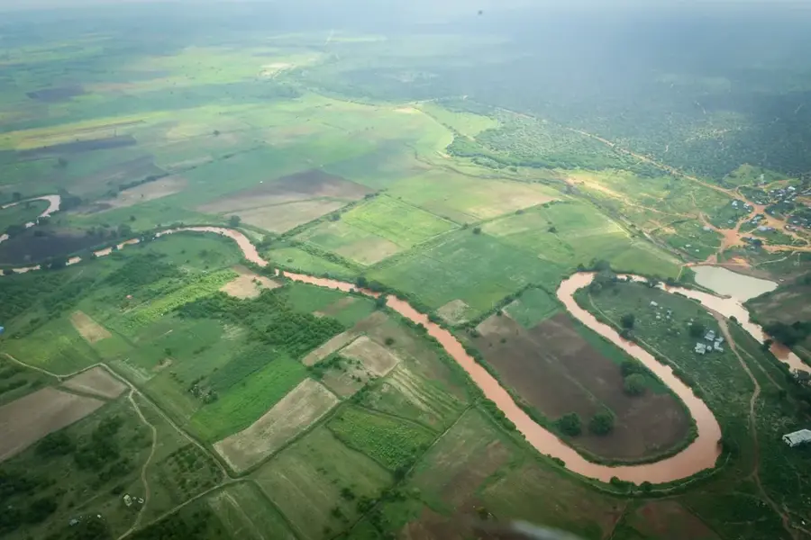
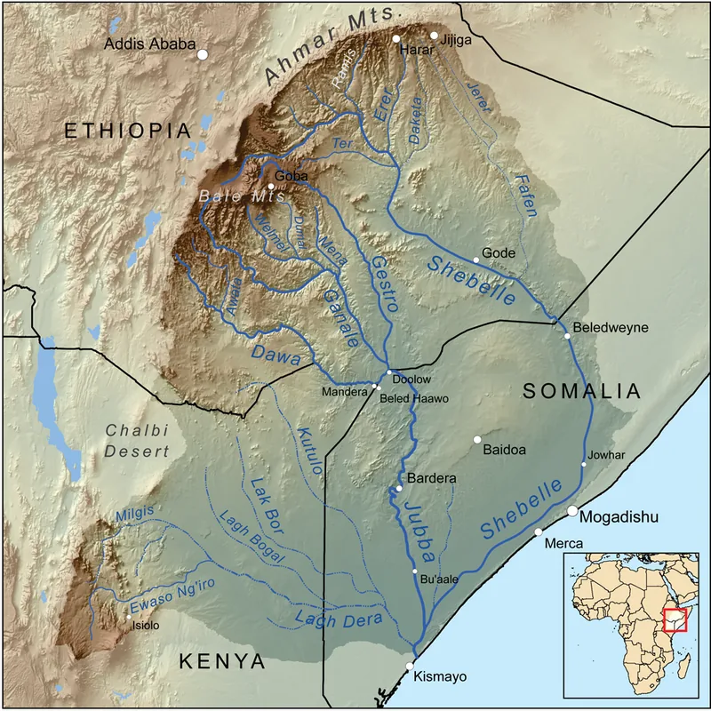
The Shabelle Plateau in south-central Somalia is a prominent geological formation rising above the fertile Shabelle River valley. This limestone plateau is characterized by a sparse but expansive landscape, serving as a transitional zone between the Ethiopian highlands and the Somali coastal plains. The vegetation primarily consists of resilient grasses and thorny shrubs, making it a convenient location for seasonal grazing by nomadic camel herds. Geomorphologically, the plateau features numerous karst phenomena, including natural sinkholes and caves that feature prominently in local folklore. While the Shabelle River itself does not directly irrigate the plateau, the area acts as a catchment for infrequent rainfall, which drains into wadis and replenishes underground water reserves. Historically, the plateau was a vital corridor for caravans transporting goods between the interior and the ports of Mogadishu and Merka. Today, the region is noted for its limestone deposits, which are increasingly utilized by the local construction industry.
- Location: Somalia
- Nearby: Tiyeglow (56 km)
Best time to visit & climate
The most pleasant time to visit is Jan, Jul, Dec.
| Jan | Feb | Mar | Apr | May | Jun | Jul | Aug | Sep | Oct | Nov | Dec | |
|---|---|---|---|---|---|---|---|---|---|---|---|---|
| Avg °C | 27 | 28 | 30 | 29 | 28 | 27 | 27 | 27 | 28 | 28 | 27 | 26 |
| Rain mm | 3 | 3 | 18 | 106 | 43 | 11 | 7 | 21 | 20 | 123 | 111 | 18 |
📋 Practical info
Geography
Facts
- The plateau sits at an average elevation of 300 to 500 meters above sea level.
- The Shabelle River flows for 1,130 km and is the region's second longest.
- The geological composition is mainly Jurassic and Cretaceous limestone.
- Daytime temperatures on the plateau often soar above 38 degrees Celsius.
- Natural karst caves in the plateau serve as critical water stores for herders.
- Historically, the Ajuran Sultanate controlled access to the plateau's routes.
Explore nearby
Notable places around
Route planner — Car & Motorhome
Where do you start? We build the route here, with stops and country notes along the way.
© OpenStreetMap contributors · OpenRouteService
Sights nearby
Frequently asked questions
Is the Shabelle Plateau suitable for hiking?
When is the best time to visit the plateau?
Are there sanitary facilities on the Shabelle Plateau?
Do I need a 4x4 vehicle to visit?
Is camping allowed there?
Shabelle Plateau: where is it located?
Shabelle Plateau: when is the best time to visit?
Shabelle Plateau: why is it worth visiting?

Nearby cities