Plizio Visual Lab

Stanovoy Range
Plizio editorial teamData Sources
Mountain
—°
Stanovoy Range (Russia)

Weather…

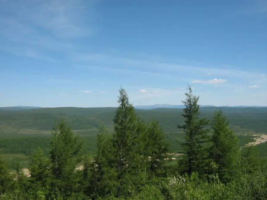
The Stanovoy Range is a formidable mountain barrier stretching over 700 kilometers in the Russian Far East, serving as one of Asia's most significant continental drainage divides. It decisively separates the vast northward-flowing river systems destined for the harsh Arctic Ocean (such as the Lena basin) from those surging southward toward the Pacific Ocean (the Amur basin). The topography is characterized by massive, rounded mountain domes and sweeping high plateaus, all densely cloaked in impenetrable taiga forests dominated by Siberian larch. Historically, this imposing, difficult-to-traverse wall played a monumental role: the 1689 Treaty of Nerchinsk established the Stanovoy crest as the first official border between the expanding Russian Tsardom and China's Qing Dynasty. Today, the range remains a geologically wealthy yet profoundly undeveloped wilderness, where bears, wolves, and reindeer claim dominion over vast tracts of land.

Explore on the map

How well do you know Russia?

Find cities, landscapes and regions in 10 varied challenges on the interactive map.

Start the map quiz 10 challenges

Your journey, your memory

A postcard from Stanovoy Range

Turn your own photo into a personal postcard with a local stamp. Free and no sign-up required.

Create a postcard

Best time to visit & climate

The most pleasant time to visit is Jun–Aug.

JanFebMarAprMayJunJulAugSepOctNovDec
Avg °C-30-26-16-561417146-5-21-29
Rain mm91018359410415812978482212

📋 Practical info

🧭
Getting there
Access to this deeply remote frontier is extraordinarily challenging, typically requiring chartered rough-terrain vehicles or highly organized expedition logistics starting from distant Siberian rail settlements to even reach the preliminary foothills.
📅
Best season
The brief, viable window for exploration is strictly limited to the height of mid-summer, when the deep snowpack briefly melts away and the extreme freezing temperatures temporarily lift enough to permit cautious overland trekking operations.
⛰️
Terrain & paths
This environment features a formidable sequence of craggy, eroded peaks, vast boulder fields, and dense taiga forests with absolutely no maintained trail infrastructure, demanding advanced wilderness navigation and strenuous rock scrambling skills.
🎒
What to bring
Extreme backcountry expedition gear is an absolute necessity, encompassing high-grade cold-weather sleeping systems, satellite communication equipment, emergency locator beacons, and enough concentrated food rations to survive prolonged isolation.
🅿️
Parking
Formal vehicular infrastructure does not exist in this wild territory; motorized transport is merely a means to approach the wilderness boundary, where vehicles are left entirely at the logistical drop-off points before continuing deeply on foot.
⚠️
Safety
Travelers face severe, life-threatening risks including sudden sub-zero weather anomalies, complete detachment from medical rescue services, unpredictable river crossings, and encounters with large, potentially aggressive native predator populations.
⏱️
Time needed
Any meaningful venture into this massive geological divide is a serious undertaking that requires a minimum of several grueling weeks, aimed almost exclusively at highly experienced professional explorers rather than casual tourist sightseeing.

Geography

Coordinates
55.00000, 125.00000

Facts

  • Length of about 700 km
  • Highest peak is around 2412 m
  • Significant historical border (Treaty of Nerchinsk)
  • Slopes are covered in dense taiga forest

Route planner — Car & Motorhome

Where do you start? We build the route here, with stops and country notes along the way.

Vehicle
Only stops with (optional):
Motorhome dimensions

© OpenStreetMap contributors · OpenRouteService

Sights nearby

Frequently asked questions

What is the Stanovoy Range like?
It is a very uninhabited, mountainous wilderness.
Are there tourists there?
Hardly, the area is not developed for tourism.
Can one hike there?
Possible only with extreme expedition planning.
How is the climate?
Continental, very cold climate.
Where is it?
In Siberia, between the Amur and Yakutia.
Stanovoy Range: where is it located?
Stanovoy Range is located in Russia.
Stanovoy Range: when is the best time to visit?
The most pleasant time to visit is Jun, Aug.
Stanovoy Range: why is it worth visiting?

The Stanovoy Range is a formidable mountain barrier stretching over 700 kilometers in the Russian Far East, serving as one of Asia's most significant continental drainage divides.
View on map → The Top 50 Attractions → OpenStreetMap →
Europe
Explore with Plizio Discover more places in Europe
More places in Russia →

Nearby cities