Plizio Visual Lab
Masungi Georeserve
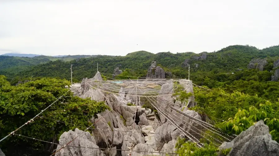
Masungi Georeserve is a conservation area and geological park located in Baras, Rizal. It is a sanctuary characterized by remarkable limestone karst formations, lush rainforest, and a diverse range of flora and fauna. The name 'Masungi' is derived from the Tagalog word 'masungki,' which means 'spiked', a reference to the jagged limestone rocks. The georeserve is famous for its Discovery Trail, a 3-4 hour trek featuring unique rope courses, hanging bridges, and a giant web-like platform called 'Sapot' that has wide-open 360-degree views of the Sierra Madre mountains and Laguna de Bay. The trail was thoughtfully designed to have minimal impact on the environment. Masungi is a private initiative focused on restoring and protecting a deforested area from quarrying and illegal logging. Its success has made it a benchmark for conservation and sustainable geotourism in the Philippines, winning numerous international awards for its efforts in environmental protection and innovative park management.
Explore on the map
How well do you know Philippines?
Find cities, landscapes and regions in 10 varied challenges on the interactive map.
Your journey, your memory
A postcard from Masungi Georeserve
Turn your own photo into a personal postcard with a local stamp. Free and no sign-up required.
Create a postcard- Location: Philippines
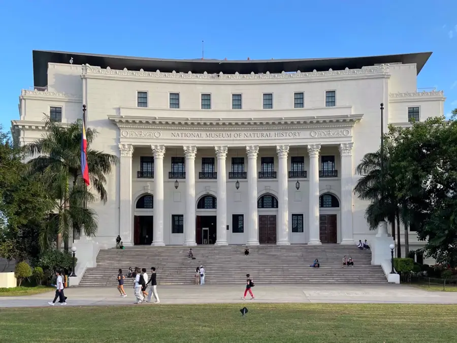
- Highlights: National Museum of the Philippines - Rizal · St Joseph Parish Church · Antipolo Cathedral
- Nearby: Antipolo (6 km)
Best time to visit & climate
The most pleasant time to visit is Jan–Mar.
| Jan | Feb | Mar | Apr | May | Jun | Jul | Aug | Sep | Oct | Nov | Dec | |
|---|---|---|---|---|---|---|---|---|---|---|---|---|
| Avg °C | 24 | 24 | 25 | 27 | 28 | 27 | 26 | 26 | 26 | 26 | 25 | 24 |
| Rain mm | 148 | 148 | 119 | 102 | 171 | 248 | 312 | 289 | 301 | 341 | 345 | 393 |
📋 Practical info
Geography
Facts
- A conservation area and geopark in Baras, Rizal.
- Characterized by its limestone karst formations.
- The name 'Masungi' is derived from a Tagalog word for 'spiked'.
- The Discovery Trail is a 3-4 hour trek with rope courses.
- Features a giant web-style platform called 'Sapot'.
- An award-winning project for conservation and sustainable tourism.
- The area was previously threatened by deforestation and quarrying.
Explore nearby
Notable places around
Route planner — Car & Motorhome
Where do you start? We build the route here, with stops and country notes along the way.
© OpenStreetMap contributors · OpenRouteService
Sights in the town Masungi Georeserve (11)
Sights nearby
Frequently asked questions
What is special about Masungi Georeserve?
Do I need to book my visit in advance?
Is the hike strenuous?
What should I bring for the tour?
Is smoking allowed in the reserve?
Masungi Georeserve: where is it located?
Masungi Georeserve: what is there to see?
Masungi Georeserve: when is the best time to visit?
Masungi Georeserve: why is it worth visiting?

Nearby cities

History & landmarks

More places