Plizio Visual Lab
Mantap-san
Weather…
Water temperature…
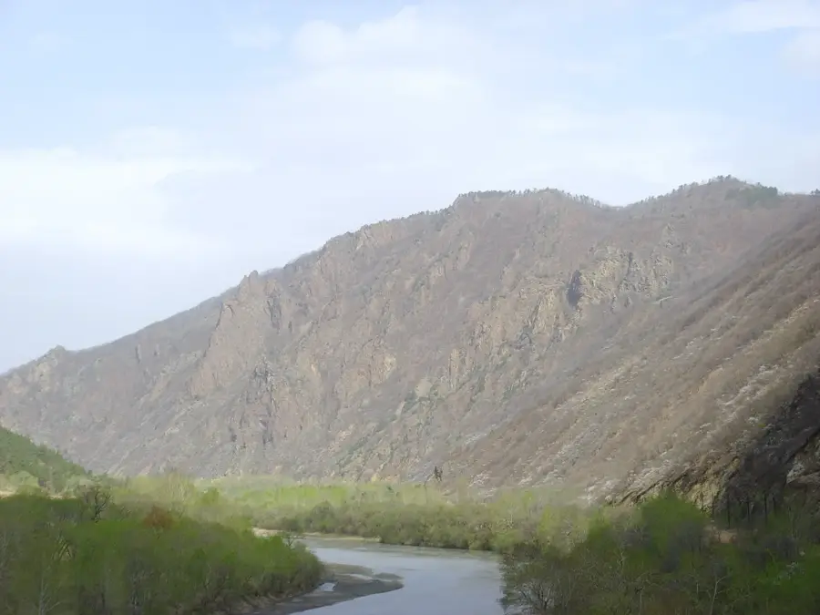
Mantap-san is a mountain located in Kilju County, North Hamgyong Province, in the northeastern region of North Korea, reaching an elevation of 2,205 meters. The mountain is part of a rugged granite range and has gained international notoriety as the site of the Punggye-ri Nuclear Test Site. Between 2006 and 2017, North Korea conducted six underground nuclear tests within the tunnels excavated deep into the mountain's granite core. These tests caused significant geological disturbances, including several induced earthquakes and landslides, which have been monitored by seismic stations worldwide. The most powerful test in September 2017 resulted in a massive collapse of the internal chambers, leading to concerns about radioactive leakage and environmental contamination in the surrounding area. Beyond its military significance, the mountain's upper reaches are covered in alpine vegetation and thick forests, typical of the high-altitude terrain in northeastern Korea. Today, the site remains under international scrutiny as a symbol of North Korea's nuclear program and the environmental consequences of high-yield underground explosions.
- Location: North Korea
- Nearby: Kimchaek (44 km)
Best time to visit & climate
The most pleasant time to visit is Jun–Aug.
| Jan | Feb | Mar | Apr | May | Jun | Jul | Aug | Sep | Oct | Nov | Dec | |
|---|---|---|---|---|---|---|---|---|---|---|---|---|
| Avg °C | -17 | -14 | -7 | 1 | 9 | 14 | 17 | 17 | 11 | 3 | -6 | -16 |
| Rain mm | 8 | 14 | 20 | 39 | 74 | 91 | 164 | 149 | 71 | 35 | 31 | 13 |
📋 Practical info
Geography
Facts
- Mantap-san reaches a peak elevation of 2,205 meters.
- The mountain is the site of the Punggye-ri Nuclear Test Site.
- Six underground nuclear tests were conducted here (2006-2017).
- The 2017 test caused an artificial earthquake of magnitude 6.3.
- The mountain's core is composed of solid granite rock.
- Tunnels within the mountain suffered partial collapse after 2017.
Explore nearby
Notable places around
Route planner — Car & Motorhome
Where do you start? We build the route here, with stops and country notes along the way.
© OpenStreetMap contributors · OpenRouteService
Sights nearby
Frequently asked questions
Where is Mantap-san located?
Can Mantap-san be visited?
How high is the mountain?
What is the geological composition?
Are there settlements at the foot of the mountain?
Mantap-san: where is it located?
Mantap-san: when is the best time to visit?
Mantap-san: why is it worth visiting?

Nearby cities


Nature
More places