Plizio Visual Lab
Kainji Basin

Weather…
Water temperature…
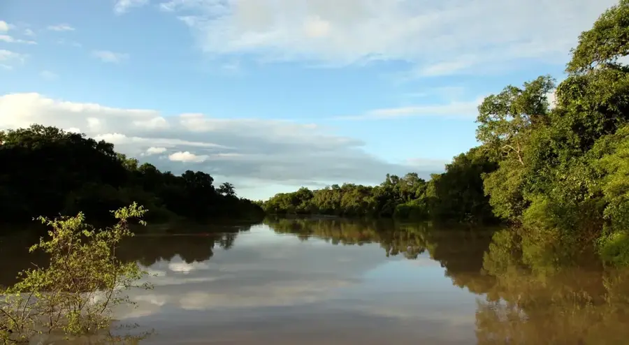
The Kainji Basin in western Nigeria is a geomorphological depression that was fundamentally transformed by the construction of the Kainji Dam on the Niger River in 1968. The relief is now dominated by the massive Kainji Reservoir, which covers an area of over 1,200 square kilometers and is surrounded by rolling hills composed of sedimentary rocks. Geologically, the basin is located in a transition zone where Cretaceous sediments overlay the ancient crystalline basement complex. The creation of the reservoir led to the resettlement of tens of thousands of people while simultaneously establishing a new foundation for inland fisheries and irrigated agriculture in the region. The adjacent Kainji Lake National Park protects the original savanna landscape and its wildlife, including hippopotamuses and various reptile species. As a central element of Nigeria's energy infrastructure, the basin regulates the flow of the Niger and secures hydroelectric power generation for much of the country.
Best time to visit & climate
The most pleasant time to visit is Jan, Nov, Dec.
| Jan | Feb | Mar | Apr | May | Jun | Jul | Aug | Sep | Oct | Nov | Dec | |
|---|---|---|---|---|---|---|---|---|---|---|---|---|
| Avg °C | 24 | 28 | 31 | 31 | 30 | 28 | 27 | 26 | 27 | 27 | 26 | 24 |
| Rain mm | 1 | 2 | 11 | 43 | 120 | 161 | 231 | 307 | 218 | 78 | 3 | 0 |
📋 Practical info
Geography
Facts
- The Kainji Reservoir was completed in 1968 and stretches approximately 135 km.
- The basin covers a total water surface area of about 1,270 square kilometers.
- Geologically, the basin features Cretaceous sandstones and siltstones.
- The Kainji Dam has an installed hydroelectric capacity of 760 megawatts.
- Kainji Lake National Park is Nigeria's oldest national park, established in 1975.
- The reservoir supports a commercial fishing industry that employs thousands of people.
Explore nearby
Notable places around
Route planner — Car & Motorhome
Where do you start? We build the route here, with stops and country notes along the way.
© OpenStreetMap contributors · OpenRouteService
Sights nearby
Frequently asked questions
What can you do in the Kainji Basin?
Is the Kainji Basin easily accessible?
Is photography prohibited in the national park?
When is the best time for wildlife viewing?
Are there tourist accommodations there?
Kainji Basin: where is it located?
Kainji Basin: when is the best time to visit?
Kainji Basin: why is it worth visiting?