Plizio Visual Lab
Manica Highlands

Weather…
Water temperature…
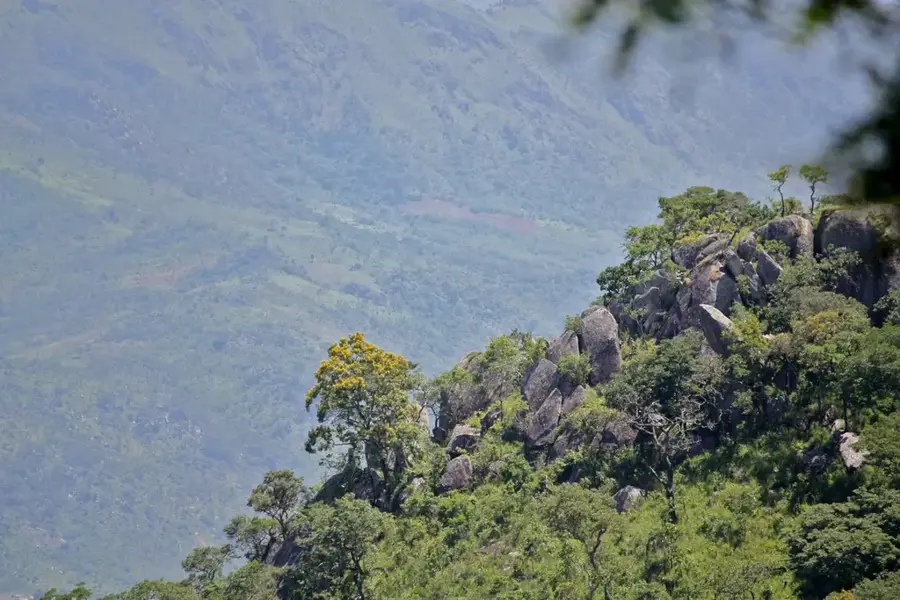
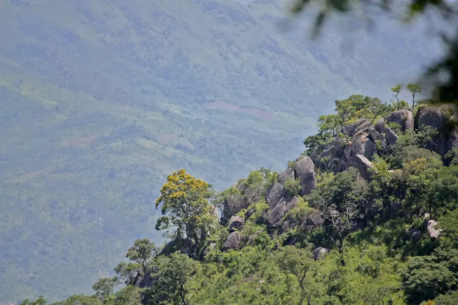
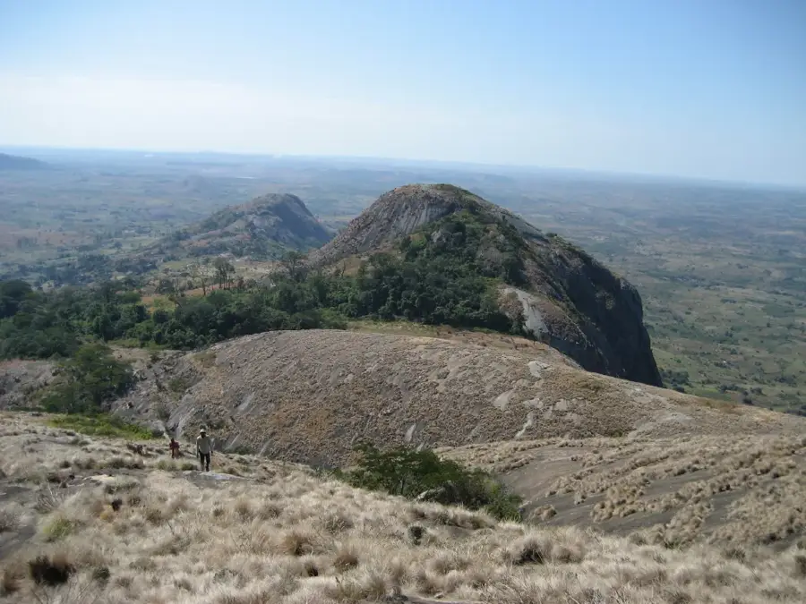
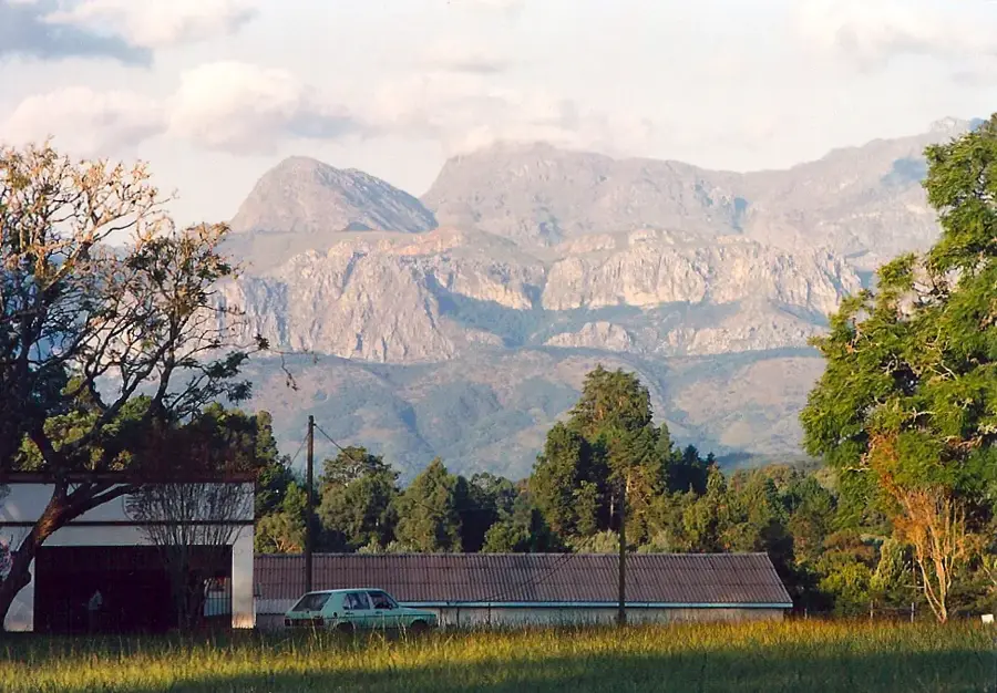
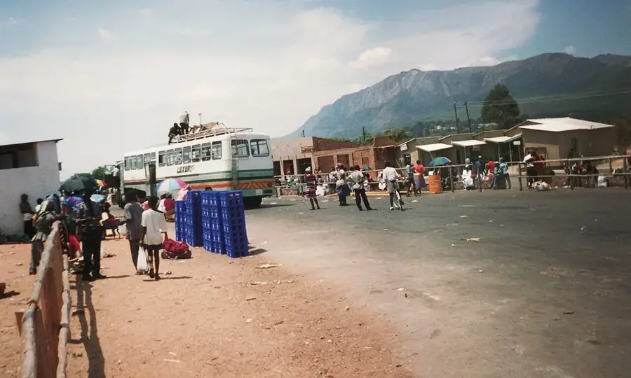
The Manica Highlands stretch along Mozambique's western border with Zimbabwe, forming part of the Great Rift Valley's eastern escarpment. This mountainous region is home to Mount Binga, which at 2436 meters is the highest point in Mozambique. The terrain is characterized by steep slopes, deep gorges, and expansive high plateaus formed by Cenozoic tectonic uplift. The moist montane climate supports dense forests and a rich diversity of flora, including numerous endemic orchids and protea species. Historically, the highlands were famous for gold deposits that were exploited as far back as the medieval Munhumutapa Empire. Today, the region serves as a major hub for forestry and plantation agriculture, particularly tea and coffee. The dramatic topography and numerous waterfalls create a vital ecological link between the humid coastal regions and the drier interior plateaus of neighboring Zimbabwe.
- Location: Mozambique
- Nearby: Manica (14 km)
Best time to visit & climate
The most pleasant time to visit is May, Aug, Sep.
| Jan | Feb | Mar | Apr | May | Jun | Jul | Aug | Sep | Oct | Nov | Dec | |
|---|---|---|---|---|---|---|---|---|---|---|---|---|
| Avg °C | 24 | 23 | 22 | 20 | 18 | 17 | 16 | 19 | 22 | 24 | 25 | 24 |
| Rain mm | 253 | 214 | 185 | 89 | 28 | 24 | 32 | 8 | 23 | 47 | 121 | 288 |
📋 Practical info
Geography
Facts
- Contains Mount Binga, Mozambique's highest peak at 2436 meters.
- The region is part of the East African Rift System escarpment.
- Gold mining has been active in the area for over 500 years.
- The city of Manica was a key center of the Munhumutapa Empire.
- It hosts the largest pine and eucalyptus plantations in the country.
- Annual rainfall often exceeds 1500 mm in the higher elevations.
Explore nearby
Notable places around
Route planner — Car & Motorhome
Where do you start? We build the route here, with stops and country notes along the way.
© OpenStreetMap contributors · OpenRouteService
Sights nearby
Frequently asked questions
What is the climate like in the Manica highlands?
Can you hike well there?
Are there accommodations?
Is it suitable for families?
When should you travel?
Manica Highlands: where is it located?
Manica Highlands: when is the best time to visit?
Manica Highlands: why is it worth visiting?

Nearby cities
History & landmarks
More places