Plizio Visual Lab
Gourma-Rharous
ℹ️Practical info — Gourma-Rharous
▾
🌤 Weather — 5 days
📍 Nearby
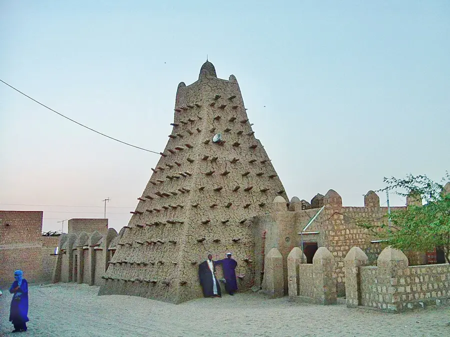
Sights nearby
💡 Tips
- Traveling along the Niger River by pinasse (traditional boat) is the most scenic way to arrive or depart.
- Be prepared for very limited infrastructure; solar chargers and high-capacity power banks are highly recommended.
- Engage with the local Tuareg and Songhai communities respectfully, and always ask before photographing people.
- Thoroughly check the up-to-date security situation before planning your trip to this remote outpost.
🍽 Food
Freshly caught from the Niger river, this fish is best enjoyed grilled at simple riverside eateries.
The traditional strong, sweet tea ritual is often offered as a sign of hospitality. Take the time to enjoy it.
A hearty rice dish cooked with meat and vegetables, typically found at small, family-run restaurants.
🛍 Shopping · 🧘 Quiet spots
Head to the area where traditional boats dock to find fresh produce and the catch of the day.
Seek out local Tuareg artisans for authentic, handcrafted silver jewelry and leather goods.
Watch the slow-moving river and traditional wooden boats passing by in the quiet light of dawn.
Walk slightly inland away from the water to experience the profound, absolute silence of the approaching Sahara.
Water temperature…
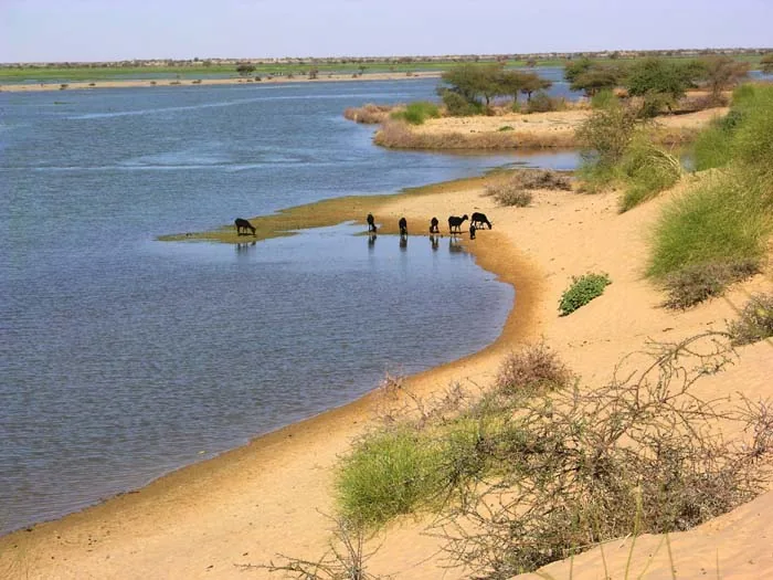
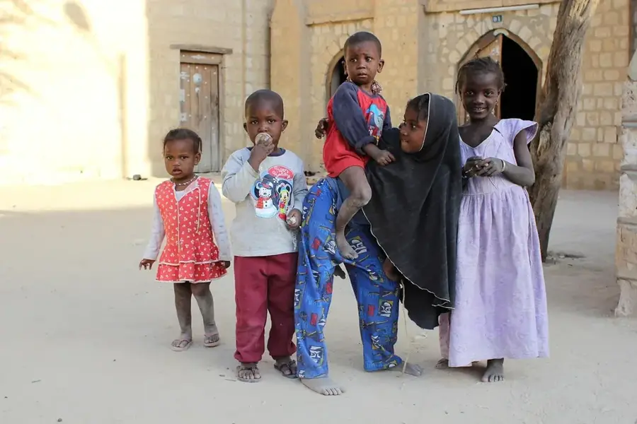
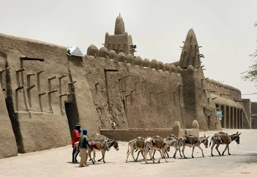
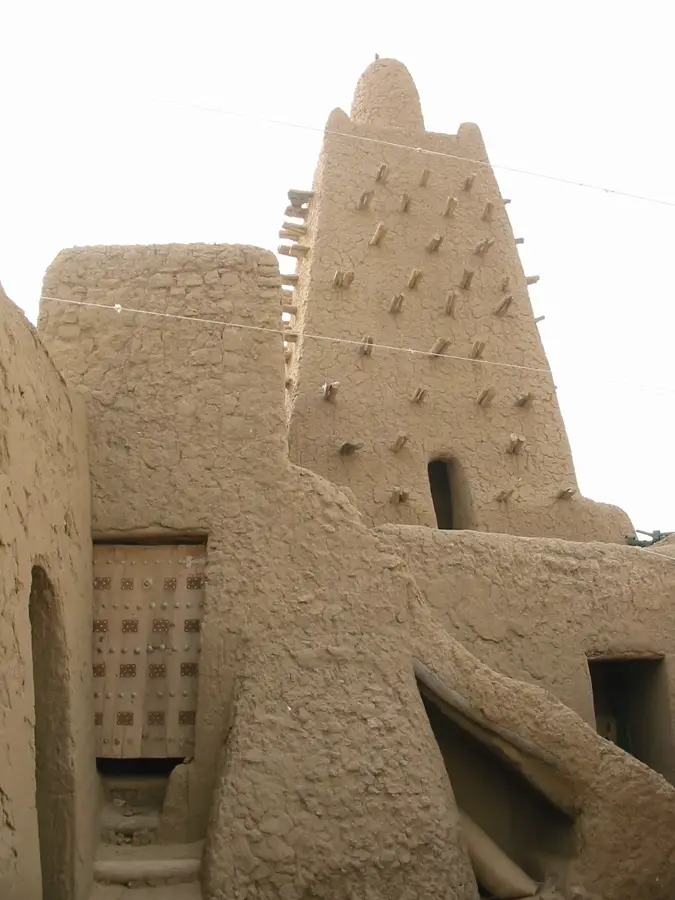
Gourma-Rharous is a remote and strategically important desert outpost in northern Mali, situated on the right bank of the Niger River in the Timbuktu Region. The town lies at the heart of the vast Gourma plain, a semi-arid region that serves as critical grazing land for nomadic Tuareg and Fulani tribes. Gourma-Rharous acts as a vital bridge between the sedentary riverine communities and the expansive interior of the Sahara. The town's economy is centered on livestock trade, river fishing, and the long-distance trade of salt from northern mines. It is notably recognized as the gateway to the Gourma elephant sanctuary, home to Africa's northernmost elephant population, which coexists with local nomadic herders. The town's architecture features robust mud-brick structures in the traditional Timbuktu style, designed to provide relief from extreme desert heat. As the administrative capital of the Gourma-Rharous Cercle, it is a key site for regional governance and development coordination. The town remains a place of vast horizons, preserving the deep-seated traditions of desert life.
Best time to visit & climate
The most pleasant time to visit is Jan, Feb, Dec.
| Jan | Feb | Mar | Apr | May | Jun | Jul | Aug | Sep | Oct | Nov | Dec | |
|---|---|---|---|---|---|---|---|---|---|---|---|---|
| Avg °C | 20 | 23 | 28 | 32 | 35 | 36 | 34 | 32 | 32 | 31 | 26 | 22 |
| Rain mm | 1 | 0 | 1 | 1 | 4 | 16 | 56 | 92 | 35 | 5 | 0 | 0 |
Geography
Facts
- Strategic town on the right bank of the Niger, east of Timbuktu
- Located on the Gourma Plain, a critical grazing area for nomads
- Main gateway to the unique Gourma desert elephant sanctuary
- Key center for livestock commerce and the Sahara salt trade
- Administrative capital of the expansive Gourma-Rharous Cercle
- Cultural meeting point for nomadic Tuareg and sedentary Songhai peoples
Explore nearby
Notable places around
Route planner — Car & Motorhome
Where do you start? We build the route here, with stops and country notes along the way.
© OpenStreetMap contributors · OpenRouteService
Sights in the town Gourma-Rharous (1)
Frequently asked questions
What characterizes Gourma-Rharous?
When is the best time for a visit?
How long should you stay?
Is it a classic travel destination?
What is the local way of life?
Gourma-Rharous: where is it located?
Gourma-Rharous: when is the best time to visit?
Gourma-Rharous: why is it worth visiting?

Nearby cities


History & landmarks
More places