Plizio Visual Lab
Matsoku River
Weather…
Water temperature…
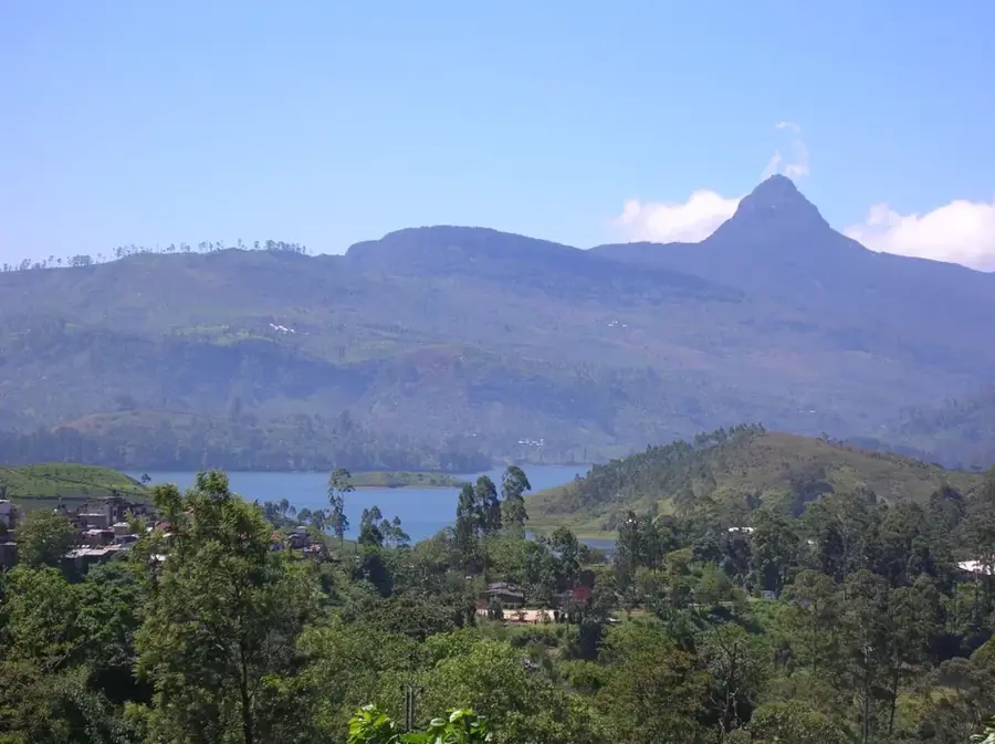
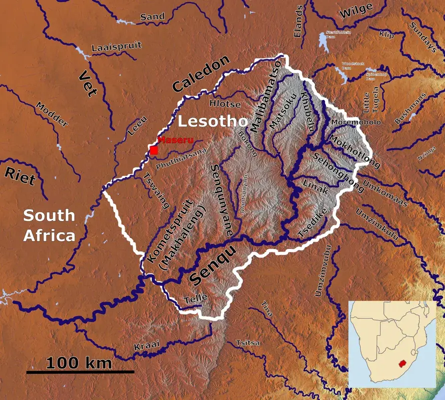
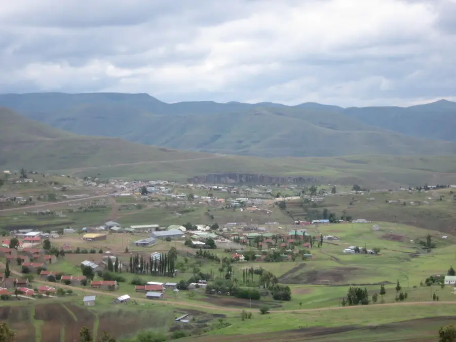
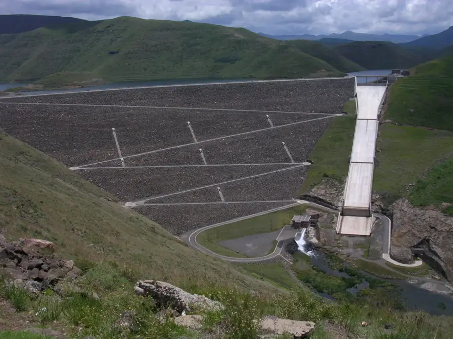
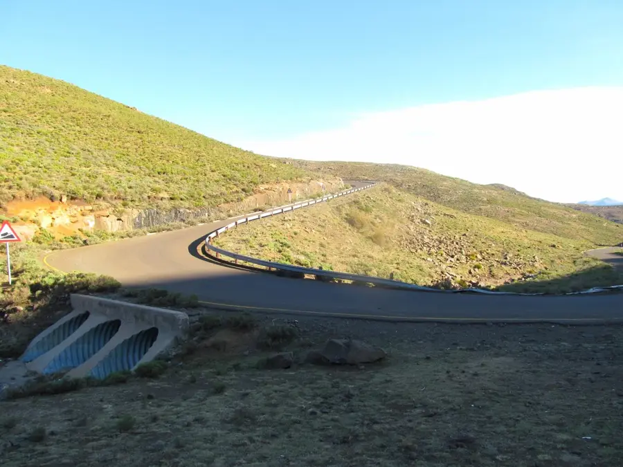
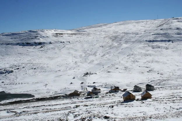
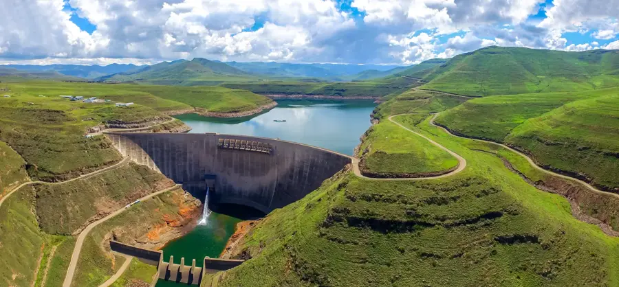
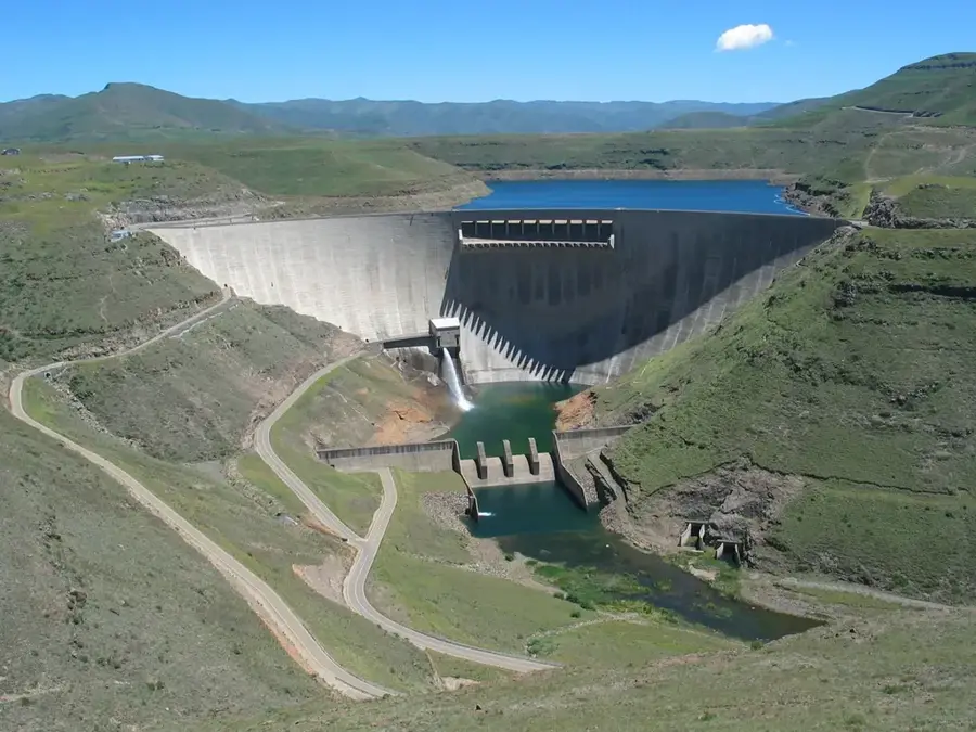
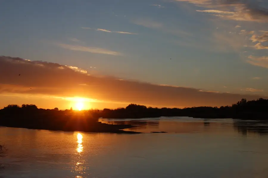
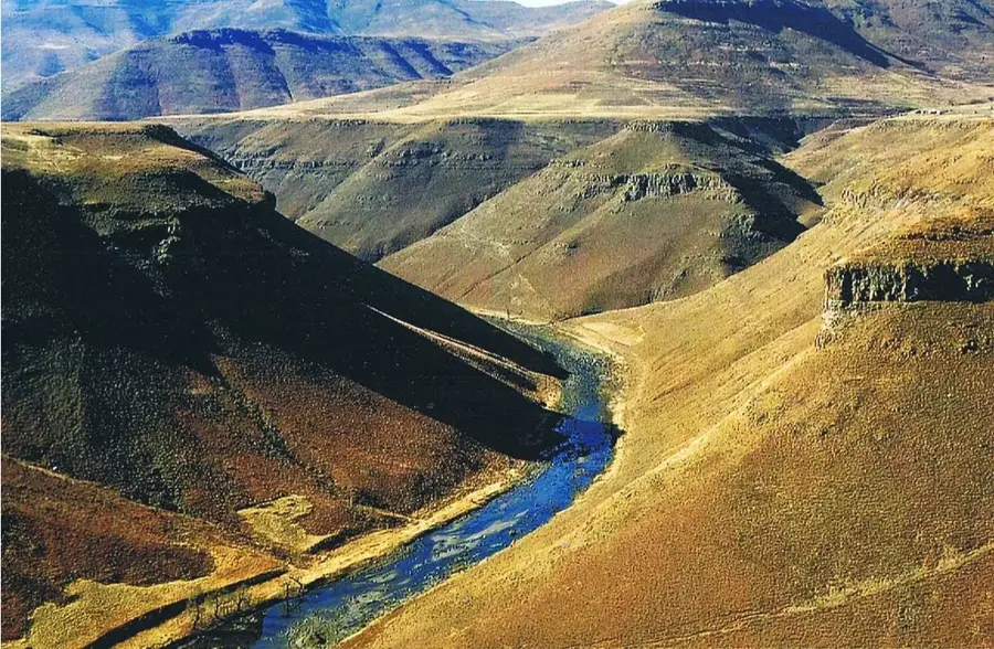
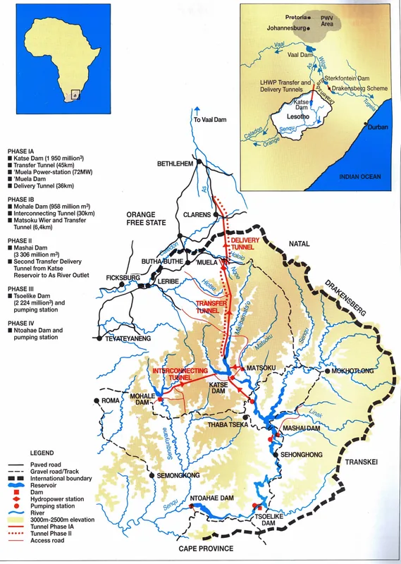
The Matsoku River is a significant tributary within the Malibamat'so River catchment in northern Lesotho. It flows through a remote and mountainous region known for its rugged beauty and its strategic importance to the Lesotho Highlands Water Project (LHWP). A central feature of the river's modern management is the Matsoku Weir and its associated tunnel, which diverts water from the Matsoku into the Katse Reservoir to enhance the overall water volume available for export. Despite these major engineering interventions, the river maintains much of its natural character in its upper reaches. The surrounding region is sparsely populated and primarily used for high-altitude grazing, with Basotho herders moving livestock seasonally. Ecologically, the river supports fragile aquatic habitats adapted to the low temperatures and high flow velocities of mountain streams. The geology, characteristic of much of Lesotho, is dominated by volcanic basalt, giving the riverbed a distinctive dark appearance.
- Location: Lesotho
- Nearby: Ha Lejone (13 km)
Best time to visit & climate
The most pleasant time to visit is Sep–Nov.
| Jan | Feb | Mar | Apr | May | Jun | Jul | Aug | Sep | Oct | Nov | Dec | |
|---|---|---|---|---|---|---|---|---|---|---|---|---|
| Avg °C | 14 | 14 | 12 | 9 | 5 | 2 | 2 | 5 | 8 | 11 | 12 | 14 |
| Rain mm | 193 | 155 | 115 | 65 | 16 | 14 | 12 | 23 | 32 | 82 | 115 | 163 |
📋 Practical info
Geography
Facts
- Feeds the Matsoku Tunnel, which is approximately 5.6 kilometers long.
- Water is diverted from the Matsoku Weir to the Katse Reservoir.
- The river flows through the Mokhotlong and Leribe districts.
- The Matsoku Diversion Project was completed in the year 2001.
- An important component of Phase 1B of the Lesotho Highlands Water Project.
- The region frequently experiences sub-zero temperatures during winter.
Explore nearby
Notable places around
Route planner — Car & Motorhome
Where do you start? We build the route here, with stops and country notes along the way.
© OpenStreetMap contributors · OpenRouteService
Sights nearby
Frequently asked questions
What is special about the Matsoku River?
Is the Matsoku River region developed for tourism?
What activities can be done there?
How are the road conditions?
Is there accommodation by the river?
Matsoku River: where is it located?
Matsoku River: when is the best time to visit?
Matsoku River: why is it worth visiting?

Nearby cities


History & landmarks
Nature

More places