Plizio Visual Lab

Sila National Park

Plizio editorial teamData Sources
park
—°13
Sila National Park (Italy)

Weather…

Highlights of 2026

1

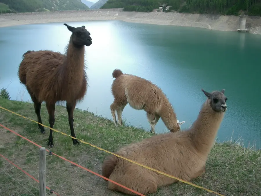
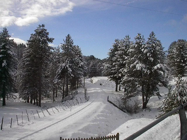
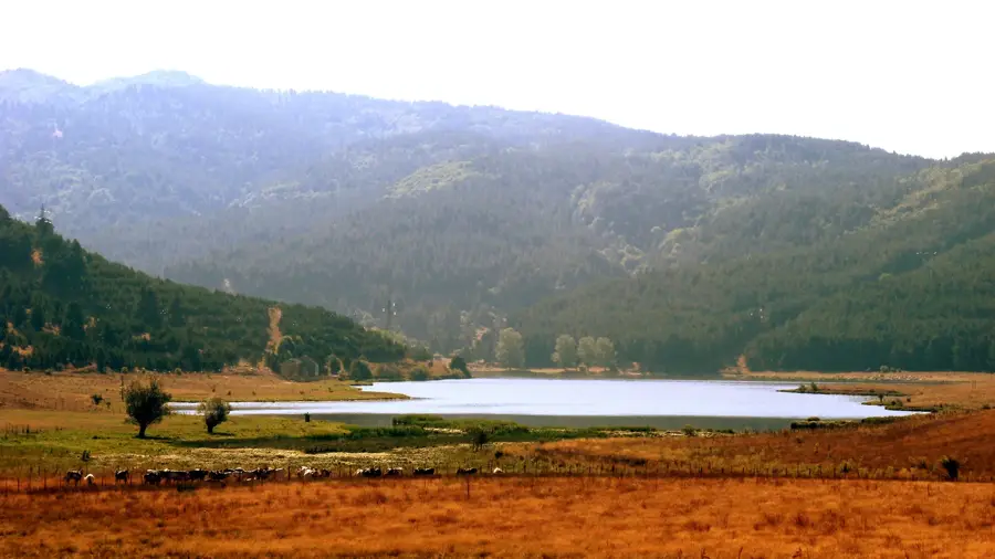
Sila National Park is located in the heart of Calabria and covers the plateau of the same name, divided into Sila Grande, Sila Piccola, and Sila Greca. Established in 1997, the park protects one of Italy's most significant forested areas, often referred to as the 'Great Forest of Italy.' The landscape is characterized by rolling hills, dense pine and beech forests, and large artificial lakes such as Arvo, Cecita, and Ampollino, which have created a unique alpine-like environment in Southern Italy. A major highlight of the park is the 'Giants of Sila,' centuries-old Calabrian pines (Pinus nigra laricio) that can reach heights of up to 45 meters. The park is a vital habitat for the Calabrian wolf, as well as deer, roe deer, and numerous species of birds of prey. Its high altitude ensures a much cooler climate than the coastal areas, making it a popular destination for skiing in winter and hiking in summer. Cultural landmarks include the Abbey of San Giovanni in Fiore, founded in the 12th century by the mystic Joachim of Fiore.

Your journey, your memory

A postcard from Sila National Park

Turn your own photo into a personal postcard with a local stamp. Free and no sign-up required.

Create a postcard

Best time to visit & climate

The most pleasant time to visit is Jun, Jul, Sep.

JanFebMarAprMayJunJulAugSepOctNovDec
Avg °C77912162125252016128
Rain mm1331279868503526328087134130

📋 Practical info

🧭
Getting there
The 73,695-hectare park spans the provinces of Cosenza, Catanzaro and Crotone. The main orientation points are Cupone Visitor Centre beside Lake Cecita near Camigliatello Silano and A. Garcea Visitor Centre near Villaggio Mancuso in Monaco di Taverna. They provide information, maps and access to guided excursion services.
📅
Best season
The best time to visit is from May to October for hiking through the cool forests and enjoying activities on the plateau's lakes. In winter, Sila is a popular skiing destination, and the landscape is often covered by a thick layer of snow, creating a unique atmosphere.
⛰️
Terrain & paths
The official trail network covers about 600 km: 66 main trails, 51 secondary trails and five sections of the Sentiero Italia. Routes across the three provinces range from short educational paths to longer forest and plateau hikes, so check the difficulty and current condition of the specific trail.
🎒
What to bring
Carry footwear suited to the chosen route, water, a light rain or warm layer, and an offline map. Hiking shoes are preferable on longer or remote trails, while winter conditions may require specialist snow equipment.
🅿️
Parking
Use designated parking at visitor centres and official recreation sites. Cupone has an equipped picnic area beside Lake Cecita; for smaller trailheads, check road access, parking and any seasonal restrictions in advance.
⚠️
Safety
Download official trail maps in advance because mobile coverage is not reliable everywhere. Stay on marked routes, check weather, snow and wildfire conditions, and tell someone about longer hikes. Visitor centres can advise on current conditions and official guides.
⏱️
Time needed
A visit to the main natural monuments can take a few hours, but at least half a day or a full day should be planned for a proper hike. Those wishing to enjoy the peace and the vast forests can easily spend several days in the region visiting different lakes.

Geography

Coordinates
39.33300, 16.50000

Facts

  • The park covers a total area of approximately 73,700 hectares.
  • The highest peak is Monte Botte Donato, reaching 1,928 meters above sea level.
  • The wolf is the official symbol of the Sila National Park.
  • The 'Giants of Sila' nature reserve contains trees that are over 450 years old.
  • Lake Arvo is a major artificial reservoir used for both hydroelectricity and tourism.
  • Sila was officially designated as a UNESCO Biosphere Reserve in 2014.

Explore nearby

Notable places around

Route planner — Car & Motorhome

Where do you start? We build the route here, with stops and country notes along the way.

Vehicle
Only stops with (optional):
Motorhome dimensions

© OpenStreetMap contributors · OpenRouteService

Sights in the town Sila National Park (3)

Raccolta Barracco🏛 museum

A museum in the Sila National Park showcasing archaeological findings and local heritage.

La Nave della Sila🏛 museum

A museum dedicated to the history of emigration, housed in a unique architectural structure.

🕒 Chiuso temporaneamente

I Giganti della Sila🌿 nature

A majestic grove of centuries-old black pines protected within the Sila National Park.

Sights nearby

Frequently asked questions

Which animals can you see in the Sila National Park?
The park is known for its wolves, deer, wildcats, and numerous birds of prey.
Are there lakes in the park?
Yes, the large reservoirs Arvo, Cecita, and Ampollino define the landscape and offer recreation.
Can you go skiing in the Sila mountains in winter?
Yes, there are ski resorts in Lorica and Camigliatello Silvano with lifts and slopes.
What are the 'Giants of Sila'?
They are massive black pine trees, up to 400 years old, located in the Fallistro Nature Reserve.
Is there an entry fee for the park?
Access to the park is free, though fees may apply for visitor centers or museums.
Sila National Park: where is it located?
Sila National Park is located in Italy.
Sila National Park: what is there to see?
Highlights include Raccolta Barracco, La Nave della Sila, I Giganti della Sila.
Sila National Park: when is the best time to visit?
The most pleasant time to visit is Jun, Jul, Sep.
Sila National Park: why is it worth visiting?
Sila National Park is located in the heart of Calabria and covers the plateau of the same name, divided into Sila Grande, Sila Piccola, and Sila Greca.
View on map → The Top 50 Attractions → Most beautiful beaches → OpenStreetMap →
Europe
Explore with Plizio Discover more places in Europe
More places in Italy →

Nearby cities

More places