Plizio Visual Lab
Mount Loura
Weather…
Water temperature…
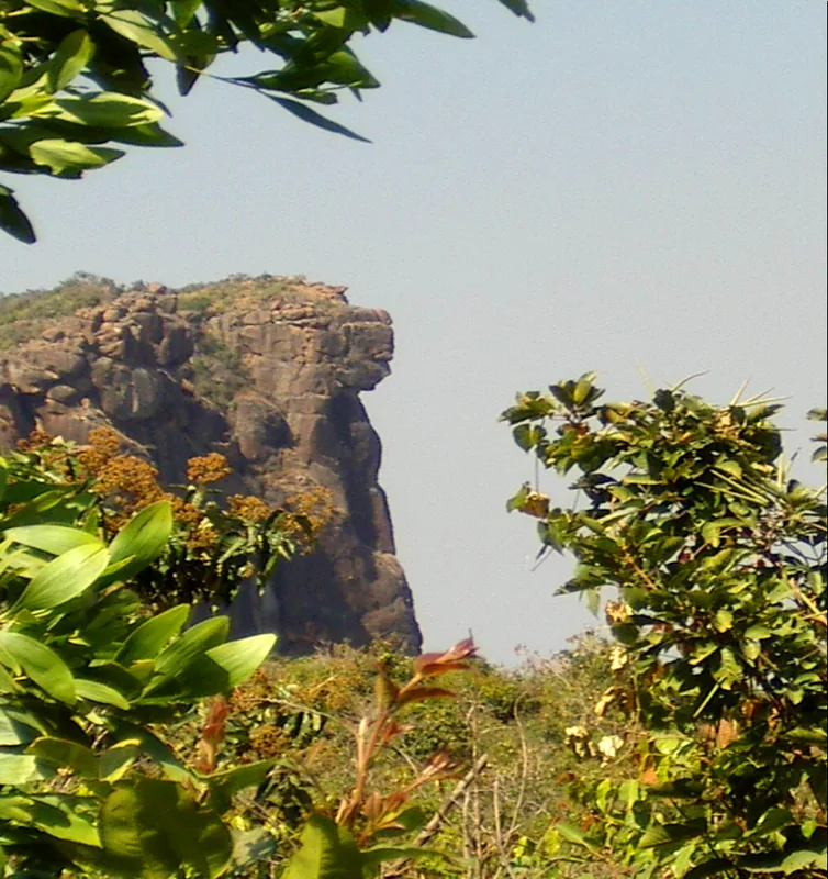
Mount Loura (Mont Loura) is the highest peak in the Fouta Djallon range, standing at 1,515 meters, and is a major natural landmark in northern Guinea. Geographically located in the Mali Prefecture near the border with Senegal, the mountain's summit gives spectacular 360-degree views that extend far into the neighboring country's plains on clear days. Mount Loura is most famous internationally for an extraordinary geological formation on one of its slopes: the 'Lady of Mali' (Dame du Mali). This natural rock wall has been carved by wind and water erosion to resemble, from a specific angle, the well-suited profile of a woman with aristocratic features. The landscape around Mount Loura is characterized by rugged plateaus, sheer cliffs, and a cool, often windy atmosphere. The climate is among the most extreme in Guinea, with significant day-to-night temperature fluctuations that can drop near freezing during the harmattan season. Botanically, the mountain supports rare high-altitude plant species adapted to the harsh conditions. For the local people, Mount Loura is a site of legends and a symbol of the rugged spirit of the highlands. It remains a premier destination for hikers and nature enthusiasts seeking the mystical and raw beauty of Guinea's highest terrains.
Explore on the map
How well do you know Guinea?
Find cities, landscapes and regions in 10 varied challenges on the interactive map.
Your journey, your memory
A postcard from Mount Loura
Turn your own photo into a personal postcard with a local stamp. Free and no sign-up required.
Create a postcard- Location: Guinea
- Nearby: Mali (4 km)
Best time to visit & climate
The most pleasant time to visit is Jan, Nov, Dec.
| Jan | Feb | Mar | Apr | May | Jun | Jul | Aug | Sep | Oct | Nov | Dec | |
|---|---|---|---|---|---|---|---|---|---|---|---|---|
| Avg °C | 25 | 28 | 30 | 31 | 30 | 27 | 25 | 24 | 24 | 25 | 24 | 24 |
| Rain mm | 2 | 1 | 2 | 10 | 72 | 174 | 332 | 468 | 296 | 113 | 13 | 0 |
📋 Practical info
Geography
Facts
- Mount Loura is the highest elevation in the central and northern Fouta Djallon.
- The 'Lady of Mali' formation is considered a masterpiece of natural erosion.
- The mountain is situated approximately 7 km from the town of Mali-Yembering.
- It experiences some of the lowest recorded temperatures in the Republic of Guinea.
- The peak serves as a strategic lookout point over the Senegal River basin.
- The site is a major hub for eco-tourism and mountain climbing in the region.
Explore nearby
Notable places around
Route planner — Car & Motorhome
Where do you start? We build the route here, with stops and country notes along the way.
© OpenStreetMap contributors · OpenRouteService
Sights nearby
Frequently asked questions
What is the 'Dame de Mali'?
How high is Mount Loura?
Is the climb difficult?
Is there a good view?
Is there water up there?
Mount Loura: where is it located?
Mount Loura: when is the best time to visit?
Mount Loura: why is it worth visiting?

Nearby cities


History & landmarks
Nature
More places