Plizio Visual Lab
Bui Gorge

Weather…
Water temperature…
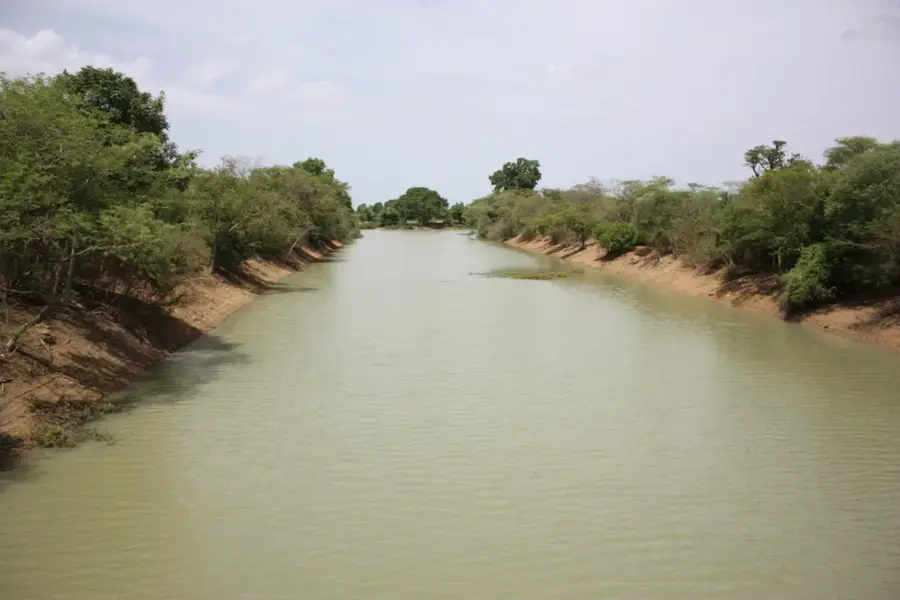
The Bui Gorge is a dramatic geological feature where the Black Volta River carves its path through the Banda Hills in northwestern Ghana. This deep and narrow canyon was formed over millennia by the erosive power of water cutting through resistant metamorphic rock. Geographically, the gorge occupies a strategic position along the river, which is now the site of the massive Bui Hydroelectric Dam, completed in 2013. The surrounding area is part of the Bui National Park, Ghana's third-largest protected area, renowned for its significant population of hippopotamuses and its pristine savanna woodland. Originally, the gorge featured a unique ecosystem of rapids and deep riverine pools. Historically, the region served as a vital landmark for trade routes and local communities within the Banda district. The dam's construction created a reservoir that submerged portions of the original gorge but opened new avenues for commercial fishing and agricultural irrigation. Despite its industrial transformation, the Bui Gorge remains an essential area for biodiversity conservation within the forest-savanna transition zone.
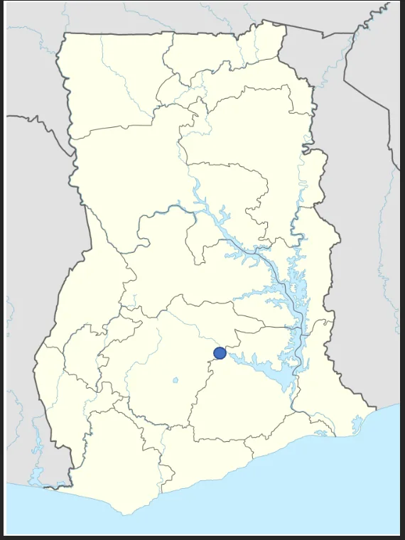
- Location: Ghana
- Nearby: Kintampo (63 km)
Best time to visit & climate
The most pleasant time to visit is Jan, Nov, Dec.
| Jan | Feb | Mar | Apr | May | Jun | Jul | Aug | Sep | Oct | Nov | Dec | |
|---|---|---|---|---|---|---|---|---|---|---|---|---|
| Avg °C | 27 | 30 | 31 | 30 | 29 | 27 | 26 | 26 | 26 | 27 | 28 | 27 |
| Rain mm | 4 | 19 | 49 | 95 | 116 | 137 | 157 | 144 | 199 | 120 | 24 | 4 |
📋 Practical info
Geography
Facts
- Bui Gorge is located within the 1,821 square kilometer Bui National Park.
- The Bui Dam situated in the gorge has an installed capacity of 400 megawatts.
- Construction of the dam required the relocation of approximately 1,200 residents.
- The gorge is home to some of the last major hippopotamus herds in Ghana.
- The rocks forming the gorge are primarily quartzites of the Birimian series.
- The reservoir created by damming the gorge covers an area of 444 square kilometers.
Explore nearby
Notable places around
Route planner — Car & Motorhome
Where do you start? We build the route here, with stops and country notes along the way.
© OpenStreetMap contributors · OpenRouteService
Sights in the town Bui Gorge (1)
Sights nearby
Frequently asked questions
What is the Bui Gorge?
Is the gorge accessible to tourists?
What makes the landscape there special?
Can you go hiking there?
What animals live in the gorge?
Bui Gorge: where is it located?
Bui Gorge: when is the best time to visit?
Bui Gorge: why is it worth visiting?

Nearby cities

Nature
More places