Plizio Visual Lab
Truso Valley
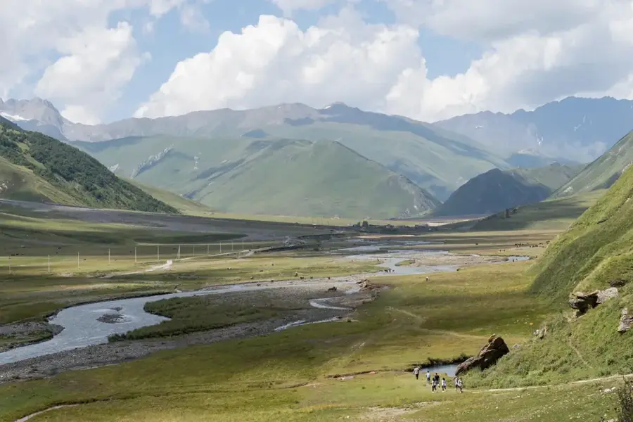
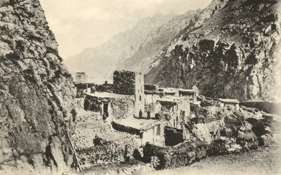
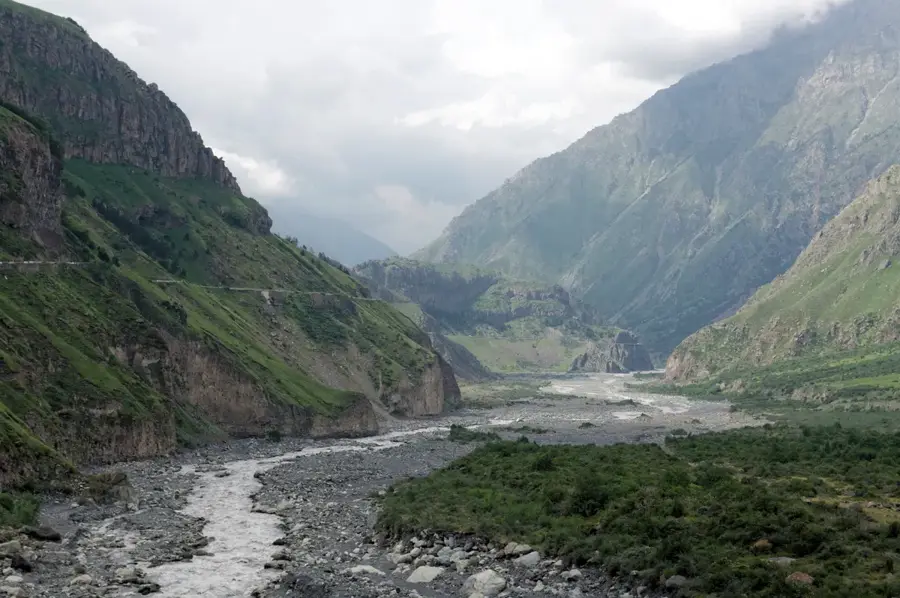
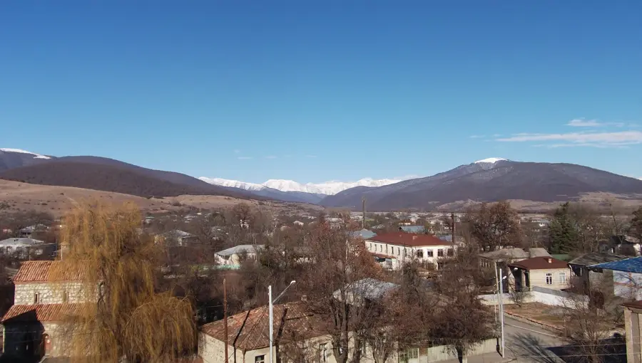
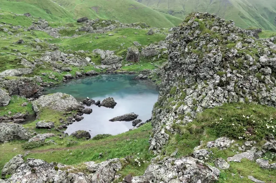
The Truso Valley is a spectacular high-altitude valley in northern Georgia, located near the Russian border and serving as the source region for the Terek River. Geographically, it is set between the main ridge of the Greater Caucasus and the Kazbek massif at an elevation exceeding 2,000 meters. The landscape is uniquely shaped by dormant volcanic activity, evidenced by numerous carbonated mineral springs and bustling travertine deposits. These limestone formations glow in shades of yellow, orange, and white, lending the valley an almost surreal appearance. Historically, the valley was primarily inhabited by Ossetians; however, today most of the medieval stone villages, such as Ketrisi and Abano, lie in ruins and are largely deserted, creating a hauntingly beautiful atmosphere. Beyond its geological allure, Truso features significant cultural landmarks including monasteries and ancient defensive towers. Trekkers are drawn to the valley for its expansive, treeless vistas and the towering views of the surrounding 5,000-meter peaks.
- Location: Georgia
- Top sights: Truso Valley · Kasara · Truso Travertines
- Nearby: Gudauri (11 km)
Best time to visit & climate
The most pleasant time to visit is Jul–Sep.
| Jan | Feb | Mar | Apr | May | Jun | Jul | Aug | Sep | Oct | Nov | Dec | |
|---|---|---|---|---|---|---|---|---|---|---|---|---|
| Avg °C | -10 | -9 | -4 | 1 | 7 | 11 | 15 | 14 | 10 | 5 | -2 | -7 |
| Rain mm | 38 | 32 | 55 | 65 | 89 | 89 | 62 | 55 | 54 | 60 | 44 | 33 |
📋 Practical info
Geography
Facts
- The valley is situated at an average elevation of approximately 2,200 meters.
- The Terek River originates here from the glaciers of the Zilga-Khokh mountain.
- The valley is famous for its travertine terraces formed by calcium-rich spring water.
- There are over 60 registered mineral springs within this small geographic area.
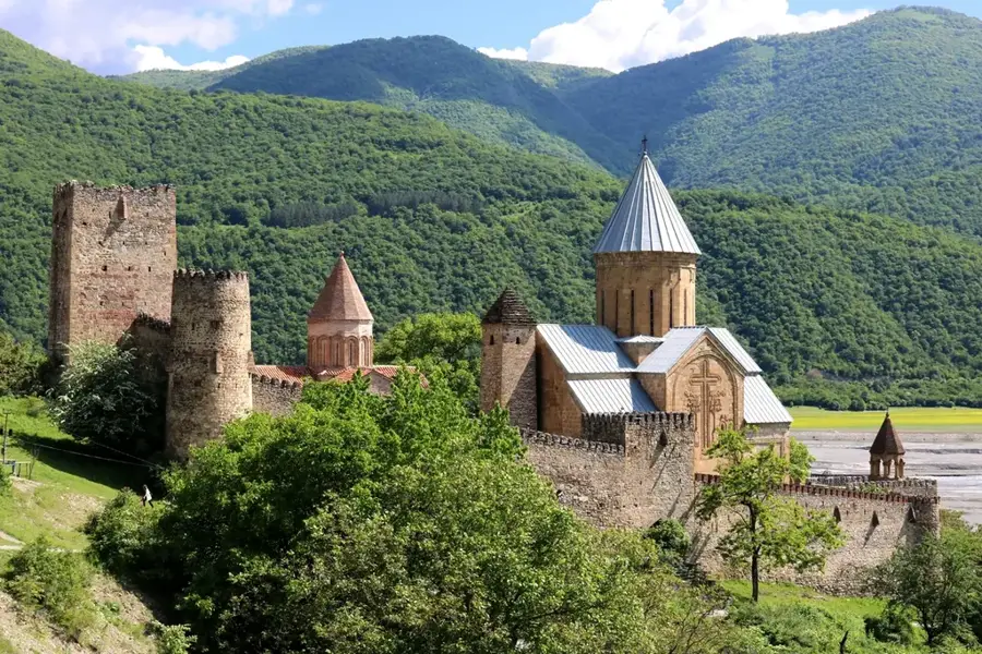
- The medieval fortress of Zakagori stands guard at the entrance to the valley.
- The valley is accessible mainly by foot or 4x4 vehicles for most of the year.
Explore nearby
Notable places around
Route planner — Car & Motorhome
Where do you start? We build the route here, with stops and country notes along the way.
© OpenStreetMap contributors · OpenRouteService
Sights in the town Truso Valley (3)
Sights nearby
Frequently asked questions
What are the highlights in Truso Valley?
How difficult is the hike through the valley?
Do you need a permit to visit?
Are there permanently inhabited villages?
Can you drink mineral water in the valley?
Truso Valley: where is it located?
Truso Valley: what is there to see?
Truso Valley: when is the best time to visit?
Truso Valley: why is it worth visiting?

Nearby cities
Nature
More places