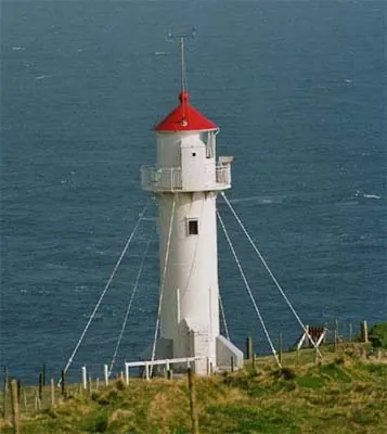
Akraberg Lighthouse
The Akraberg Lighthouse (Vitið á Akrabergi) stands proudly at the southernmost tip of Suðuroy, which is the southernmost island of the Faroe Islands. Constructed in 1909, this iconic cylindrical tower is a vital navigational beacon that has guided maritime traffic through the treacherous and often unpredictable waters of the North Atlantic for well over a century. Its distinctive white structure with a bright red top contrasts starkly against the dramatic, rugged, and barren landscape that surrounds it. The lighthouse is perched on steep, windswept cliffs, offering visitors breathtaking, uninterrupted views of the fierce ocean crashing with immense power against the rocky shores below. The site is steeped in history, not only for its crucial maritime significance but also for its role during World War II when a British radio beacon was established here. Today, visiting Akraberg provides an awe-inspiring experience of nature's raw power. The sheer isolation and the extreme weather conditions make it a compelling destination for photographers, nature lovers, and adventurers.
Weather…
Practical info
Tips
- Dress warmly and ensure you are wearing windproof outer layers.
- Secure your camera and loose equipment against sudden, powerful gusts of wind.
- Be fully prepared for rapidly changing and unpredictable weather conditions.
FAQ
What is the Akraberg Lighthouse?
Where exactly is it located?
Why is it famous?
How can I reach it?
Route planner — Car & Motorhome
Where do you start? We build the route here, with stops and country notes along the way.
© OpenStreetMap contributors · OpenRouteService