Plizio Visual Lab
Djoli Hills

Weather…
Water temperature…
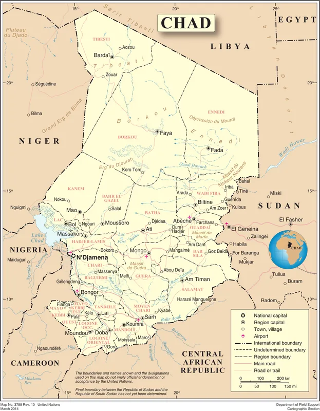
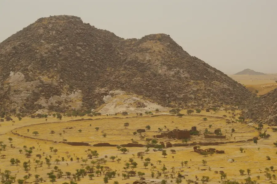
The Djoli Hills are a cluster of elevations in eastern Chad, marking the transitional zone between the Ennedi Region and the Ouaddaï Highlands. This hilly landscape is primarily composed of crystalline basement rocks and sandstone outcrops created by tectonic uplift. The region is characterized by a semi-arid climate, with the hills functioning as natural water collectors during the brief rainy season. Seasonal streams accumulate in the valleys between the elevations, supporting sparse vegetation that is crucial for local livestock grazing. Historically, the Djoli Hills have been significant for nomadic groups, such as the Zaghawa and Arab tribes, who utilize the area as pastureland. Geomorphologically, the hills show advanced signs of weathering, including isolated inselbergs and deeply incised wadis. Due to their strategic location, they frequently served as navigational waypoints for caravans traveling between the Central Sahara and the Sudanese regions. The vegetation is dominated by thorny acacias and seasonal grasses adapted to drought conditions.
- Location: Chad
- Nearby: Guéréda (65 km)
Best time to visit & climate
The most pleasant time to visit is Jan, Nov, Dec.
| Jan | Feb | Mar | Apr | May | Jun | Jul | Aug | Sep | Oct | Nov | Dec | |
|---|---|---|---|---|---|---|---|---|---|---|---|---|
| Avg °C | 22 | 25 | 28 | 31 | 32 | 32 | 29 | 26 | 27 | 27 | 25 | 22 |
| Rain mm | 0 | 0 | 0 | 1 | 7 | 19 | 90 | 168 | 53 | 6 | 0 | 0 |
📋 Practical info
Geography
Facts
- The hills are located at the border of the Ennedi and Ouaddaï regions.
- Geology consists of a mix of ancient granite and sandstone layers.
- Average elevations in this area range from 800 to 1,000 meters.
- The region is a traditional grazing area for Zaghawa nomadic tribes.
- Valleys host temporary water bodies called Rahats during the rains.
- Weathering has created distinct isolated peaks known as inselbergs.
Explore nearby
Notable places around
Route planner — Car & Motorhome
Where do you start? We build the route here, with stops and country notes along the way.
© OpenStreetMap contributors · OpenRouteService
Sights nearby
Frequently asked questions
What are the Djoli Hills?
Are the hills developed for tourism?
How to reach the Djoli Hills?
Is wild camping possible?
When is the best time for a trip?
Djoli Hills: where is it located?
Djoli Hills: when is the best time to visit?
Djoli Hills: why is it worth visiting?