Plizio Visual Lab
Nessebar Ruins
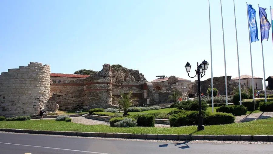
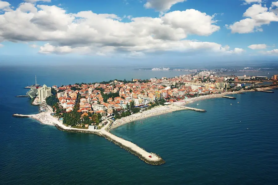
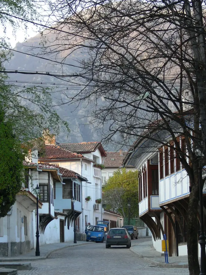
Nessebar is one of the oldest cities in Europe, situated on a rocky peninsula on the Bulgarian Black Sea coast. Founded over 3,000 years ago by the Thracians under the name Mesembria, it later developed into a significant Greek polis and a Roman regional center. The ruins of Nessebar bear witness to a turbulent history, featuring Thracian fortifications, Hellenistic city walls, and Roman infrastructure. The city is particularly famous for its numerous medieval churches from the Byzantine and Bulgarian eras, such as the monumental Church of Saint Sophia (the Old Bishopric) dating back to the 5th century. The town's architecture is defined by narrow cobblestone streets and characteristic residential houses from the Bulgarian National Revival period. Due to its exceptional cultural heritage, the ancient town of Nessebar was included in the UNESCO World Heritage list in 1983. Today, it serves as an open-air museum that attracts thousands of visitors annually, showcasing a unique blend of ancient and medieval history.
Explore on the map
How well do you know Bulgaria?
Find cities, landscapes and regions in 10 varied challenges on the interactive map.
Your journey, your memory
A postcard from Nessebar Ruins
Turn your own photo into a personal postcard with a local stamp. Free and no sign-up required.
Create a postcard- Location: Bulgaria
- Highlights: Nessebar UNESCO Sign · Ancient Nessebar Museum · Old Nessebar Windmill
- Nearby: Pomorie (14 km)
Best time to visit & climate
The most pleasant time to visit is Jun, Aug, Sep.
| Jan | Feb | Mar | Apr | May | Jun | Jul | Aug | Sep | Oct | Nov | Dec | |
|---|---|---|---|---|---|---|---|---|---|---|---|---|
| Avg °C | 3 | 4 | 7 | 11 | 17 | 22 | 25 | 25 | 20 | 15 | 10 | 5 |
| Rain mm | 65 | 47 | 45 | 34 | 45 | 49 | 47 | 26 | 52 | 68 | 46 | 63 |
📋 Practical info
Geography
Facts
- The city was originally founded by Thracians as Mesembria.
- Nessebar was added to the UNESCO World Heritage list in 1983.
- There are remains of over 40 churches from different historical periods.
- The Church of St. Sophia dates to the late 5th or early 6th century.
- The old town is located on a peninsula 850 meters long and 300 meters wide.
- The massive fortress walls at the entrance date back to ancient times.
Explore nearby
Notable places around
Route planner — Car & Motorhome
Where do you start? We build the route here, with stops and country notes along the way.
© OpenStreetMap contributors · OpenRouteService
Sights in the town Nessebar Ruins (7)
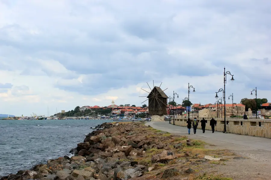
Old Nessebar Windmill
Historic windmill on the peninsula, a landmark of the old town.
Church of Christ Pantocrator🏛 museum
Medieval church from the 13th, 14th century, now a museum with fresco fragments.
Early Byzantine Terms
Ruins of early Byzantine bath complexes from the 5th, 6th century.
Ancient Theatre
Ruins of an ancient theatre from the Hellenistic period, partially preserved.
Rumka's fine arts
Art gallery in Nessebar hosting rotating exhibitions of contemporary art.
Sights nearby
Frequently asked questions
Are the Nesebar ruins free to visit?
How much time should I spend in the old town?
Is Nesebar wheelchair accessible?
Is there parking near the ruins?
Is photography allowed in the old churches?
Nessebar Ruins: where is it located?
Nessebar Ruins: what is there to see?
Nessebar Ruins: when is the best time to visit?
Nessebar Ruins: why is it worth visiting?

Nearby cities

History & landmarks