Plizio Visual Lab
Shashe River
Weather…
Water temperature…
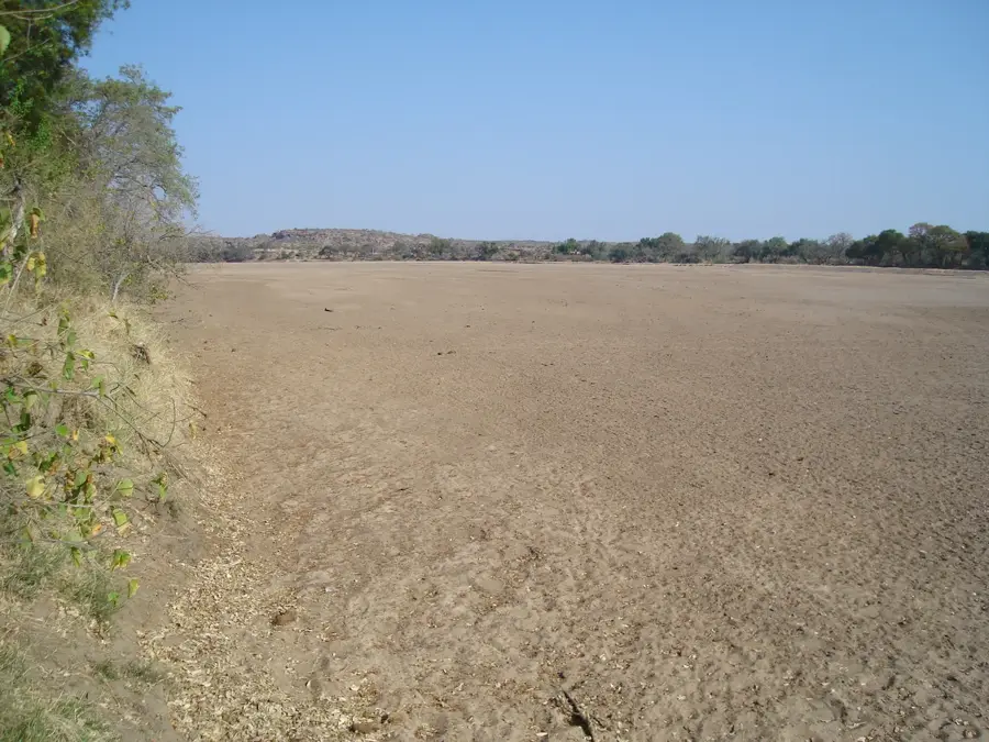
The Shashe River is a major left-bank tributary of the Limpopo River in southern Africa, spanning a total length of approximately 362 kilometers. It originates northwest of Francistown in Botswana and flows in a southeasterly direction, defining the international border between Botswana and Zimbabwe for about 200 kilometers. Geomorphologically, the river is characterized by a wide, sandy bed that remains ephemeral, carrying surface water only during the summer rainy season. The Shashe Dam, completed in 1982, is a critical infrastructure component providing water to the city of Francistown and the industrial mining complex of Selebi-Phikwe. The river's catchment area covers approximately 18,900 square kilometers and is ecologically vital for the Tuli Block region, supporting a wide array of wildlife. At its confluence with the Limpopo, it forms the tri-border point between Botswana, Zimbabwe, and South Africa, a region of significant geopolitical and conservation importance.
Explore on the map
How well do you know Botswana?
Find cities, landscapes and regions in 10 varied challenges on the interactive map.
Your journey, your memory
A postcard from Shashe River
Turn your own photo into a personal postcard with a local stamp. Free and no sign-up required.
Create a postcardBest time to visit & climate
The most pleasant time to visit is Apr, Aug, Sep.
| Jan | Feb | Mar | Apr | May | Jun | Jul | Aug | Sep | Oct | Nov | Dec | |
|---|---|---|---|---|---|---|---|---|---|---|---|---|
| Avg °C | 26 | 26 | 24 | 22 | 19 | 16 | 15 | 19 | 23 | 26 | 27 | 26 |
| Rain mm | 92 | 81 | 60 | 22 | 4 | 4 | 1 | 0 | 6 | 25 | 66 | 95 |
📋 Practical info
Geography
Facts
- The total length of the river is approximately 362 km.
- It serves as the border between Botswana and Zimbabwe for 200 km.
- The Shashe Dam was commissioned in 1982 for water supply.
- The river's catchment area is roughly 18,900 square kilometers.
- It joins the Limpopo at the Botswana-Zimbabwe-SA tripoint.
- The riverbed is sandy and mostly dry outside the rainy season.
Explore nearby
Notable places around
Route planner — Car & Motorhome
Where do you start? We build the route here, with stops and country notes along the way.
© OpenStreetMap contributors · OpenRouteService
Sights nearby
Frequently asked questions
Where is the Shashe River located?
Is there a large dam on it?
Does the river flow all year?
Can you hike along the Shashe River?
Is the Shashe important for agriculture?
Shashe River: where is it located?
Shashe River: when is the best time to visit?
Shashe River: why is it worth visiting?

History & landmarks
More places