Plizio Visual Lab
Laghouat
ℹ️Practical info — Laghouat
▾
🌤 Weather — 5 days
📍 Nearby
Sights nearby
💡 Tips
- Visit during spring or autumn as summer temperatures in the Sahara are extremely hot.
- Dress conservatively, covering your shoulders and knees to respect the local culture.
- Explore the old town (Ksar) ideally with a local guide to avoid getting lost.
- Always carry plenty of bottled water when wandering through the oasis.
🍽 Food
Eat this hearty dish at traditional restaurants in the center.
Enjoy the sweet, hot tea in the small cafes around the main square.
🛍 Shopping · 🧘 Quiet spots
Look for traditional hand-woven rugs in the local Saharan style.
Buy sweet, fresh dates at the bustling local market.
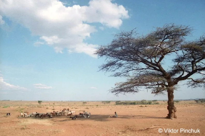
This large palm grove gives wonderful shade for a quiet walk.
Climb the hills for a sweeping view over the city and the oasis.
Water temperature…
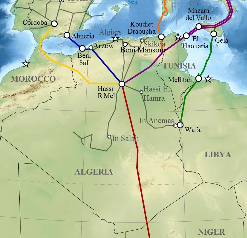
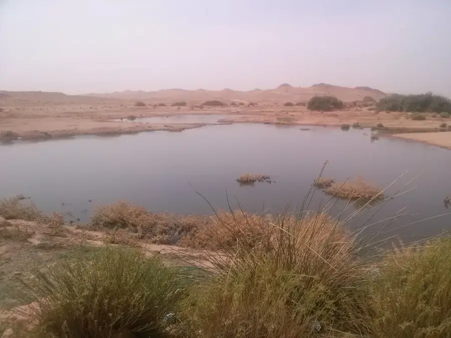
Laghouat, often referred to as the "Gateway to the Desert," is situated on the southern edge of the Saharan Atlas mountains along the banks of the Oued M'zi. The city possesses a tragic and heroic history, most notably marked by the 1852 siege by French troops, which encountered fierce resistance from the local population. Geographically, Laghouat marks the transition between the high plateau steppes and the Sahara Desert, historically making it a vital crossroads for nomads and traders. The city's architecture blends colonial influences with traditional oasis settlements, surrounded by extensive palm groves and gardens. In recent decades, Laghouat has gained immense economic significance due to its proximity to the massive Hassi R'Mel gas field, transforming it into a major industrial hub. Despite this industrial expansion, Laghouat remains an essential center for education and culture in southern Algeria, home to a respected university and museums preserving local heritage. The climate is characterized by significant diurnal temperature shifts and hot, dry summers.
- Location: Algeria
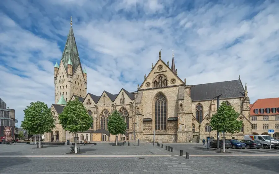
- Top sights: Fort Bouscaren · Musée Ex-Église · Regional Theater
- Population: ~134.372 (2026)
Best time to visit & climate
The most pleasant time to visit is May, Sep, Oct.
| Jan | Feb | Mar | Apr | May | Jun | Jul | Aug | Sep | Oct | Nov | Dec | |
|---|---|---|---|---|---|---|---|---|---|---|---|---|
| Avg °C | 7 | 8 | 12 | 16 | 21 | 27 | 31 | 30 | 24 | 19 | 11 | 7 |
| Rain mm | 14 | 9 | 11 | 20 | 13 | 8 | 5 | 14 | 23 | 21 | 14 | 12 |
Geography
Facts
- Endured a severe siege by the French army in 1852.
- Located on the Oued M'zi river at the foot of the Saharan Atlas.
- Key location for the Algerian natural gas industry (Hassi R'Mel).
- Situated at an altitude of approximately 750 meters.
- Renowned for its production of traditional woven carpets.
- Home to Amar Telidji University, established in 1986.
Explore nearby
Notable places around
Route planner — Car & Motorhome
Where do you start? We build the route here, with stops and country notes along the way.
© OpenStreetMap contributors · OpenRouteService
Sights in the town Laghouat (5)
Frequently asked questions
How many days should you spend in Laghouat?
When is the best time to visit?
What is a local specialty?
How to reach the city?
Is the city family-friendly?
Laghouat: where is it located?
Laghouat: what is there to see?
Laghouat: when is the best time to visit?
Laghouat: why is it worth visiting?